My navigational incompetence is no secret. I do OK with Jeff along to help me out when I get stuck, but solo attempts have ended in tears and my turns at navigating during rogaines typically go awry. Granted, it's not a huge deal since my team has multiple good navigators, but I still really want to improve and not be such dead weight.
Luckily, the St. Louis area has a permanent orienteering course set up at
Rockwoods Range, but while I've known this for ages and done nothing about it, I luckily have more motivated friends. Wanting to get more practice after
the Hawn meet, Mickey bought a map and we headed there today to try our luck. We were supposed to meet
Dave at 7:45, but we missed a turn and ended up being about 20 minutes later than we'd planned. It's always a good sign when you get lost on the way to navigation practice, right?
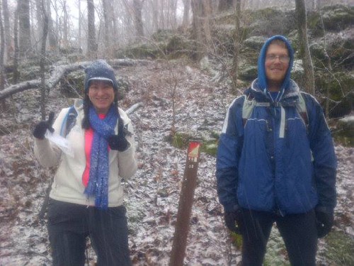
We set off in search of our first control and found it without too much trouble and just a slight suggestion from Dave. We weren't exactly sure how the points were marked and so didn't know what we were looking for, but eventually we found it. And now you know what you're looking for. They're easy enough to see head-on, but they're almost invisible if seen from the side. Definitely made me appreciate the orange and white bags used during meets!
 |
| 10% chance of precipitation my ass |
Our next control was in a reentrant. I was trying to follow along on the map but kept getting distracted by talking (go figure). We agreed on our attack point, but when we got into the reentrant and didn't see the control, Mickey and I got a little sidetracked and ended up on the far side of the reentrant, while Dave (who'd mentioned that he thought the control could well be hidden off to the side) stayed opposite, finally calling over "You're getting cold!"
 |
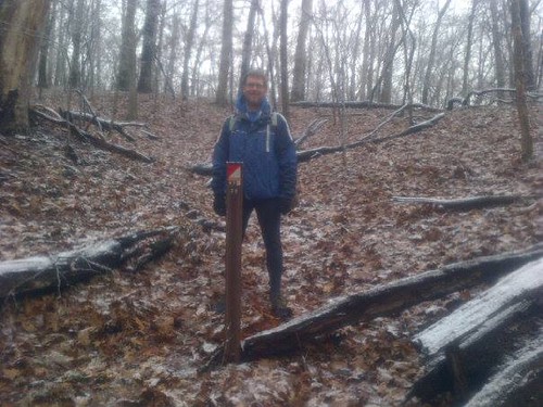
| Dave got the solo picture while we stood to the side wearing our orienteering dunce caps. What's cool is you can turn them upside down and make them cones of shame. |
Mickey asked Dave to explain what we'd missed, which he did (basically, since the circle marking the point was off-center, it suggested the point was off to the side of the main reentrant, and the little squiggles on the sides were smaller side reentrants, one of which held our control).
We hiked back up to the trail, which we took around towards our attack point for the next control. I was making more of an effort to follow along, and I kind of felt like I knew basically where I was, which is something of an unfamiliar feeling. Reaching our attack point, we headed downhill off-trail. The guys are much better judges of distance than I am, so that's one area where I still just followed along like the sheep I am. As we neared where we thought the point was, we discussed the clue, pit. What's the difference between a pit and a depression? I still don't know, but thankfully we spotted the marker.
 |
| Presenting...the pit |
To get to our next point, we could trek back up the hill we'd just descended (grumpy face). Looking at the map, I suggested that instead we head to the creek and then follow the creek until it intersected with the trail we needed. Then we could take the trail to another trail to the point. So easy!
 |
| Going from 21 to 22 |
Like pretty much all of my brilliant navigational ideas, this one didn't quite go as planned. We got to the creek/trail intersection with no problems (well, except for the fact that Mickey was so busy looking ahead that he totally missed the fact that the trail crossed the creek...I'm starting to understand how I ended up
being crashed into a downed tree!). We headed northish on the trail looking for the other trail heading off to the right and...nothing.
Probably the smart thing to do once we couldn't find the trail would have been to immediately attack from the creek, but instead we spent a lot of time here. Mickey went off to check things out while Dave and I waited, then after waiting a while we headed up the trail and then off where the other trail *should* be, missing him as he came down looking for us. Thank goodness for cell phones or we might still be out there wandering back and forth, and a good reminder of why in adventure races teammates are required to stay within 100 feet of each other. Eventually Dave and I made our way to where Mickey had found the next CP, just in time for Dave to have to head back towards the parking lot.
 |
| Solo credit for this find. |
With an hour or so left before I needed to be back in the parking lot in order to get to my father-in-law's Christmas party, we settled on two more controls. I may have been a little nervous about losing our Dave-shaped navigation security blanket, but I was hopeful we wouldn't get
too lost.

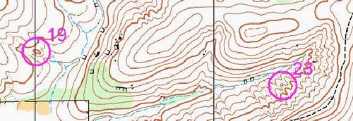
We got back onto the trail and decided to attack 23 from the hilltop the trail crosses at the bottom right corner. With all those little squiggles representing a wavy series of small ridges but nothing that stood out to us as a defining feature to use to help us, I really thought finding this point would by like looking for a needle in a haystack. Instead, we practically walked straight to it.
 |
| Dual selfie fail, but so proud of ourselves for finding it on our own! |
All we had left now was CP19. We decided to hike north up to the hilltop, then stay high as we hiked west and downhill along the rock faces (those black bracket-y things you see on the way to #19). If we kept them to our right, we should go in a line right to the reentrant where we'd find 19. It seemed pretty foolproof, which of course was reason for me to worry.
We executed our plan well and ended up down in the creekbed, which was wide and flat and located in a pretty open area. I'd expected the reentrants to be a little more noticeable, but I didn't see anything like what I'd been looking for. We walked a very short way down the creek and I saw a little side channel. "Do you think this could be it?"
I wasn't at all sure, but the direction of the channel and the way it turned into the creekbed made me want to try it out, and Mickey thought it could be right. We hiked up the reentrant until it split. (Above, just outside of the pink #19 circle you can see how the blue line forks). "If this is right, the point should be here between the two reentrants, right? The clue is knoll...could this be a knoll?"
I was nervous as we climbed the small rise. I really,
really wanted to be right, and it
felt right, which would've made being wrong that much more depressing. I wasn't wrong though and spotted the marker with a happy yell.
 |
| Feeling very triumphant |
From here, we planned to hike uphill (always uphill) to the trail and then follow the trail down (finally down) to the parking lot.
 |
| We planned to basically follow those faint dots up to the top of the hill. |
We hiked uphill, and then the land leveled out we still didn't see the trail, so we paused to figure out where we were. Looking around and at my compass, I said I thought we were on that long finger. Now, to anybody even halfway competent, I'm sure that would have been blatantly obvious, but it was a huge deal to me to be able to look around and relate what I was seeing around me to what I saw on the map. Very exciting moment for me.
We hiked the rest of the way to the trail and then followed it down to the parking lot. It was a great morning to be outside, really pretty with light snow and ice-covered trees. It was definitely chilly, but all the uphills kept you warm. Even if Mickey can already navigate circles around me on his second outing, it was fantastic to feel like maybe I was making some progress. I'm definitely looking forward to getting back out there and practicing more, and we've got plenty of points left to find.


Good girl!! That permanent o-course is a gem, and definitely under-utilized. Some tricky controls in there! Nice work!
ReplyDeleteI must admit I learned via your blog about races like this. So in my book you are certainly very competent if not one of the real experts! :)
ReplyDeleteWe have an orienteering course not to far from us as well - you've inspired me to make 2014 the year we go try it out!
ReplyDeleteNice work! Better get good soon, I think your SIL talked me into an AR at happy hour the other day :-)
ReplyDeleteThis looks like so much fun, but also makes my head hurt a little. I don't think I would do well with something like this, but it looks like a blast!
ReplyDeleteYou don't stop. Do you have any kind of a down season? I race all year but so much shorter races.
ReplyDeleteWay to go! I don' think I'd know which way is up on a course like that.
ReplyDeleteI couldn't find my way out of a paper bag. I took wilderness survival as a college class and my partner and I tried to find some points for an assignment. I think we missed 5 of 20 and ended up with poison oak.
ReplyDeleteVery impressed with the knoll find :)
Hope you have had a wonderful Christmas, Kate!!