Stubborn Mule 30-hr AR
Thanks to schedules and such, my adventure racing schedule was looking pretty empty this year, so when my friend Kelly posted a link to the Stubborn Mule AR in Wisconsin I was all in. I was really excited to tackle another long race; so far, 24 hour races are my favorite, and it seems like there are fewer and fewer of them around us. I was keeping a bit of a secret in the week leading up to race, though.
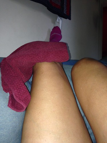 |
| That's me icing my knee. |
As it was, if I started racing and my knee bothered me too much, the guys could continue on as a 2-person team. Plus, I have a history of feeling really shitty right up til race time and then being fine as soon as it starts. Plus, I'm always limping sooner or later, so how much would it matter if I started out with a limp. PLUS, I really wanted to race. On Monday, I was still pretty worried. By Thursday, I was cautiously optimistic, which was a good thing because we were leaving Friday morning.
Kelly and Matt picked me up around 11 or so, and we headed north to Wisconsin. Our drive was featured multiple checks of the Wisconsin-area radar interspersed with laughter over the GPS's repeated helpful instructions: "In 2 miles, keep going straight." The sketchy weather forecast was borne out by a steady downpour as we neared the start location in Tomahawk, so we ended up getting hotel rooms instead of camping as planned. I actually didn't have much to do to get ready, so I managed about 4 hours of sleep before the 3:15 wake up. That may be a new record, and it vastly surpasses my pre-DK sleep of 0 hours.
Race check-in started a 4:30 a.m., and there were quite a few points to plot before the race started at 6. This is the first time I've experienced getting maps and plotting the day of the race, and it was pretty stressful, even for me and I wasn't involved in the maps. While Kelly and Matt plotted points, I did what I could to get our stuff together, and that hour and a half passed WAY too quickly. We got some last minute instructions and a pre-plotted map for the initial stage of the race, took a group picture, and were off!
Team challenge and land nav (6 CPs) 5.5 miles
Typically, in adventure racing and orienteering racers are given a passport which you punch to prove that you've been to certain checkpoints. One interesting thing about this race was that for quite a few of the CPs you proved you'd been there by answering questions on the map or race instructions.
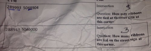 |
| Not for the first section, but it shows what I mean. Our race instructions were pretty battered by the finish. |
Kelly: While I couldn’t tell Kate
was injured I could sense she was reluctant to run much beyond the first mile
or two. Maybe it was when she said, “We
are NOT going to run this entire race are we?”
Phrased as a question I don’t believe it snapped her long race with
without complaining streak. I am pretty
sure that is when I told them my story of my very first adventure race when I
dragged my bonking race partner “Downhill Bill” for a 12 hour finish.
I think I actually asked that in the car. I was getting very nervous with all the talk about Matt's 50K and wondering just what I was in for.
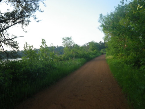 |
| ATV trail between (or maybe over) a lake (or lakes). Beautiful morning. |
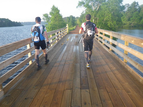 |
| Further down the trail. |
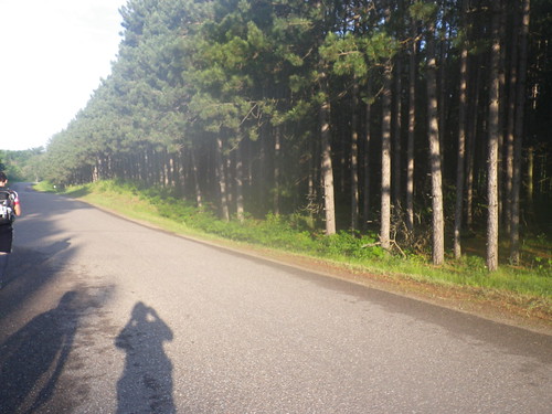 |
| Love the trees. The race, in Wisconsin's Northwoods, was really scenic. |
We got 5 out of the 6 initial CPs, skipping one that needed to be plotted using headings from two other points when we weren't entirely sure how to do that (thanks to Boom Boom Pow for trying to help on that), and then checked back in at the race HQ (now TA1). We didn't need a passport yet because we were going to "punch" by answering questions on our race instructions like for the first trek, but we needed to finish marking up the maps and doing some route planning. Once that was finished, we headed off on our first bike leg.
Bike (3 CPs) 15* miles
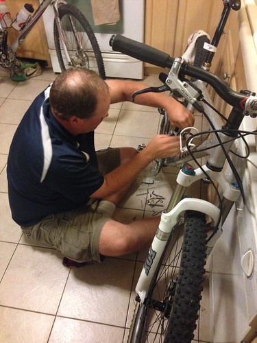 |
| My hero |
I always joke that if I marry again it'll be to a bike mechanic, but Jeff is pretty handy with replacing saddles, putting on water bottle cages, and adjusting saddle height. In the background of the picture you can see my cross bike, which I brought in to use as a reference for how high my saddle should be (+2 inches) and how far back it should be (less far than it had been). Between the different saddle and the adjustments, I was far more comfortable on my mountain bike, even with the heavy AR pack I carried. Too bad it took me four months to get around to making those changes.
We got off to a fast start on the bikes, and I was delighted to not be running anymore. We made quick work of the first few roads, and were about to make our next turn when I spoke up. "Isn't Hwy 8 off limits?"
The guys didn't think so. I was pretty sure of what I thought I'd heard at the pre-race meeting, but I hadn't actually read the race instructions because the guys had been using them to plot the course, so I wasn't bet your life positive or anything. Kelly looked at the map and it wasn't marked off as off limits (there were some off-limits roads we'd had to copy/mark off from a master map), and it was the only route choice that made sense for where the CP was located. Because of those factors and the fact that neither of the guys had heard what I thought I had about Hwy 8, we went ahead and made the turn.
A little bit down the road we passed a silver pickup truck sitting on the side of the road, and as we rode by I noticed the driver was wearing a blue shirt like the race shirt. I was pretty sure he was a volunteer. A little further down the road, there was the silver pickup parked in front of us again. This time he got out. "I have two things to tell you," he said, "One, you're off-course. And two, you're on highway 8 and you shouldn't be."
When we showed him the maps, it turned out we had CP7 (where we were headed) misplotted, which is why the off-limits Hwy 8 looked like the right way to go. (Also, since I made a point of saying it wasn't marked off on the maps, I want to clarify that it does say in the instructions that it's off-limits. We just managed to miss that when I brought it up before making the turn.) Since we were near CP8, we went ahead and got that one and then just moved on towards CP9.
Kelly: This was a major screw up
on my part and could have cost us a race if we didn’t have such an
understanding race director. We had CP 7
and 8 plotted correctly but in my haste to pick our route had missed the fact
that there was a country road that went directly to CP 7 and then on down to CP
8 on Hwy 8. I had planned our route down
the highway then out a legal major road to CP 7 then on down the country road
to 8 but we changed maps right at the same location so I copied the route from
CP 8 on the second map. When we started
the bike section I figured I’d be able to hit 7 and then move on to 8 without
much trouble. Getting on the bike I was
just cranking down the road and blew past our turn for CP 7 and turned on Hwy 8
when Kate raised the red flag. I had
remembered them saying we could cross Highway 8 legally and use a snowmobile
trail on the other side so we crossed and….no trail. In the end I should have listened to Kate,
slowed down and got my head straight.
I think the lesson here is always listen to Kate, unless I'm wrong, which is probably more often.
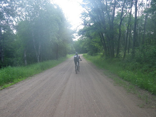 |
| Matt riding down gravel almost smooth enough to be pavement. |
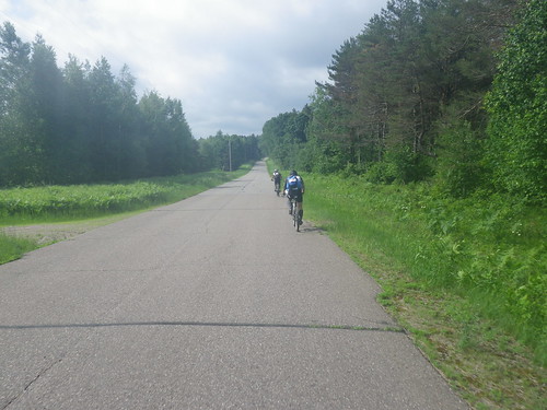 |
| Matt and Kelly getting ahead of me while I document our race. :) |
Although Matt has barely ridden a bike lately, he did great. Kelly hadn't eaten breakfast in the rush to get to the race start and then to plot all those points, and he was definitely feeling it towards the end of the bike leg, but he soldiered through and we rolled into TA2 at Treehaven in good time.
Kelly: I was really not feeling
well after this bike section which was probably due to a lack of breakfast, but
I also noticed late in the ride that my front disc brake was rubbing somehow
and may have contributed to my early bonk. Not cool….especially after telling
the story of Downhill Bill.
* The race instructions say the bike leg was 15 miles, but I don't know how our off-course detour changed the distance we rode. My guess is that we rode fewer than 15 miles, but without looking at the maps I don't know.
Land Nav (11 CPs) 6.3 miles
 |
| About to start the trek. (Photo credit: 180 Adventure) |
This was a really pretty area, but you'll have to take my word for it because I realized after leaving the TA that my camera was still in my bike bag, just far enough back that I wasn't interested in making the return trip. Matt did the nav for this section, and he was dead on. It's a good thing, too, because while the trails were nicely cleared doubletrack, any bushwhacking was through thick brush. The off-trail hiking was complicated by the fact that a knee-height layer of thick-leafed plants obscured all of the branches, holes, and general forest debris lying on the ground.
We'd decided to attack the far points first and then hit the closer ones on our way back. Route planning had to avoid some areas of private property. At least one of the CPs was in an area so thick that you had to push small trees and branches out of your way for every step forward. Somehow Matt led us directly to the CP, thank goodness, because we could have searched forever out there. Definitely not one of those cases where you can look around and spot the flag if you're somewhat near. Partway through Kelly had Matt give me the passport, and while at first I wasn't thrilled, it ended up being a good thing because suddenly I was the one spotting a few of the CPs. While I hadn't been exactly dragging, it still picked me up some.
Kelly: I was pretty impressed
with Matt’s nav on this section. Kate
did a great job spotting two or three flags in a row. I on the other hand was starting to feel the
heat of the day. I was glad the bugs
weren’t bad at the time as I unzipped my shirt half way and pulled the
waist of the shirt up to my chest so that I looked like a deranged Jamaican
dancer.
It was quite a look, and one more reason to regret having left my camera at the TA.
The forecast high was something like 81 degrees, and I don't know how warm it ended up getting, but it felt HOT (and that's with me coming from temps in the mid-90's around here). With about an hour left in the trek, I emptied my Camelbak and was really glad I'd stuck an extra water bottle in my pack. We were all really feeling the effects of the heat and being in motion for 8 hours, and that's when we went looking for CP11. The clue was stream, and while we didn't find the CP, the cold stream water gave us a new lease on life. Kelly soaked his head, then filled his water bottle and sprayed us. It felt amazing.
This is where I finally
came back to life. A combination of food
and cool water had done the trick. I was
back in the game. The area was just
gorgeous with tall pines, birch and plenty of water.
I think we'd all have welcomed a rain shower during this stretch, which makes later events slightly ironic. Timing really is everything.
 |
| Photo credit: 180 Adventure |
Bike (4CPs) 15-27 miles
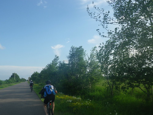 |
| If you look at the tree top directly over Kelly's right shoulder, you can see how the wind is blowing. |
We found the first two CPs of this leg with no problems. I did fall a bit behind the guys at one point, a pretty good downhill followed by a flat section and then another downhill, when I wanted to see if I could coast the entire section without pedaling at all. (One of many many reasons in addition to lack of fitness that I'm not cut out for an elite team.) And yes, I could. :)
Maybe halfway through the bike leg, we encountered a pretty good rain shower. We rode through it for a little while until some thunder and lightning started. At that point, Matt, who's not a fan of lightning, found a spot where we could shelter from the rain and wait out the lightning. I hadn't noticed any mosquitoes all day, but they found us here. One of the tricks to avoiding them must be to keep moving. Once the lightning moved on, we did too.
As we neared the town of Rhinelander, somehow we got off track. I *think* the roads have had some changes since the map data was collected, and that threw us off. Matt noticed pretty quickly after our turn that something seemed wrong, but after looking over the maps and everything seeming like we'd made the right turn, Kelly and I pushed to keep going. In retrospect, we probably should have looked even more carefully, because JMatt was right. Anyway, we ended up some distance out of our way, finally stopping at a Hardees for shakes and directions. These mid-race stops for "extra nutrition" are starting to become a tradition; however, the boy at Hardees was far less invested in helping us make a quick transition than the waitress at the brewery during Goomna.
The USGS maps were dated
1986 so the bypass we were on was not on there.
But the shakes and directions put us back on track. Probably added another 3 miles to the route.
This first paddle leg was 5.5 miles up the Wisconsin River and then back down, with a stop for 3 optional trekking CPs. Because we had to be past the rapids in the second paddling section before dark, we basically had to short course ourselves and skip this paddle section. We'd already pretty much come to this conclusion before getting there. Knowing how much I don't love paddling you can imagine that I wasn't heartbroken, and you'd be correct. While we were there, Kelly did a bike polo challenge to get us one bonus CP, and then we moved on to the next leg of the race.
Paddle section 2 (1 CP) 12 miles and land nav (9 CPs) 4.5 miles
We had to portage the canoe (a super nice royalex one) around the dam at the TA before starting the paddle, and by "we", I mean the guys carried the canoe while I brought down our PFDs, packs, and the drop bag we'd sent to the canoe put in. We left our bikes to be transported downriver but had to take our helmets/shoes with us in the canoe. It was about 7:30 (12.5 hours into the race, or not quite halfway through, if you're counting...which I was) by the time we were on the water, and the volunteers had warned us that most teams were taking 2 hours to get to the rapids, a time frame which had us hitting them after dark.
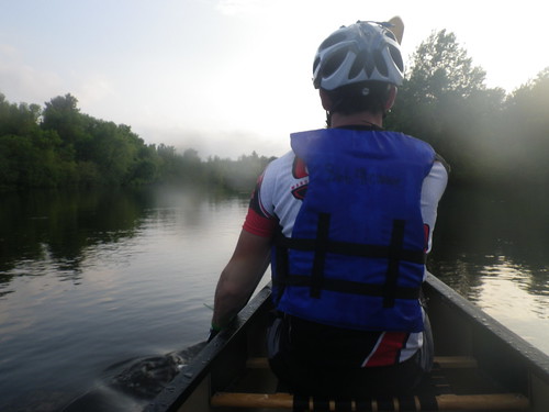 |
| Matt in the front |
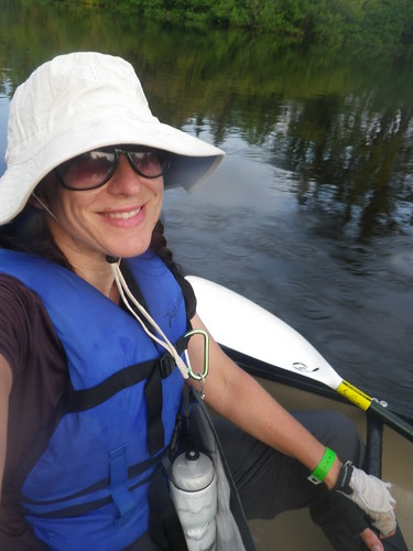 |
| I'm smiling because I'm not paddling... |
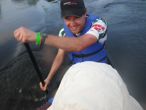 |
| Kelly does not hate paddling. This nut has done the MR340 (a 340 mile canoe/kayak race) more than once! |
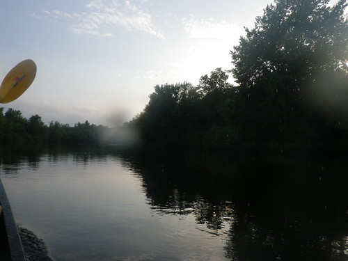 |
| If it seems like there are a lot of paddling pictures, that's because you can't paddle and take pictures at the same time and my arms were hurting. ;-) |
In the interests of getting off the river before it was too dark, we ended up skipping all of the land nav points except for the one at the recommended canoe drop that we could paddle up to and punch quickly. In retrospect, skipping this nav section was probably a mistake. Even if we'd only gotten a couple of the CPs it would have broken up the paddle leg and given us a chance to stretch our legs, which might have changed the way things played out downriver. Lacking that hindsight, we punched that one CP and moved on.
Kelly: A stretch might have been
nice but I’m still glad we didn’t stop there. The river after the trek section had quite a
few rocks and stuff to navigate and hitting it after dark was not my idea of
fun.
Further downriver we started seeing lightning in the distance. This had Matt's storm Spidey sense tingling, and it was making me pretty nervous as well. I don't mind getting rained on, but I wasn't crazy about being on the river with lightning in the sky. Kelly assured us it was really far away, but we all redoubled our efforts, and we made it to the take out at TA 5 sometime before midnight, taking the volunteers by surprise because they hadn't expected to see any teams for a while (because most teams stopped and did the land nav section).
I’ve done a bit of canoe
racing and will have to say this was the fastest I’ve ever done any adventure
race paddle section. We were cranking.
I won't lie. Rather than dismay, my first reaction was a small surge of hope that we could all quit, quickly eclipsed by the knowledge that I'd given up at Indian Camp Creek and it doesn't take too many such instances for quitting to become a pattern rather than an aberration. If Kelly was still in, so was I.
Matt and Kelly went to plan out the route for our next bike leg while I got what I needed from the canoe drop bag and put everything else by the truck to be transported back to race HQ. Taking off my soaked pants and changing into dry socks and shoes was wonderful. Boom Boom Pow had come off the river not long after we had, also skipping the trek, so I talked to them for a little bit before finding Kelly and Matt. Once they had everything figured out, we set off again.
I pulled Matt up with me
to go figure out his ride back to race HQ and go over maps for the rest of the
race. I was hoping to buy a little time
and maybe he would feel better and maybe change his mind but no luck. A bunch of 12 hour racers hanging out at a
bar/grill at the takeout ended up dropping him off.
Bike (1 CP) 20 miles
Though my ride satisfaction was greatly improved by the better saddle, I'd reached the point in the race where nothing was going to feel that good. We initially missed a turn, but Kelly was on it and corrected before we'd gone a block out of our way. Down to two of us, I tried to take a little more responsibility for helping with navigation and checked with him on what to expect and what turns to look for.
We were riding on primarily gravel/sand roads, and the rain we'd had so far had probably helped by packing down the surface. Several of the roads had a bunch of twists and turns, often changing from one name to another and then back again, which got a little confusing...especially after racing for 18 hours. We got to one intersection and Kelly sighed (or maybe cursed), "I don't know where we are..[my heart sank]...oh...we're here!" Thank goodness all the mailboxes we were facing reminded him of the question for CP44 ("How many mailboxes are on the NE corner?" It was 9, in case you're curious.)
Same old map issues. Some of the road names had changed. I was following along and staying in contact
with the map but it had been a while since we’d seen a road that matched so
when we finally got the intersection and road name didn’t match yet again I
might have said a derogatory word in vain. Then I saw the mail boxes.
At 12:30, the rain started again. "I think we need to get on our rain jackets," Kelly said. Before I'd even set my pack down the shower intensified to a downpour, and I still had to dig out the rain jacket I'd brilliantly packed in the bottom of my loaded pack. I was freezing and drenched, but once I got the jacket on and started moving, and least the water soaking my clothes warmed up.
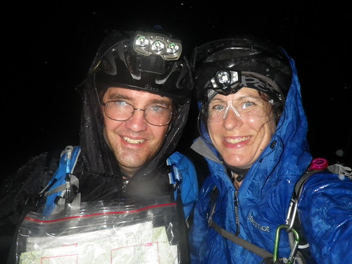 |
| Standing in the pouring rain, at 12:30 a.m., 18.5 hours down/11.5 to go (but who's counting). Nothing to do but laugh and start riding again. That's what AR is all about. |
The next hour or so until we reached the TA was the biggest struggle I've ever fought against sleep in a race. I was surprised to have such a hard time because I'd done three previous 24-hour races as well as 19 hours at Dirty Kanza without any issues, and at this point we were only around 19 hours in. I'd even gotten four hours of sleep the previous night, which is a lot before a long race. Whatever the reason, I couldn't hold a straight line to save my life, and a couple times when Kelly stopped to check the maps I probably only needed one more minute to fall asleep standing up. I kept thinking, I know it's raining, but if I could just lie down on the ground and nap for a few minutes...
Reaching TA 6 and seeing that it was inside a building was a wonderful relief. One of the volunteers (a 12 year old boy who'd done the 12 hour race with his family and then stayed to volunteer overnight with his dad...too cool!) came out to tell us there was soda and food inside. Heaven!
Chicken Salad Sandwich….saved
my life.
Also inside were our friends from Boom Boom Pow...super nice to see their faces. We turned in our answer to the CP question, and when the volunteer started to tell us about the map for the mountain biking section, I told him, "We're not doing that!"
You might notice a pattern where I try to get out of things that I don't like to do (paddling), and mountain biking at night in the rain is high on that list. When the rain started, I'd suggested to Kelly that maybe we could skip the mountain biking leg because it was only 3 CPs and it was sure to be muddy. I'm not sure he was all on board with that plan, but he was willing to humor me and go along with it. Jeri and Stacy couldn't believe we were going to skip the mountain biking, and they had a persuasive argument.
Their logic for doing the MTB leg was that even "if" it sucked, the CPs were right along the trail and would be easy to find, unlike trying to do the next trekking leg looking for points off-trail in the dark. We could do the mountain biking, then hang out at the TA until it started to get light. As much as I didn't like it (and didn't want to sit on my bike again), I knew they were right, and we were reluctantly getting ready to set off on the next leg when WABAR came in from mountain biking.
"How was it?"
"Hard."
Awesome. If those AR machines found it hard, it was sure to be a real treat for us. A couple of us were still bundled up in our rain jackets, and Andrei warned us that he'd ridden in long sleeves and was still feeling too warm, so we lost the jackets...thank goodness, because once we were on the trails we were plenty warm.
Mountain biking (3 CPs) 6 miles
I am a huge chicken, and the reason I'm so forthcoming about that is so that when I'm humiliated by my wimpiness at least I don't have the added embarrassment of not living up to some false badass image that I've cultivated. And much of the mountain bike leg was pretty humiliating.
One positive was that the trail was such a mix of dirt and sand that we didn't encounter the kind of mud and ruts we'd have to deal with riding local trails in such wet weather. There were several sections I'd have been walking even in dry, daylight conditions, but overall I think it would probably be a really fun trail. I really struggled at night, though. Early on, I didn't even have a chance to slide on wet rocks and roots because I kept bailing. I walked a lot. Everyone else was way more comfortable than I was, so I was constantly behind and near tears. I didn't like myself very much; what a big baby.
Six miles isn't much on a bike -- or on foot, for that matter -- but distance expands on singletrack, and we were out there for a long time. About halfway through it started raining again, but the trails (and we) were already so wet that it wasn't much of a change. I never felt super comfortable, but at some point I realized I was riding more than I was walking, and occasionally it was even a little bit fun.
Another bright spot was that the bike riding discomfort was minimal because we were off our saddles so much, and I was no longer sleepy at all. Yea fear! We found the first CP really soon, but the second and third took for-ev-er. After what seemed like a really long time (because it was) we made our way back to the TA, where the volunteers now had a fire burning in the outdoor fireplace. Hurray! That meant semi-dry clothes for the bike back!
This bike leg was
epic. I was miserable, wet, dark,
hot…and we were riding way over our heads.
I loved it. I had purchased Matt
and I some 1700 lumen helmet mounted bike lights before the race and kept mine
on low for the entire road section.
Since Matt dropped after the canoe I had grabbed his battery just in
case and decided to use my light on bright for the singletrack section. If my battery petered out I still had his
unused one to last me an hour or so to sun up.
So I go blazing into this trail loving my light. It looked more like a light sabe than a bike
light. About ¾ of the way through my
light drops down a level and I switch batteries. Nothing. Battery is dead. Probably got wet in the paddle section and
was completely done. Matt would have
been hating life if he had decided to go on.
For me, I turned on my backup handbar light and added my regular running
headlamp and squinted my way through the last of the trail. Lesson learned. Conserve.
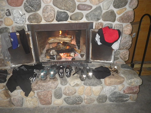 |
| Obviously I wasn't the only one to have that idea. |
Who ever thought that a
cold concrete floor would sleep so good.
It actually felt good on my back after paddling and biking.
Land nav (26 CPs) 8 miles
We once again ended up on the heels of Boom Boom Pow as we all went in search of the first CP. We got split up as we went one way and they went the other. We ended up finding it first and then went after our next point. Kelly followed his compass to the ridge...no CP. We walked more. Nothing. "I'm not sure where we are..."
When one navigator is struggling, that's the point where it helps to have someone else to bounce ideas off of and help get things back on track. Unfortunately, I'm not that someone. My navigation skills have gotten far better, but thinking things through on a map still takes me a long time, and I had barely seen the map all day. I wanted to help but figured it would probably just make things worse; what could be more fun than one sleep-deprived person trying to walk another sleep-deprived person through where they might be on the map, right? Instead I just followed along and tried to be encouraging.
We walked a LOT. Up and down hills, across side slopes. I wasn't sure what we were doing, but my policy has always been don't second-guess the navigator because I surely couldn't do a better job. Finally, Kelly turned one way, looked at his compass; turned another way, looked at his compass; turned again, looked, exclaimed, "This compass is [screwed up] (PG edit :D)"
Ahhh, this is a problem I could help with: "Here, use mine!"
He got started and then told me, "This one is messed up, too."
The look on her face when I questioned her compass was like “Oh no you didn’t!"
My compass has never had any issues before, and I thought it was a little weird that two compasses were malfunctioning. "Do you have any magnets on you?"
Sure enough, Kelly's new pack had a magnet on the front strap to hold his camelbak mouthpiece, and it was interfering with the compass. That darn new pack had sent us scurrying in circles! Once we'd figured out the problem, Kelly got us to a road, and we trekked back to the TA. By the time we got there, it was 8:30, and neither of us really had the heart to go struggle for any more trekking points. We went to check back in with the volunteers and get credit for our whopping one CP...which is where I realized I'd lost the passport.
I'd zipped (or obviously, thought I'd zipped) the passport into my pants pocket after punching the CP we found, but after digging repeatedly through every pocket I had to accept that I'd lost it. I felt terrible about it; I mean, it was only one CP, but still! We'd spent so much time on the trek with nothing to show for it. Thankfully Kelly was very cool about it. I was warming myself by the fire getting ready to head back to the finish line when the END Racing/Yogaslackers team (check out their video and race report!) came in from the trek and asked a team sitting at a table, "Did you lose a passport?"
Hope began to rise. I asked, "Is it team 144?" Yes, yes it was. Even though it was just one CP, at least we had credit for it. :) Thank you SO much to them. Our heroes!
I was actually thought she
might have lost the passport on purpose to make me feel better about leading us
all over creation. Luckily she lost it
near the checkpoint because where we went afterwards, I can guarantee you no
other team followed.
Bike (2 CPs) 15 miles
Except for the mountain biking section, all of the biking to this point had been on pavement or nice packed gravel roads, so this last 15 miles should be a piece of cake...at least as much of a piece of cake as possible when the last thing you want to do is sit on a bike.
Yeah, not so much. These roads were primarily sand (with just enough rocks to keep my hardtail bashing my rear on a regular basis), saturated to the point that they were no longer packed firm but getting soft and mushy. That made for some fun riding. On top of that, any time you stopped, the mosquitoes swarmed, as I discovered when I stopped to stuff my jacket into my pack. I spent more time swatting bugs than putting away the jacket, finally leaving my pack partway open so I could get moving again. The permethrin coating my clothes seemed to have lost its effectiveness (that said, I don't think I had more than one mosquito bite from the weekend, so I guess it was more effective than it seemed on that final bike leg). I was so thankful we hadn't had to deal with bug swarms on the previous day as well.
After we'd found the first CP, we were riding up a hill when Kelly groaned, "Flat tire!!" Normally that's just an inconvenience, but with the mosquito situation it was pretty awful. I put my jacket back on, slathered on more bug repellent, and made like the Tasmanian devil swatting at bugs while leaving Kelly to take care of his tire (perhaps not my best "team" moment"). He dealt with the mosquitoes by walking back and forth while he pumped up the tire, and before too long we were rolling again.
That was the fastest I’ve
ever changed a tire and it still felt like forever. THE MOST MISERABLE I’VE EVER BEEN IN A
RACE. And if cursing doesn’t count as
complaining…I never complained.
Cursing most definitely doesn't count as complaining; it's just stating a fact emphatically.
We just had to grind out the rest of the bike leg (longest 15 miles ever), and finally hitting pavement was sweet relief. I was delighted to hit the road that the HQ was on but somewhat less overjoyed at the fact that the road just kept going and going with no finish line in sight. By the time we passed the volunteer taking photos, I was over the whole bike thing and so happy when she told us, "Almost there!" Of course, at that point "almost there" really needed to mean "around the corner", and when it wasn't my mood took a bipolar dip. I was pretty much ready to sit down on the road and let someone come pick me up when Kelly said, "There it is!" and suddenly all was right with the world again.
 |
| Finishers! (Photo credit: 180 Adventure) |
The Stubborn Mule was tough, probably the toughest race I've done, though on the surface it really doesn't seem like it should have been. The area was beautiful, the volunteers were plentiful and amazing, the course was well-designed, and the race offers a long course in a time when it seems like there are fewer and fewer of them around. I'd definitely recommend it, and though my thoughts at the finish line were more on the lines of "never again", I'd even go back and race it again.
Big thanks to Kelly and
Matt for letting me race with them. Racing with a new team is always a little
daunting...you aren't sure how team dynamics will be or if you can keep up (on
the run and mountain bike, that was most definitely a no), but I had a good
time. They got a bigger dose of "quiet Kate" than most people
experience, but who knows...that may have been a plus in their book!
Definitely one of the
tougher ones I’ve done. Had a great time
on and off the course with Matt and Kate.
Kate is a true ambassador of the sport and had a kind word for everyone
she met. (Quiet Kate my Ass) I can be a
bit growly at times on a race course (especially if/when I screw up) but it was
cool to have a super cool group to race with that just enjoyed the day and did
what we could and sometimes a little more than we could. I do hope to come back and race this one
again next year. Maybe we can talk some
more Team Virtus into a road trip. I
really enjoyed it.

Impressive Kate! It must feel good to have kept going when didn't want to several times and complete a tough race.
ReplyDelete