Tomahawk Challenge 24 hour AR
This year's Tomahawk Challenge was an inaugural event, but you'd never know it from how smoothly and well the race was run. Extras like free camping at the start/finish area and free pre- and post-race meals were an added value, but perhaps best of all in a school year where I've already had to take two personal days, the location was close enough that I could leave for the race after work.
Check-in was held at the Ribeyre Center in downtown New Harmony, a very cool historic town near the Illinois-Indiana border. Once we'd taken care of that, Chuck and I headed to Harmonie State Park to set up camp. BOR was already there, so once tents were set up and we'd discussed Chuck's and my awesomely (and exhaustingly) full race schedule we all headed back into town, stopping at a cool brewery Larry had scoped out while waiting for the rest of his team.
 |
| Hello, super creepy circus poster. Photo credit: Scott Shaw |
 |
| Yea free stuff!! |
 |
| Race director John going over race details Photo credit: Heather Kluch |
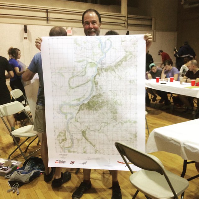 |
| Chuck modeling our gigantic map/tent/emergency blanket/tablecloth |
Finally it was time to get our maps and race instructions and see just what the next day would hold. I went up to collect them and returned with a gigantic map and...coordinates for 12 checkpoints. We would go into the race, not blind, but exceedingly nearsighted, our only glimpse of the race being the instructions for the initial trek.
That left the majority of the race as one big question mark. Of course, we could make some good guesses. We had a bike drop at a boat ramp some 20 miles south of our start, and the trek would take us about 12 miles north, ending next to the Wabash River. Obviously we would be paddling on the second leg; it was less clear whether we'd have any mid-paddle trekking and, if so, how long it would take. I'm happiest when the entire race is set out before me and I know what to expect, so this myopic view was an enduring frustration for me throughout the race.
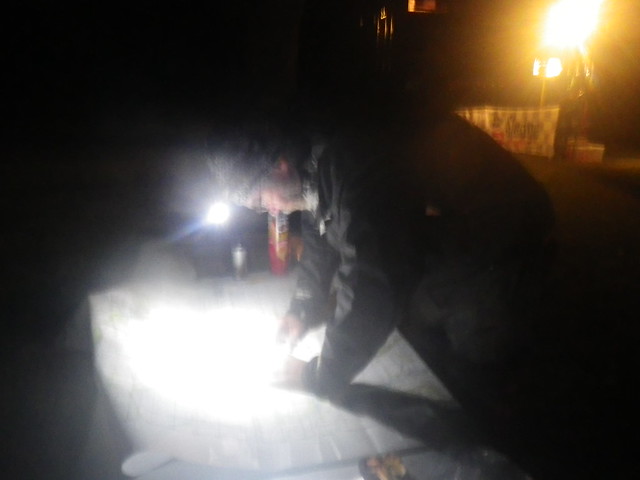
On the other hand, the minimal pre-race plotting left plenty of time to get back to camp and load up our packs. For once, I was in bed by around 10, giving me almost 6 hours of pre-race sleep, an unheard-of luxury that helped soothe the indignity of the 4 a.m. wake-up call necessary to get to the bike drop and back with a comfortable time cushion.
It's a good thing we'd left early, because I realized at the bike drop that my rear blinky wasn't working. Neither of us had the right kind of batteries (or anywhere to buy them at 5 a.m.), but Chuck dug through his gear tub, dragged out an ancient red blinky, and lucked into the right batteries. It provided enough illumination to make me technically legal but questionably safe, so I stuck an extra glow stick in my pack to supplement the mandatory light. We were back at the race start in plenty of time for last-minute preparations.
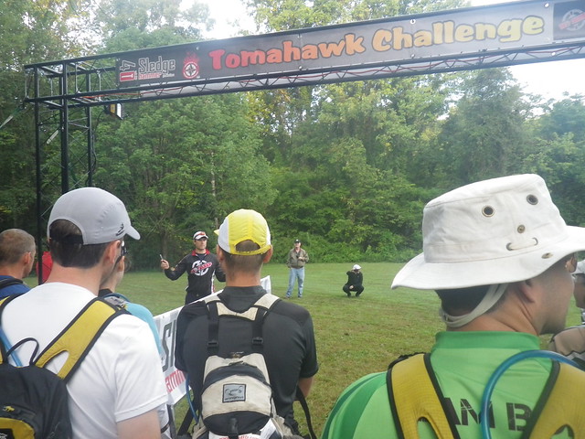 |
| Getting ready to start. I have no idea why we stood so close to the front. |
Trek 1: Checkpoints 1-12, in order
Passport secured, we opted to run the longer, flatter road route instead of retracing the shorter trail through a reentrant. While I was all for this idea at the time, in retrospect our route was only more effective if we ran the whole time, and I'm most definitely not in running shape. We arrived at our attack point for CP 1 just as Checkpoint Badgers were emerging, and rather than shoot a bearing towards the CP we just dove into the woods where they came out.
We had some trouble locating CP1, coming very close; in fact, Chuck had just said "I bet it's just over that spur," before we headed uphill instead. We need to learn to trust
 |
| (Not CP1) Photo credit: Heather Kluch |
Rather than ease our navigational woes, CP2 continued our downward spiral. We found the correct reentrant pretty quickly and proceeded to climb up and down it several times, unable to close in on the checkpoint. At one point Lupine and a couple of solo racers passed us, going in the same direction we'd come from, but we didn't follow. We should have: after over an hour of fruitless searching, we gave up, while they eventually spotted the marker hanging from a tree.
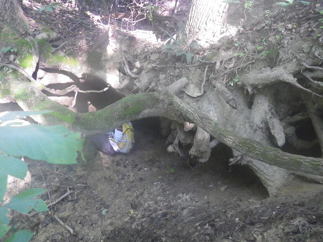 |
| Root cave |
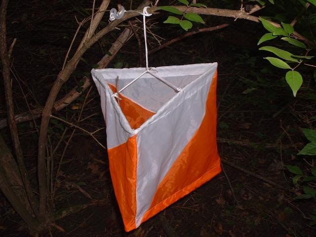
Chuck: These CP's were really hard for me to see. My inability to spot them would haunt us all day. Compared to the typical orienteering controls with the bold square shape and triangle orange/white pattern, these tubes took on the shape of every sapling and tree branch in the forest. Even this early in the morning I was looking forward to sunset with the hopes that the reflective tape would make them more visible.
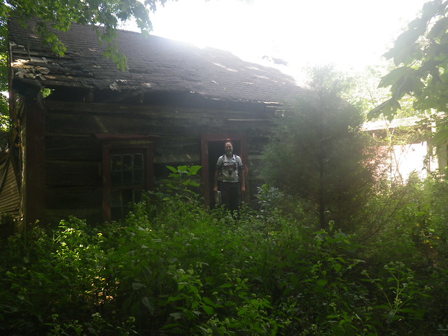
We didn't go straight to CP3, running into BOR in the vicinity as we all scoured the hillsides for the root cave it was plotted in. Chuck spotted it and slid down to punch our passport. What a great spot for a checkpoint! I love it when races take me to cool places I wouldn't otherwise see.
We trekked away from CP4 in the company of the same solo racer we'd seen around the previous two checkpoints. Since it seemed obvious we were moving at the same pace and likely to see a lot of each other on the course, we introduced ourselves and killed time on the way towards 4 (failed dam/dry pond) by getting to know Mike.
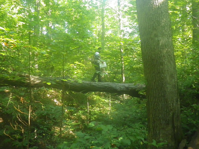 |
| Chuck also practiced his tightrope-walking skills while I recorded my more daring teammate from the safe, safe ground. |
Moments later Chuck got the first "yeah, I just said that" look of the race when he looked up and exclaimed, "Hey, that looks like a dam!"
Chuck: SO true, and unfortunately it gets worse every year. My teammates are constantly accomodating my shortcoming by repeating things to keep me involved in conversations and up-to-date on all the race instructions I don't hear. They even go out of the way making adjustments to walk, run or ride on my right side or change positions to look in my face while talking. They even find ways to make what must sometimes be an annoyance into a humorous exchange. Thank You again to my amazing teammates for accepting this about me!
Kate: He's worth it, plus it's not like I can get pissed and walk away...I don't know where I'm going!
The CP was indeed on the dam, the first time in the race we'd gone directly to our target. "It's so much more fun when we find them right away," I told him, "let's just do that for the rest of the day." We must have done just that for CP5 and 6, because I don't remember anything about them, and then came CP7 ("tip of spur").
When doing our route planning, Chuck and I had different thoughts on our approach to 7. He'd planning to shoot a bearing from an intersection; I voted to avoid climbing up and down across reentrants by following the spur to its end. That's what we ended up doing until we reached the end of the spur and...no marker. We scoured the lower section of the spur. Nothing.
 |
| The elusive CP7 |
Thinking maybe we'd come down the wrong spur somehow we trekked further up the creek, climbing up and down and across at least two more spurs as we went out and back. The whole time we did this I was kicking myself for bringing up this failed strategy. Finally we retraced our steps back to where Chuck had originally planned to attack, shot a bearing, and walked straight to...the same spot we'd been nearly an hour before.
This time BOR was also scouring the area for the marker, and despite seven of us climbing all over the end of the spur we couldn't find it. In fact, we were just about to give up on yet another CP when Chuck spotted it across a tiny reentrant from where we'd been standing. Huge relief, but so frustrating to have lost so much time when we'd been right there so long ago.
 |
| Me in the front on the left, getting as far away as I could. |
 |
| Chuck at the cabin |
Chuck: After having been denied a good attempt to pop the possum, I made sure there was time for a quick exploration of the cabin interior while Kate, Mike, and BOR punched passports.
The cabin was easy to find (and another cool spot for a checkpoint). We continued on together, having to backtrack when the old road shown on a map led, in actuality, through a soybean field. Hard to believe that maps that were last updated nearly 100 years ago weren't entirely current. Though we thought the "road" was possibly legal, we weren't positive and thought whatever farmer had planted the field might not be super happy about a crowd of adventure racers tromping through his crops. Instead we retraced our steps and took a road route.
We all attacked (CP9) from the same point, but when we didn't immediately see the point Chuck, Mike, and I trekked up the creek a bit...and then a bit more, running into Bushwhacker who was already on their canoe leg and looking in vain for a hilltop. There was some confusion as to who was dramatically in the wrong place, but in the end it wasn't us. They moved on in search of their hilltop, and we retraced our steps back to where we'd first come in off the road, once again finding the CP right where we'd originally thought it should be before we'd headed in the wrong direction.
BOR was long gone by that point, but we met up again coming from (them)/going to (us) CP10 (hilltop). Neil warned us to stay (right?? Left??), which we did, finding the marker with zero drama and then doubling back to head into town for our next CP. We took a trail that led directly behind the labyrinth where the next marker was hidden, reaching it just as BOR was emerging.
 |
| Heading out after finally having punched the passport. |
Chuck: But it was very entertaining watching Kate run through the multiple concentric rings while I took pictures.
We refilled our camelbaks at the nearby spigot and then followed the sidewalk into town, catching BOR where they'd stopped outside of the Ribeyre Center (and real bathrooms). We walked towards CP12 just long enough for Amanda and I to squash the boys' dreams of a mid-race beer stop, and then as we reached the golf cart path that would lead to the Wabash River, our final trekking point, and eventually the canoe put-in, BOR inexplicably turned off.
Confused but sure of our route, we stuck with our plan, quickly finding CP12 and then the TA, where we were given the "bad news" that we had to skip CP13, an upriver paddle that we'd anticipated and already decided to avoid, passed a gear check, and were given the coordinates for several paddling points. Always eager to cut out whatever paddling time possible and concerned because of the strong Bushwhacker team's problems finding 14, I voted to skip any points that looked tricky -- basically anything that required getting out of the canoe. Much like my running prohibition, however, that plan quickly changed.
Paddle leg: CPs
Despite our head start at the TA, BOR arrived, plotted more quickly than we had, and were on our heels as we put in on the nasty mud of the Wabash River. In no time Chuck had spotted the creek that was the attack point for CP14, which we found with no problem: all you had to do was climb up a gigantic hill. We passed BOR on the way back to our canoes and hastened to CP15 (reentrant).
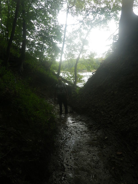 |
| Looking back out the reentrant towards the river. |
We tried to set a strong cadence as we splashed through on the left side, but the boat tipped and we went over. Our packs were strapped to the canoe, but our paddle bag and a ziploc with almost all of my race food for the next several hours floated away while I watched in despair. The strong current and slick bottom made it nearly impossible to stand up, so we did our best to swim the canoe towards the river bank.
It took ages to get the canoe to a spot where we could stand and dump out all of the water, and once we got it as drained as possible we hopped back in and paddled back out, thankfully past the rapids. The safety boat motored toward us, a volunteer inside tossing me the paddle bag and MY FOOD once they were close enough. We were saved! I'd been sick feeling to lose all of that food. It had been really careless to leave the food out unsecured, but I'd thought having it easily accessible would make it more likely for me to eat during the paddle. This ended up not being the case.
I'd packed with the same lack of forethought that led me to leave nearly all of my calories lying on the seat of the canoe, so while I had a very thin baselayer shirt and several pairs of socks in waterproof baggies, the rest of my cool weather gear (waterproof jacket, gloves, and a fleece hat) were loose in my pack and therefore completely soaked. The weather forecast showed lows in the 40's after dark, but I tend to run pretty hot and felt confident I had enough clothes...which I did until everything I was wearing got soaked.
Luckily the sun was still out, giving us hopes of drying out during the rest of the paddle. Chuck was exhilarated by the whole experience. "That was awesome!" he kept repeating. I didn't want to be a buzzkill, but I'd found it significantly less awesome.
CP16 was on Mink Island, and Chuck led us straight up the wide, dry creek to our point. Though I'd felt relatively comfortable while paddling, I couldn't stop shivering as we hiked across the shady island. It was another of the many times that, despite not having looked at the map in hours myself, I was convinced he was wrong...and it was another of the many times I was glad I just kept my doubts to myself because he was totally right. Within a few minutes we were back in our canoe and on to another gear check at CP17 (boat ramp), where we told the volunteer that Mike and BOR were close behind us and explained that BOR stood for "Boring Old Racers".
Chuck: I planted that "Boring Old Racers" seed with hopes that the volunteers would pass it along when BOR got to the CP, but we never heard anything afterwards, so I guess it didn't get passed along.
CP18 was on another island, the first of two on the map. We found the island pretty quickly but the point itself was hard to find. Chuck thought that maybe the island had been cut apart by the river in the time since it was mapped, so we moved on to the next section, where with some teamwork with Kiss My Compass, a 3-man team, we were able to park our canoe and scramble up the steep embankment to the CP.
 |
| That long skinny island is now two islands. |
That wasn't our only concern. Chuck kept obsessing about the bike leg: "I just wish we knew how long it was going to take!" I was confused by his worry; after all, we'd driven 21ish miles from the start/finish to the bike drop that morning. It couldn't be much longer than that. And we had plenty of time. I said as much to him, and he replied, "But we only have 5 hours left and we aren't to the TA yet!" For some reason, probably residual Thunder Rolls hangover, he had a midnight start/finish in his head.
"Chuck," I said, "It's 7:00. We have twelve hours left!"
Chuck: Ha! Thunder rolls hangover indeed.
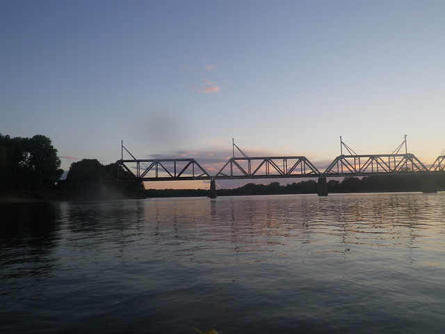 |
| Railroad bridge just past Grand Chain Island, where CP18 had been located |
The sun finished setting as we paddled up the creek, and I spent the rest of the paddle straining my eyes to watch for any strainers or other obstacles in the water, really REALLY not wanting to do any nighttime swimming. The paddle seemed to take forever, though it was broken up by the dulcet tones of a solo racer whistling and singing "Eye of the Tiger" and he paddled back towards us and, later, our second Checkpoint Badger sighting of the race.
We easily found the marker hanging under the railroad bridge, its reflective tape making it far easier to spot at nighttime than during the day, and then paddled back towards the river, finally reaching it and making our way towards the next transition area, the bike drop we'd visited some 15 hours earlier. By this point, the temperatures had cooled and I was shivering in earnest. "You know what would be awesome?" I asked Chuck. "If they had hot chocolate!...and a fire!"
Sure enough, in the kind of glorious dream-come-true scenario that's the closest I'll ever come to winning the lottery, both ingredients of my hypothermic fantasy were at the TA. I chugged hot chocolate while huddling close to the fire; the only thing that could have been better is if Mark Wahlberg was there warming me with his body heat while wrapping us both in a puffy jacket...
...uhhhh...where was I? Oh, yeah...fire. Hot chocolate. Yet more points to be plotted, these ones for the bike leg to the TA back at the state park. And the opportunity to take off my sodden jersey and replace it with a dry shirt. Even though my chamois felt like a wet diaper and my pants were still damp, my upper body was much happier.
Bike 1: Checkpoints 20-25 (in order)
BOR had come in slightly after we had and made another lightning-fast transition, so we all rolled out at about the same time, though they quickly left us behind. Somehow, despite all the bike riding I do, it takes me a long time to get comfortable riding in the dark, so I really slowed us down. We picked off CPs 20-24 with no problems, Chuck's stellar nav keeping us in the mix with several teams who'd left the TA ahead of us.
Like on the paddle, we went for every possible bike point, knowing we'd be far faster on wheels than on the anticipated trekking leg back at Harmonie. Most were super easy, though CP25, down a rutted, slippery, mud/sand road was a little stressful in the full-on wimp mode I'd found myself in. From there we took gravel and forest roads and then rode a park road uphill forever back to the TA, where we were greeted with fire, more hot chocolate (though, sadly, still no Mark Wahlberg)...and more coordinates to plot.
 |
| Around 12:20 a.m. |
Though we plotted all of the coordinates we were given, we quickly decided to skip the trek. Bike points would be faster and easier, a much better use of our time than another trek. I was pretty thumbs-down on the ropes CP, and there were another couple on singletrack that looked like they featured a lot of climbing. Instead we decided to tackle the a bike/trek combo, the four closest singletrack points, and then see what kind of time we had left. If we had enough time, we could go for a couple of bike points along the road. The downside of this was that I'd be spending the remainder of the race in my soggy chamois instead of being able to put on all dry clothes.
I was able to trade my wet trekking pants for dry running tights, and I added a thicker base layer shirt under my waterproof jacket, but that was the extent of warm clothes I had available. After a pretty leisurely transition (an hour-ish), we climbed back onto our bikes again.
CP31 was at an old cemetery reminiscent of ones we've visited during different iterations of the SHITR, approached by horse trails that were somewhere between singletrack and doubletrack. That was easily found, and then we headed to 32, which I believe was at a trail/creek intersection, another easy mark. From there, we pushed our bikes up some super shitty trail before getting back onto grassy doubletrack. Nearing 33, we saw BOR coming in the other direction, having given up after struggling to find it.
They backtracked with us to give it one more go, dropping the point after the six of us were still unable to find it. Not having looked as long, Chuck and I were reluctant to give it up, but we had to admit defeat after additional fruitless searching.
Bike 2b: checkpoints 34-?; no bikewhacking
Checkpoints 34 and 35 were along the beginner singletrack (comically explained in the park brochure as "suitable for beginners", while the intermediate trails were -- you guessed it -- "appropriate for intermediate level riders") in Harmonie State Park. As we rolled onto the singletrack I initially thought how nice it would be for my 11 year old, smooth and flowy with little elevation change, but I quickly revised my opinion as it wound like the tentacles of an octopus along the edge of a reentrant.
Chuck called back, "These are awesome trails!!", an opinion I didn't share. While on one level I could recognize how fun the trails should be, I was totally fixated on the gaping chasm of death to my left (full disclosure: I have no idea how deep it actually was; it was dark and I was afraid to look to my side for fear of plunging in.). Every single other person I talked to about those trails loved them, so I think I'm pretty safe in assuming that I'm the only one who crept along like a petrified snail. There was so much winding back and forth that I started to feel like we were in some kind of bizarre Hotel California trail system, continually riding the same piece of trail without ever reaching our destination.
Eventually we reached the CP, and the trip to CP35 seemed a bit shorter. Looking at the map for our next singletrack segment, it seemed clear that we could cut a significant amount of distance from our ride by approaching the trails from a parking area. We quickly located the trail entrance for CP36 and it was a short ride to the marker. Then we backtracked to the road to look for the trailhead on the other side of the parking area.
This one took a little bit longer to find, but again we were successful. These trails had a bit more elevation change, and while my mental game was pretty nonexistent my body felt good. Chuck, on the other hand, was starting to feel bonky, so he chugged an Ensure at CP37 and we took it easy as we retraced our steps to the road.
Back on the road we looked over our maps. We had less than two hours remaining. The other singletrack points looked like a lot of riding to get there, but there was one CP down some of the gravel park roads that we felt comfortable going for and the possibility of one more that was farther away.
Without the likelihood of certain death of the singletrack to hone my focus, I started really struggling with sleepiness as we rode the pavement towards CP41. I felt so good riding...if I could just pedal with my eyes closed I could continue forever. One of Chuck's Foosh mints helped wake me up (yea, caffeine!), and we made it to the CP without incident.

Looking at our map after punching the passport neither of us felt confident about our ability to get one more CP without missing the cutoff and being penalized, so we called it and rode back towards the finish line, coming in just before 6 a.m., thanking the race directors, and gratefully climbing into our respective tents and sleeping bags to finally, after nearly 12 hours in wet clothes, get warm and dry.
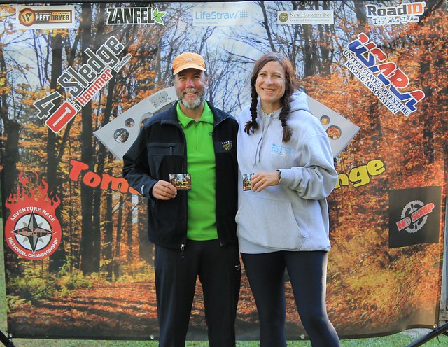
We got up and hour or so later to eat pancakes and sausage, pack up, and catch up with all of our friends. The awards ceremony featured no surprises. Perennial powerhouse Alpine Shop took first overall, and Bushwhacker came in second and Lupine third. In our division, AC/BDAR won first place, and Chuck and I took second.
 |
Chuck: This one is definitely going on the 'gotta-do' list for next year!


Comments
Post a Comment