M.O.R.E. or less day 7 - Mackinaw City KOA to Hog Island campground
Commentary by Chuck (green) and Steve (orange)
Previous: Day 6 - Sand Lake to Mackinaw City
June 7, 2021
We'd planned a later start to the day, but in a one-room cabin the first person to wake up to go to the bathroom (usually Chuck) effectively operates as an alarm clock for everyone. And so it was that despite our slothful intentions we were on Shepler's Ferry by 8:30. Though logistics rarely fail to stress me out -- I aspire to an attitude of it'll work itself out but often fall short -- the process was largely smooth.
We'd ordered tickets online in advance and called the shuttle that morning. The driver picked us and our bikes up at the campground for the short drive to the dock, where we lined up to have our tickets scanned. Our bikes were tagged and loaded along with all the other bikes going to the cars-free island, and then we boarded. Well, Steve and I boarded. Chuck's QR code ticket somehow had gone AWOL. I was already on the ferry and thought that he might have to meet us later, but the issue was quickly resolved at the service counter and we were all able to ride over together.
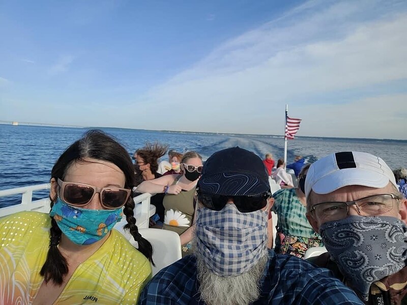 |
| On Shepler's Ferry |
Disembarking was like walking into Disneyworld; the streets were crowded with bikes and horses, and tourists packed the sidewalks. The ferry had been a time machine delivering us to lovely historic buildings and carless cobblestone streets. Steve was able to quickly get his shifting issue resolved at a bike rental place, and after breakfast in a busy cafe we set off to ride around the island.
Thank you for the kind and prompt service, Mackinac Wheels Bike Shop!
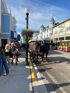 |
| Looking back towards the ferry dock 8:56 a.m. |
I was really excited about the idea of exploring this car-free island and early on loved the sound of the horse hooves clopping through town while pulling their wagon loads. That quickly changed to disillusionment, This was just a tourist-trap gift mall with pretty surroundings. I was happy to leave the main downtown area.
I too was glad to pedal away from the busy downtown area, and we all thoroughly enjoyed the gorgeous scenery along the ride. We circled the island on the outer road, stopping to take pictures, climb 200+ steps up to Arch Rock, and dip our toes into Lake Huron.
 |
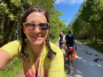
| Setting off on the loop around the island. 10:37 a.m. |
While the outer loop around the island was almost dead flat, the interior land rose steeply. Still, we couldn't resist the lure of the signs for Arch Rock. Parking my bike in one of the omnipresent racks I announced my intention to run to the top. That plan lasted through the second flight.
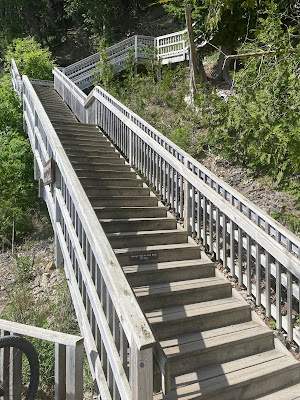 |
| The 207 steps to the top |
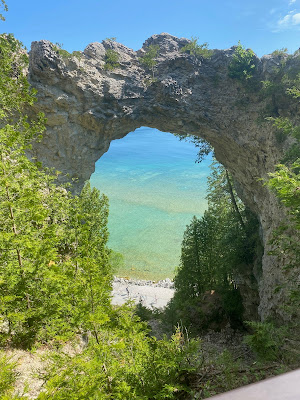 |
| Looking down at Lake Huron through Arch Rock. 10:46 a.m. |
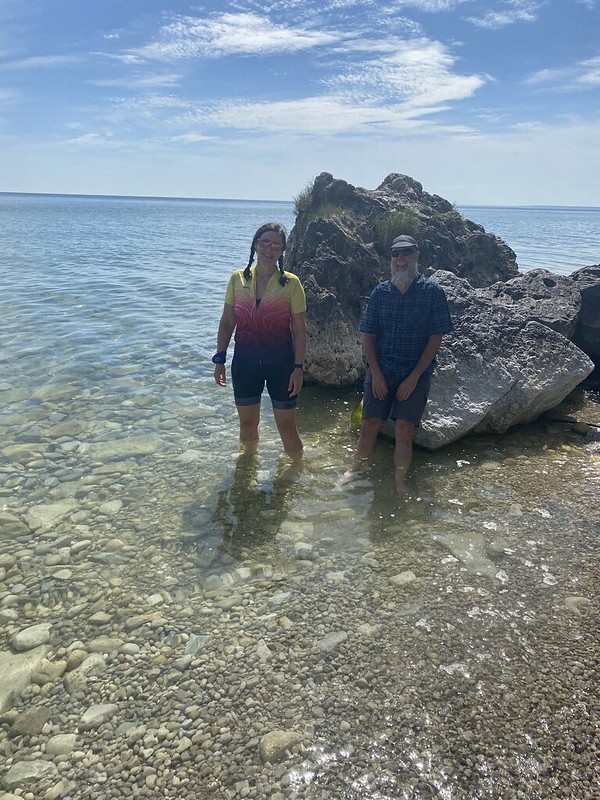 |
| Lake Huron! So clear and beautiful 11:07 a.m. |
 |
| 11:41 a.m. |
We enjoyed our circumnavigation of the island but opted not to spend extra money on tours or tourist-priced lunches. Another short ferry ride brought us to St. Ignace, our gateway to the UP. In place of fine dining on Mackinac Island we stocked up at Dollar General. It's hard to shop when nothing sounds good, so I settled for some high-calorie items I can almost always stomach.
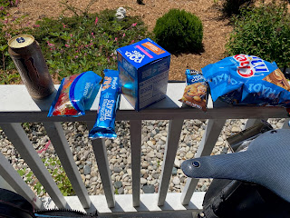 |
| Totally unintentional blue theme going on here... 1:17 p.m. |
...and then it was back to the MORE route because the first 16 miles sounded wonderful. I'll admit to some early doubts as we bounced out town on some sketchy gravel...
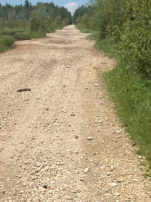 |
| Not the worst I've ever ridden but suboptimal 1:57 p.m. |
...but our faith in Matt Acker's course notes was rewarded by 13+ miles of blissful forest roads and zero traffic.
 |
| Smooth, lovely gravel roads! 2:14 p.m. |
Unfortunately, his comments about the subsequent two miles -- "tough sand section along power lines...with some hike-a-bike" (any adventure racer knows no good thing comes from taking the powerline) -- were, in the immortal words of Mona Lisa Vito, "dead on, balls accurate".
At first we were able to stick to the grassy middle of the road. It wasn't rideable -- at least it wasn't worth whatever effort it would take me to slog through the soft surface -- but at least it was semi-walkable. Soon we lost even that small comfort.
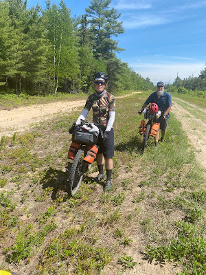 |
3:16 p.m. |
The grassy median abruptly ended in ankle deep dunes: all beach, no water. We trudged for two miles through this death sand, accompanied by a cloud of gnats and mosquitos. We'd enjoyed a largely bug-free trip so far, and these little assholes seemed determined to overcompensate for that lack. After a while I couldn't take it any more; I grabbed a bottle of repellant and slathered it on all of my exposed skin. This provided a little relief, but the only real solution was to power through as best we could, swatting the air around us while manhandling our bikes through drifts of sand.
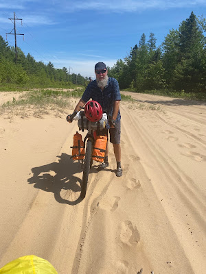 |
| 3:23 p.m., just after the end of our grassy respite |
At the end of our death march, I sat at the edge of the road to pick the ticks off of my legs. Only then did I realize something had been gnawing on my legs, all the way around the cuffs of both socks, leaving small open wounds. I had also jabbed a sharp stick into the inner side of my left calf in my haste to finish the powerline segment. The combination of insect bites and the puncture wound made my lower legs a bloody mess. This little connector was a tough two miles.
No picture of this because it was still insanely buggy and I rode away as quickly as possible, abandoning my friends to potential exsanguination by mosquito. Steve dubbed this stretch "Blood Road".
We took the first opportunity to diverge from the route. Rather than resign ourselves to a desperately long sandy slog, we dropped down to the Lake Michigan Scenic Highway and sailed along the smooth pavement. After all of my work locating services along our course, this sudden departure from the plan could have been a challenge but for a lucky coincidence.
 |
| Hello, Lake Michigan! 4:07 p.m. |
While creating the loop section we added to the MORE route, Chuck had found an Adventure Cycling Association route to get us most of the way from the Porcupine Mountains to Manitowoc and the Badger ferry. I'd bought a digital copy for their very useful Bicycle Route Navigator app but had accidentally purchased the wrong section. As it turned out, our detour took us onto the route I'd mistakenly picked, and we were able to use the information on the ACA map to find dinner and camping for the night. (Absent this, we also had a good cell signal and Google Maps, but I was happy to get some use out of my error.)
 |
| 4:29 p.m. |
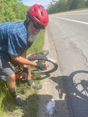
The highway was much busier than forest gravel, but it offered lovely lake views, a wide paved shoulder, and respectful traffic. We had our second (and last) mechanical issue of the trip when Chuck's tire picked up a big screw. He and Steve quickly plugged it while I documented their work. A passing car actually turned around to offer help, but by that time Chuck was almost finished.
Passing car = cool decked out adventure Jeep!
We stopped for a leisurely dinner at Cut River Inn in Epoufette, charging our devices and checking the ACA and MORE maps. I made reservations for the next day, which would lead us back to the course by way of a cabin with WiFi. This was important because it would allow me to watch Jacob's first match of volleyball regionals. And I've mentioned it before but it bears repeating how lucky I felt to be traveling with people who understood and facilitated my desire to watch those matches.
 |
| Taking advantage of the nearby outlet. 6:53 p.m. |
After stretching out our meal in order to maximize our electrical input, we rode eight miles to the nearly deserted Hog Island State Forest campground. Our site was prime lakefront property, though there wasn't much to see.
 |
| Moody Lake Michigan 8:20 p.m. |
A layer of fog, accompanied by a 15 degree temperature drop, made everything gray and damp. Lake Michigan had changed from calm blue to colorless and choppy. We'd made a point of wading in Lake Huron and planned a dip in each of the Great Lakes, but the chilly air and rough water suggested waiting for a more opportune time. No-see-ums filled the air and covered every surface, so we set our tents up as quickly as possible. Between the soggy air and annoying bugs, an early bedtime seemed like the best option, and I fell asleep to the lullaby of crashing waves.
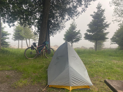 |
| Actually my campsite, not Chuck's, but picture a slightly smaller tent and you'll get the idea. |
My tent spot was flat, covered in thick pine needles, and combined with the waves and wind, I slept great on Hog Island. (Despite the crazy bugs!)
Next: Hog Island State Forest campground to Jack Pine Lodge and Campground
Links:
M.O.R.E. UP section 1 info (we only did the first 20 miles and used
RWGPS UP section 1 route (which, again, we largely ignored)


Comments
Post a Comment