There is cursing, and than an admission. "I don't have my tent."
We've just driven an hour to drop his Jeep in Elizabethtown and then an hour back to Ferne Clyffe to start our bikepacking trip, and Chuck's tent isn't in my car. I really don't want to drive another two hours to retrieve it, and I really don't want to share mine. Though I know it's not, I hopefully suggest, "Maybe it's in the trunk." There's no tent, but we find a tarp, and I have extra tent stakes. Chuck has rope. The forecast is clear. Problem solved, for tonight anyway.
That hurdle cleared, I lift my pack. It's ridiculously heavy. Surely there's something I can leave behind. I dig through it and then once more. All I can let go of is a water bottle and a stick of deodorant. Chuck offers to carry some things for me now that he's one tent lighter, but I turn him down, telling him I need to live with the weight of my decisions. It sounds almost profound, but I mean it in the most literal sense possible. Part of this experience is learning what's actually worth carrying and what I can do without.
I think it was in
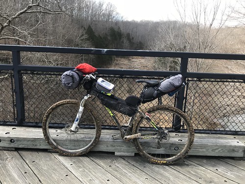
Jill Homer's blog, where she's written extensively about her outdoor adventures, that I read "you pack your fears". Judging from my load, I'm afraid of being hungry, being thirsty, and having wet feet. I carry too much food, too much water, too many pairs of socks. For water purification, I have a Steri-Pen and iodine tablets, just in case. This, as it turns out, is a good thing, but still...My bike weighs 29 pounds. My gear, including the pack I'm wearing, is 30.2.
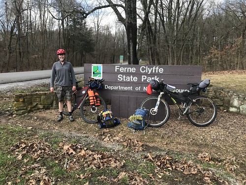 |
| Chuck and our loaded bikes ready for adventure! |
We finally start, and my legs aren't concerned about any of this. We start to climb out of Ferne Clyffe and I downshift. After a year on a singlespeed this feels like magic, like cheating. I've been saving for years for my Tour Divide bike, but since the ti Fargo I'd finally decided on is unavailable until at least the next model year, I'm making do with what I have. This weekend, I have no complaints. My Trek Xcaliber handles great fully loaded. It's a little bit of a drag on pavement, where Chuck's Cutthroat cruises along, but I feel totally confident on the trails, and with 60 pounds of bike + gear I build up effortless speed on downhills.
The night before we left I stayed up til 2 a.m. making a river to river route on the Gaia gps app, and we pull it out almost immediately when we make a turn too early. This trip will be one long game of "is it a driveway or a road", and we've guessed wrong this round. We have so many maps. Annotated forest service maps downloaded from a
River to River hiking blog (one of the main resources I used in planning this), equestrian maps I bought from the Forest Service office in Vienna, a Shawnee region State of Illinois cycling map, and a forest road map. We end up using everything except the forest road map. We spend plenty of time staring at maps and still make wrong turns. It's all part of the adventure.
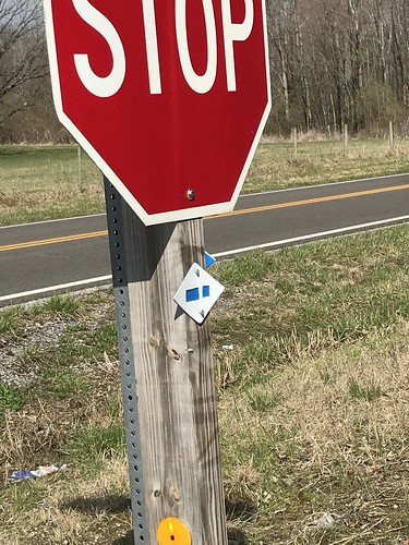 |
| Blaze at the first intersection. The dot of the i points the direction of the turn. |
Leaving Ferne Clyffe, the trail is the road. We make quick work of the first miles, agreeing that it's much better on bike than on foot. Information about cycling the River to River trail seems best described as "it's complicated". It's not expressly forbidden anywhere I've seen, and we've ridden parts of it in races permitted through the Forest Service. I specifically asked at the ranger station and wasn't told no (or yes, for that matter). Just because it's legal, of course, doesn't mean it's a good idea, but sometimes bad ideas make for good adventures and Chuck was the perfect partner for such an undertaking. We've raced together enough that I knew the weekend could be a trainwreck and he wouldn't be rattled. Plus, someone had to read all those maps.
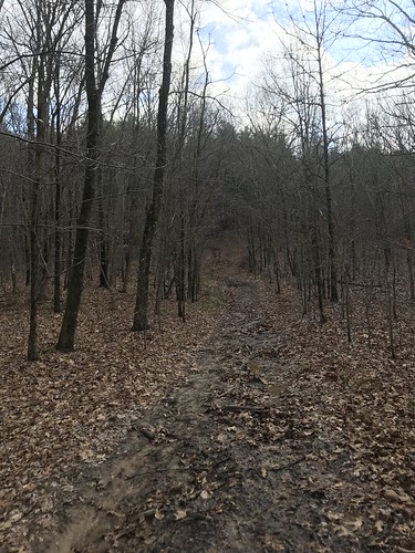 |
| Better than what I expected given the amount of rain the area has had. There was actually a river flood warning until Saturday morning. |
Not quite 6 miles in, our route turns from road to "road" and then to trail. Riding our bikes through this pine forest is magical, and we're both delighted we hadn't let the initially sketchy weather forecast scare us away.
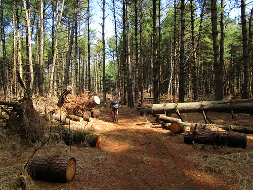 |
| Apparently all these trees were knocked down in a powerful "inland hurricane" several years ago. From the looks of things, they haven't been cleared that long. Good timing on our part! |
We follow the trail down from the pine forest over the Dutchman Lake dam, and then along a mix of trail and road to an intersection with the Tunnel Hill bike trail. I want to ride through the eponymous tunnel, so we detour north, taking advantage of the smooth trail to eat sandwiches while we ride.
 |
| Trestle just south of the R2R intersection |
Tunnel Hill is a lot like the Katy Trail with different scenery and higher bridges. Though I'd been looking forward to the easy surface, my mountain bike is much less fun on the flat bike trail than the River to River. The miles go by quickly, but the time passes slowly. The tunnel is worth it, though.
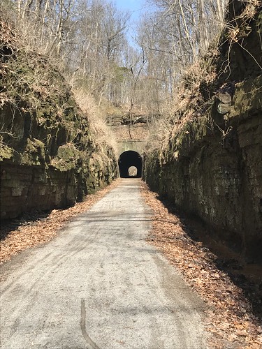 |
| The tunnel is longer than it appears here, enough that you can get a little disoriented and it would be easy to run into the side if you lose focus. |
Both the trail and bike maps show the trail intersecting with Gilead Church Rd, which we could then take to reconnect with our River to River route. Simple, just take the trail to the intersection, then turn right, but we never find our turn. After staring at maps and Gaia, we eventually realize that the "intersection" is actually where the road crosses over the tunnel. We pull onto the narrow county highway and cringe our way to the top of the hill. I think about how I promised Jeff we'd be sticking to safe, quiet roads and hope no one hits me and makes me a liar.
Snik...snik...snik...The velcro on my seat tub bag scrapes the inside of my knee with each pedal stroke. I try folding it over on itself, but that doesn't help. I think about asking Chuck if he has any duct tape, but instead I keep riding.
Snik...snik...snik... By the time we stop for the night my knee is raw.
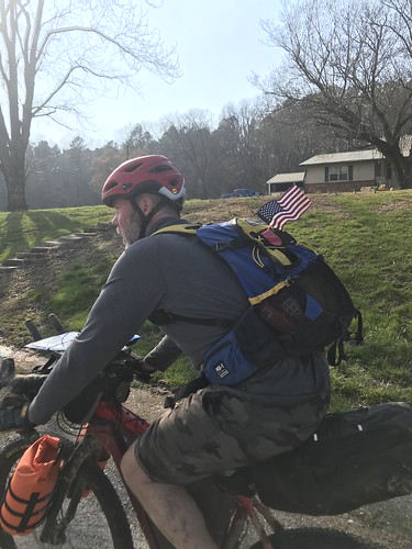
Gilead Church Rd. is a downhill delight, and all too soon we reach the turn to get back to River to River. We'd initially routed ourselves away from this stretch of creek-bottom singletrack, but that route is marked on a different map and our forest service map beckons us forward: "nice bluffs here". How does one skip nice bluffs? One doesn't; this is an adventure, after all. We plunge down the gravel road, Chuck's American flag fluttering in the wind, and turn onto rutted up mud.
The trail follows a creek bed. There are cool rocks. The bluffs are, at best, nice -- definitely not spectacular. Definitely not worth the 2.5 hours it takes us to push our bikes through horsed up mud and over trees and rocks. We rarely ride more than 50 feet at a time. Bikepacking here, I tell Chuck, is like mule-packing, but you have to push and pull and carry the mule as well. I wonder if I'll be able to lift my arms tomorrow. It's pretty but I don't take any pictures. I need both hands to wrangle my bike.
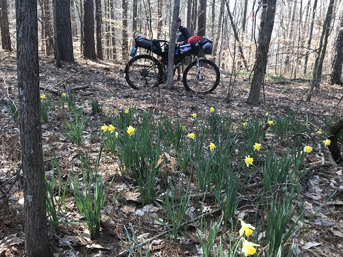
We finally escape the creek bottom and manage to ride a little more. I take a picture of my bike with flowers. It looks and feels like spring. For a few minutes this no longer feels like a bad idea, and then the trail drops back down a rocky, muddy slope that's only partly rideable. We finally pop back out onto the road. I'm so over the trail, and that's ok because now we're going to revisit Trigg Tower, which we last saw sometime around midnight in last June's No Sleep 24 hour.
We ride gravel to highway 147, enjoying its nice, wide shoulder before turning onto Trigg Tower Rd. We begin to climb and I notice the huge hills looming to our right. "It would break my heart to look up there and see the tower," I tell Chuck, who tries to tell me exactly which one we're headed to. I refuse to listen, leaving him to bear the weight of that knowledge. I'll carry my own gear; he can keep the bad news.
Two huge dogs spot us and begin to chase. We speed up and they fade back, or so we think. A little further ahead the slope gets steeper and we have company again. One is a Great Dane whose head reaches our grips. Chuck suggests that they tow us, but the dogs prefer to watch us work. If they wanted to eat us, all that would be left is a pile of bones. They walk beside us as we struggle up the climb.
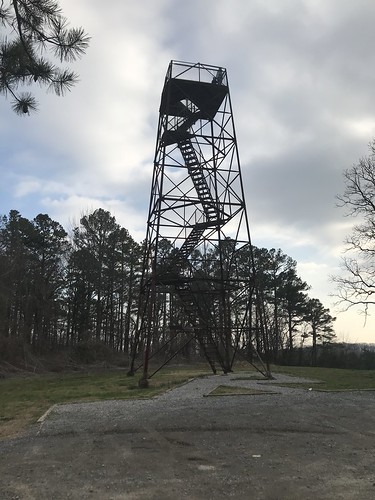 |
| Trigg Tower |
People are already on the tower when we arrive. They show no interest in leaving, and I don't mind because I've just realized that to see the daylight view from the top I'll have to climb it again. The two guys finally come down, but a family has just pulled up and goes up next. The sun hasn't set yet, but the afternoon has already cooled off a lot. I add a jacket and cover my ears. As the family climbs back down the stairs, the daughter asks incredulously, "How are you wearing shorts??" I tell her it was a lot nicer when we started riding, but the truer truth is that I'm too lazy to pull out my leg warmers.
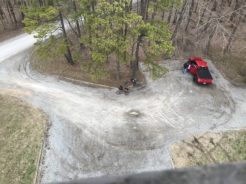 |
| Our bikes look very small from the tower. |
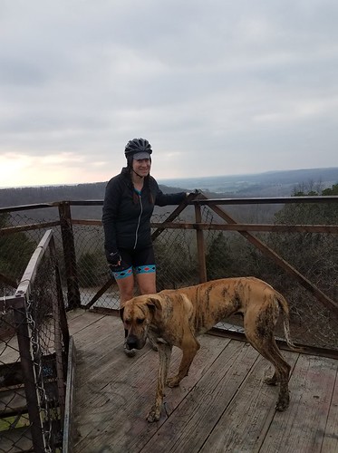 |
| Me and my new BFF. |
The dogs follow us to the top of the tower, which does nothing to soothe my nerves. We take some pictures and then I white-knuckle back down, dogs swirling around my ankles. We look at the maps again. It's nearing dark and time to find somewhere to sleep.
Chuck picks out a forest road off of Highway 147. The highway is signed as a bike route and has a nice shoulder. The few cars are unfailingly polite, giving us wide berth as they pass. The paved miles pass quickly, and we reach our turn. This is more of a road than some of the others, but there are some sketchy places. Chuck glances down at his chain and rolls off the road into a big rut. "What the hell are you doing in that ditch?" I laugh, echoing his taunt years ago when I did something similar.
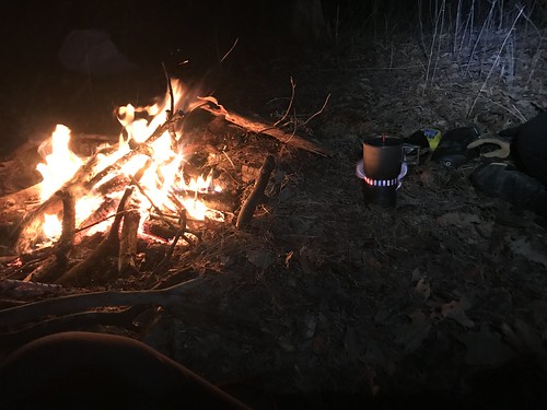
We pass up a potential campsite to find the creek and treat water. My Steri-Pen's batteries had enough juice to light up when it turned it on back at home but are not, it turns out, full enough to actually purify the water. I'm glad I brought the iodine. Chuck's filter works perfectly and quickly. I think I may be making a new purchase. We push back up the hill to the spot Chuck has picked out, build a small fire, set up our tents (well, my tent and his tarp).
My JetBoil lights using the igniter, so I don't have to use the lighter that scares me. I make a cup of hot chocolate even before I make dinner, and it's perfect. I cook my heaviest meal (literally the heaviest, a premade rice dish that weighs twice what my Mountain House meals do) and eat both servings as well as some bacon jerky. We sit around the fire and drink some whiskey and I'm in bed before 10 for some well-earned sleep. It's been a darn near perfect day.
Day 2


Great read and pics!I will stay tuned. I have been considering doing this but was unsure about riding the RTR. This helps.
ReplyDeleteThanks!
You should probably still be unsure about riding the RTR. ;-)
DeleteOh I loved reading this one, especially since we were just in the RTR area recently. That pic of the dog on the tower is great!
ReplyDelete