Day 1 recap
I fall asleep quickly but wake in the night feeling like my head is resting on a rock. Maybe that dry bag of clothes wasn't a brilliant pillow substitute after all. I shove it aside, bundle the hood of my mummy bag under my head, and the figurative lights are out again with the immediacy of a flipped switch.
It's not a restful sleep; I'm chilly despite my 32 degree bag. I have other layers, a down jacket, and a SOL bivvy with me for just this possibility, but I'm not uncomfortable enough to fix the problem. Instead I curl up in a ball, doze off, and repeat the process throughout the night.
Eventually I wake to a light sky, shocked to see that it's already 7:10. I pull on my puffy jacket but stay in my sleeping bag as I deflate the pad and repack the few items I had out, only leaving the tent when I run out of reasons to stay in its relative warmth.
My initial thought is to get packed up and hustle out. With an earlier start we should be able to knock off way more miles on day 2, but when Chuck asks if we have time for coffee, my motivation does a 180. A hot drink sounds -- and is -- fantastic. We briefly consider making breakfast but pin our hopes on theoretical biscuits and gravy at the Eddyville Shawnee Mart.
Packing up goes surprisingly well compared to the multiple attempts it had required the previous day. It's quite chilly, and though I have lots of clothing choices -- too many, really -- I dress for the temperature I expect to have in the next hour or two, something like the beautiful weather we'd had the previous day.
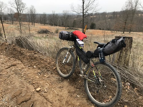
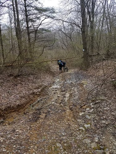
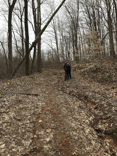
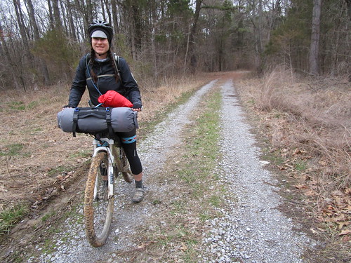 |
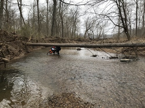
| Leaving our campsite |
We pedal away from the wide spot we'd called home the previous night, and this time I bomb downhill and across the sketchy little creek without hesitating. "I'm moderately shocked that you rode that," Chuck tells me. Honestly, I am too, but on day two it appears I'm less nervous about falling than about losing momentum and having to push my bike uphill.
It's only four paved miles to Eddyville, and here Chuck's Cutthroat really shines. He seems to cruise effortlessly while I work to stay with him. This, I think, bodes poorly for the rest of my day. We reach the Shawnee Mart, and my heart momentarily sinks at the empty lot until I notice the "open" sign. We're in business.
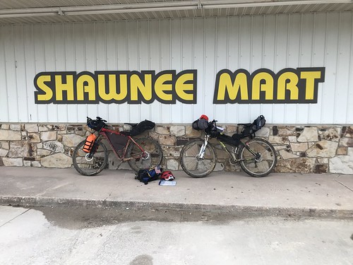 |
| Quite an assortment of food, drinks, and random supplies. |
Sadly, there are no biscuits and gravy to be had, but the girl behind the counter is willing to cook us a pizza, and that's not a bad consolation prize. She does not, however, give up the WiFi password, so while I enjoy a tiny sliver of service Chuck is left with just my company. We fill up our water, drink coffee, and look at maps while our pizza cooks. The stop takes just over an hour, but it's not like we're racing. This, I think, is going to be my problem with bikepacking in general. Not racing, it turns out, is pretty fun.
Our initial plan had been to stick close to the River to River Trail, though this day was always going to involve some detours around the Bay Creek, Lusk Creek, and Garden of the Gods wilderness areas. I'm writing this four months later, so I don't remember now when we decided to modify our day two route. Regardless, at some point during the day we decided to take a more direct route to Elizabethtown, skipping over the section where the trail swings north before curving back around.
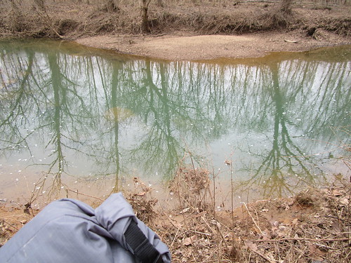
 |
| Heaven |
We're on more pavement as we depart Eddyville, the primarily downhill miles making for an easy ride. I could get used to this.
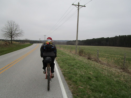 |
| Chuck leading the way. |
The pavement is easy, but then we turn onto the most perfect gravel road and my ride satisfaction jumps. We cruise down the tree-lined paradise to our turn. Well, maybe it's our turn. We're navigating by the
Friends of the Shawnee equestrian map for the eastern side of the National Forest, and the road we see is nothing more than a couple of overgrown ruts with a private property sign. A quick check of google maps reveals no other likely road in front of us. Even potential trespassing is a big no for me, so we turn around. Aren't we lucky, we get to ride this pretty gravel uphill now.
 |
| A road so nice we rode it twice. |
Thankfully Chuck is a magician with the maps and quickly works out a new route. I'm grateful again and again for his presence as we arrive at turns labelled differently than on our maps and he makes sense of it all while I follow behind in hopeful confusion.
 |
| This picture totally fails to show how pretty it was with the hills in the background. |
The roads are relatively easy riding, though we make a lot of stops to make sure we're on track. I'm not miserably cold, but I'm never warm enough to be comfortable. Despite having easy access to more layers, I stubbornly refuse to put them on. I hate to be hot on the bike and just know it's going to warm up. After all, the forecast had been similar for both days, and the previous day had been super nice. I just had to wait it out.
 |
| A little tourism |
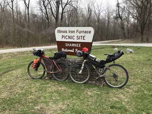
The trail passes near the
Illinois Iron Furnace , so of course we route ourselves past it. Kind of a cool little stop, though I wouldn't drive out of my way just for it.
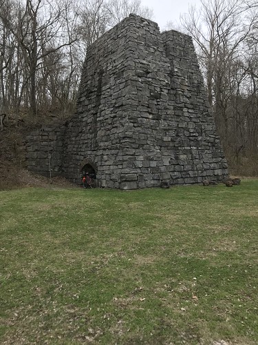 |
| "The only remaining iron furnace structure in the state of Illinois" |
As we ride, we talk about the next day. In addition to the two weekend days we'd both taken two days off from work so that we'd be able to ride the whole trail. We'd modified that plan to "ride across Illinois" when we opted to skip the northern section of trail on the East side. Then we'd both decided that we'd like to be finished by Monday evening. Now, still chilly, looking at the rainy forecast for the next day, we considered the chances we'd make 50 miles in the rain when we'd logged less than 40 on two relatively nice days. It seemed quite unlikely.
In retrospect, we probably could have made it had we committed, actually gotten an early start, and stuck it out. Thanks to wilderness and state park rules, our trail time for that leg would have been limited. The next day did get heavy rain, but we both had brought rain gear. Still, our main goal for the trip had been to get some experience, and both of us were comfortable putting off the type 2 fun variety of experience until another time.
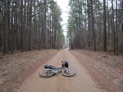
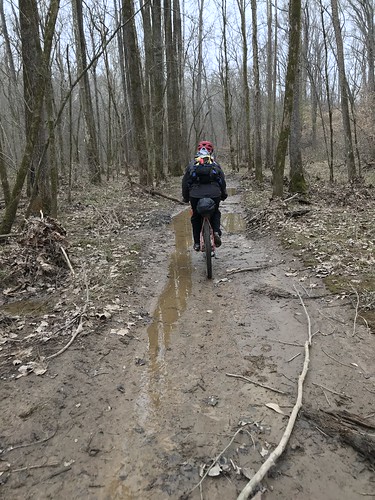
After the furnace we jump back onto the trail. Conditions are typical for the Shawnee; the going is far slower and way more fun.
 |
| Just another Shawnee road. |
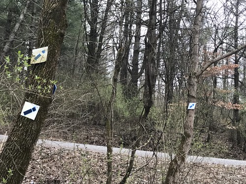
 |
| Bike limbo. You can just see the trail blaze on the tree at the far right of the picture. |
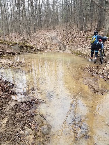
Even with all of our maps and trail blazes we make mistakes. We choose the more used trail at an intersection, and naturally it's the wrong one, petering out at the most perfect swimming hole. Well, perfect if it wasn't 50 degrees.
 |
| This would be great on a hot summer day. |
We retrace our steps. We really need to start making uphill errors so at least we can coast back down our mistakes.
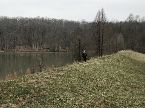
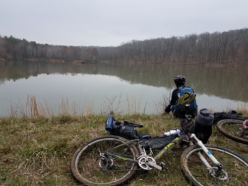
The trail passes by Lake Tecumseh, so of course we ride out onto the dam.
It's the perfect spot to snack and ponder how lucky we are to be on our bikes.
The trail leads to road again. Normal people road, not jeep road.
 |
| Not sure there are enough trail blazes here. |
But only momentarily, then it's back to trail.
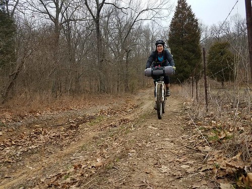
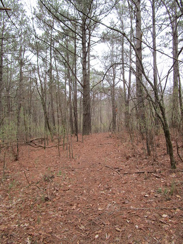 |
| A lovely, rideable spot. |
Our map shows that we'll be following roads for the rest of the way out. Just a few miles. Nothing to it.
Right.
 |
| "Roads" |
It's clear we're getting closer to town when the jeep ruts and mud puddles get deeper again. We pass a couple whose Jeepish vehicle is mired in mud up to the chassis. They say a buddy is coming to pull them out, but we don't see any other trucks or Jeeps on our way out.
We pass a piece of sign pointing to an old cemetery. Of course we detour to check it out, but all we find is an old foundation and well.
 |
| Only three miles until the end, I'm done staying out of the mud. |
Our last three miles take over an hour as the trail meanders vaguely along jeep roads with far more rocks and mud than blazes. We wander along, hoping we haven't missed some obscure turn. Chuck rides while I do a lot of pushing and dragging. Whether it's the lighter bike or better fitness (likely both), when you combine those with his superior technical ability, he was the much stronger rider at the end of this trip.
Finally we pop out on to a dirt road that's much more recognizable as something you'd drive on.
 |
| Ah, the sweet relief of pedaling instead of pushing! |
I'm thrilled to see Chuck's jeep waiting for us and less happy when he insists on riding into town to dip our wheels into the Ohio River. In the end, of course, it's the right choice.
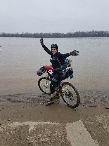 |
| Finished! |
It's been too long to remember the specifics of what I packed where. Best guess: I think the front roll held my tent poles, sleeping bag, and clothes. The seat bag held my tent + rain fly (old Eddie Bauer 2-p backpacking tent), sleeping pad (Thermarest neo-air), and JetBoil. I carried food, medical kit, Steripen, and water in my backpack. The red bag carabinered to my front roll held layers for easy access. Snacks were in that white top tube box and the Jerry can on the seat post, and I kept my phone, external battery, and cords in the top tube box as well. I had other snacks and meds (ibuprofen, benadryl, and electrolyte tablets) in the feed bag on my handlebars.
Take-aways:
- I definitely overpacked on food and clothes, though I'd have used more of the food had we camped as long as initially planned. I wasn't sure how much food to pack and opted to go with close to the number of calories I'd take for adventure racing (where I aim for ~250 calories an hour). I didn't eat anywhere near that much.
- I spent the entire day chilly and worried about how I'd feel the next day, which was supposed to be colder and rainy. As it turned out, our temp was significantly colder than the previous day and around what the next day would be. If I'd just dressed for the weather we had rather than the weather I expected, I'd have been much more comfortable and likely much less worried* about the next day's conditions. (*Worried is probably the wrong word, but I was definitely not looking forward to it.) I had plenty of layers with me, so it was dumb to not use them.
- I need to work on making a realistic estimate for how many miles I'll cover in a day. I'd read this before the trip, but miles take a lot longer on a loaded bike.
Route notes:
- Strava link to day 2 route.
- Eddyville and Elizabethtown both had gas stations/convenience stores where you could get water and buy food and some supplies. Treatable water was available on the trail section after the Iron Furnace and at Lake Tecumseh.
- This day was 36.4 miles with about 3100 feet of climbing, mixture of pavement, gravel, jeep roads, and singletrack.
- Cell service was spotty.


Comments
Post a Comment