Part 1
Part 2
After questioning myself in the lead-up to the trip and considering turning around and going home for basically the whole drive down, getting on the bike made everything better. The first 11 miles of River to River follow a gloriously flat levee trail from Grand Tower to some lovely bluffs. Well, if not glorious it was at least pretty nice on a bike. I can imagine it would get long and boring on foot, and overall that's been my experience of the River to River Trail. The road parts are so much better on a bike, and the trail parts are so much better on foot.
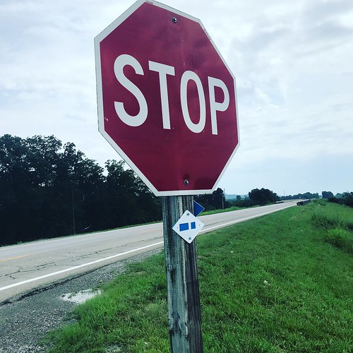 |
| I didn't see nearly as many River to River trail markers on this trip since I skipped nearly all of the trail parts. |
Though the weather forecast had promised storms, the reality was bright sun and gentle breeze. The trail took a quick jog onto Rte. 3 to cross the Big Muddy River, then returned to a quiet levee road.
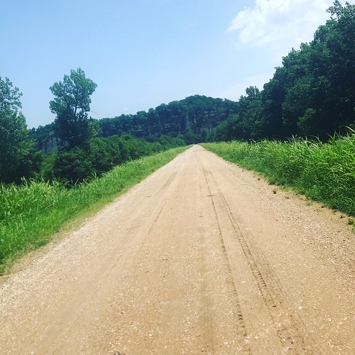 |
| The first 8 miles had a Katy Trail-ish feel to them. |
The route was pancake flat until I turned onto LaRue Road, but the increasing elevation was accompanied by deep shade, making it a worthwhile change.
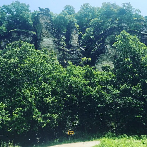 |
| A huge bird was nesting partway up in those bluffs. |
The road was lined by towering bluffs, and I pedaled along enjoying the view. The trail turned onto Pine Hills Rd, where I saw a sign for Inspiration Point. I considered a quick detour since that sounded cool, then calculated that reaching a "point" would likely require climbing. Never mind. I stuck with my plan.
River to River cuts through Clear Springs and Bald Knob Wildernesses on singletrack, so I had to skirt these on Rattlesnake Ferry Rd. and Milligan Hill Rd, rejoining the R2R route at the intersection with Bald Knob Rd. This section, though climbier than my first miles, wasn't ridiculously so, but even early on I had a harder than expected time with hills. I walked early and often, now glad that no one was there to have to wait on me.
Not twenty miles in I felt a lot like I remembered feeling in the later miles of
Motherlode. At the time I attributed it to being out of shape, which I definitely am compared to my bike fitness in March, but in retrospect I think the heat and humidity were bigger issues.
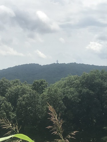 |
| Bald Knob Cross of Peace |
The Bald Knob intersection was another opportunity to seek adventure, or at least do a little sightseeing, but looking downhill and knowing I'd have to ride back up on my return trip, I didn't even think twice about it. A little further down the road I pulled over to take a picture of the cross in the distance, and while I was stopped an old man on a cruiser bike rode past without speaking.
That was to be typical of my (non)interactions with cyclists on this trip. Three different times I was stopped (this time to take a picture, once clearly struggling in the heat, and once to look at a map) and people on/with bikes passed by without a word. Drivers, on the other hand, were unfailingly polite. In two days I encountered no unfriendly drivers or aggressive passes.
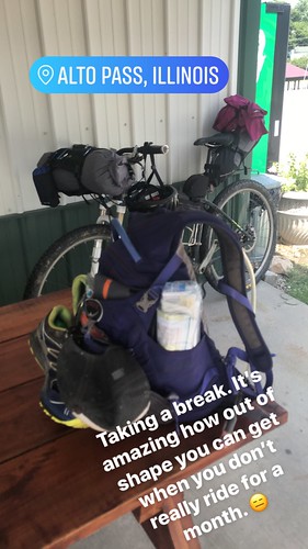
I rolled into the town of Alto Pass starving and ready for a break from the heat. The Rootbeer Saloon I'd read about on rivertorivertrailhike.com was closed, but happily there was a little store just uphill from it. I stopped at the little park between them to refill my water, having drained nearly three liters in just 20 miles, then rode to Duty's Market for the finest in convenience mart dining.
After soaking in the back room air conditioning as long as possible, I hit the road again, briefly missing a turn but quickly righting myself. Two miles later I crossed a sketchy wooden bridge and arrived at what was to be my first turn onto a trail section of the River to River, only to be greeted by a driveway full of private property signs.
I had a brief angel/devil on the shoulder conversation with myself that went something like
It's fine, the Garmin says turn here! But...private property signs! I don't want to be shot or yelled at by an angry landowner. Just turn, it'll be fine. In an entirely predictable decision if you know me at all, I opted not to make the questionable turn. Luckily, I'd planned out a road detour in case of issues with the trail, so all I had to do was load my detour and continue on. Maybe I'd feel adventurous and try the trail on my way back the next day.
I actually had access to the information I needed all along thanks to my trusty River to River Trail resource but had skimmed over it when doing my original prep, so it wasn't clear to me until I came home and really looked over
the page that describes this section of the trail.
"You will deviate from the map because the map shows the trail just to the east of a creek, where in real life it travels across the West side of a large square field on the West side of the creek."
 |
| Where the forest service (and Garmin) maps show the trail. |
Basically, I should have looked for my turn before crossing the bridge. I used the forest service maps to create my route, but I guess I also should have compared them to the notes on the website. That would have likely helped me catch the mistake.
At the time, I was none too broken-hearted to miss the actual trail since our March experience involved more hike-a-bike than riding, but after looking again at some of the images on
rivertorivertrailhike.com for this section, I'm a little sad. They look shady and rideable, while my reroute was sunny and not particularly interesting. It first crossed some pretty gravel roads than felt a little like riding up someone's driveway, then turned onto old US Hwy 51 for 4 more miles. It didn't have much of a shoulder, but thankfully the traffic was relatively light. Still, I was happy to reach Makanda and return to my original route.
That sentiment lasted for about half a mile, the time it took me to coast down Eastern Star Trail/Rd. and see the entrance to the trail in front of me.
 |
| I didn't feel lonely all day because I spent the whole time adding pictures on facebook and instagram. |
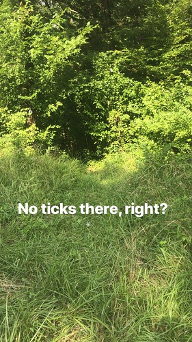
My sense of adventure had evaporated in the heat, and I wasn't excited about turning onto the overgrown trail. My attitude wasn't improved by thick spider webs and flat, mossy, off-camber rocks that looked about as walkable as an ice rink. I grabbed a stick to clear the webs and grumbled to myself,
This is where "This is a great idea" turns to "This is a dumb idea." Thankfully the chunk of trail was less than a quarter of a mile, and I somehow managed not to fall in that time.
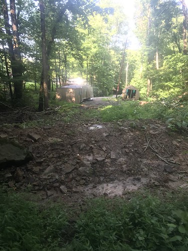 |
| The end of the trail was even less welcoming than the beginning. |
The trail led to a busted out trailer/open shed that I passed as quickly as possible, crossing into town and beginning the climb up Baptist Hill Rd. Steep and narrow with no shoulders, this is a route choice I wouldn't repeat. I didn't have to worry about swerving into traffic as I rode up the hill because it was all I could do to walk my bike from shady spot to shady spot, catching my breath before attempting the next sunny section. I'd been hoping to catch a second wind and be able to knock out the final 20 miles to Ferne Clyffe, but this section settled me on the earlier stop at Giant City.
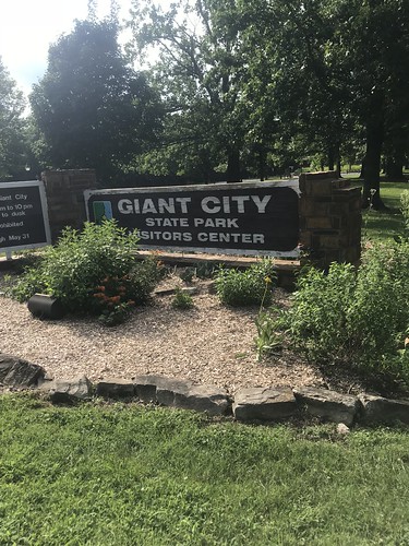 |
| Home sweet home for the night. |
Once I reached the summit, the rest of the ride was smooth sailing. I cruised into Giant City State Park and, not having planned a route to the campground, followed the signs until I found it. I'd initially planned to get a site in the tent section, but it was empty. Realizing the limit of my "solo girl" bravado for the day, I opted to spend an extra $10 for an electric site because I felt more comfortable with other people nearby.
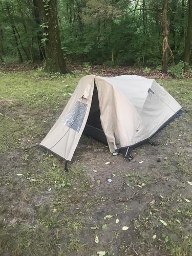 |
| My bargain tent, still going strong. |
I set up near a pavilion, where I fully intended to move if the predicted storms moved in, then showered, hung my sweat-soaked clothes in the futile hopes they'd dry, and made Mountain House lasagna for dinner. Camping alone wasn't lonely, but it was boring. And hot! Even at 11 p.m. the "feels like" temperature was 91. It's hard to complain much about a tent you bought 15+ years ago for $20, but mine sure doesn't allow for much air circulation. I definitely could have done without the packable blanket I took with me.
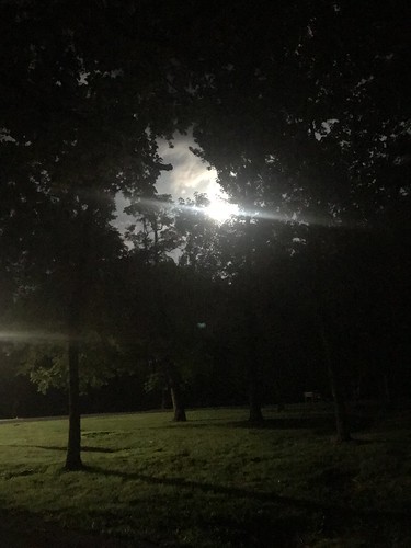 |
| The moon that night was huge. |
Eventually I fell asleep. Day 1 of my solo experiment hadn't been a rousing triumph, but it was a definite success in my book. Now I just had to get back home in one piece.
Part 4


Well done for being brave. I remember my first solo camping night, I was convinced everyone was staring at me, but I don't think they were. I did find a rabbit friend though.
ReplyDelete