Perfect 10 (again)
This was BonkHard's third time holding the Perfect 10 orienteering race, Team Virtus's third trip to the event, and my first attempt at truly solo-ing the course. In 2012, Luke, Bob, and I all registered as solos but ended up spending basically the whole day together. The following year, we had an intra-team competition pitting Bob and Casey against Luke and I (a competition, I might add, that we won). I've put a lot of work into improving my navigational skills this year and so again I registered as a solo, this time intending to actually race on my own.
Intending to, but not at all excited about it. I was nervous about the potential for me to get really lost, and I knew there was no way wandering around the woods by myself for ten hours could possibly be as fun as hanging out with my team. Anybody who knows me (and has been distracted from the map by my constant chatter) knows that the social aspect is my favorite part of racing, so it shouldn't be a surprise that on race morning I still hadn't committed to racing alone.
Or that I spent more time talking than looking at my map...
Eventually I sat down with the map. Thankfully the CPs are all pre-plotted; we just had to decide what points we were going to try for and in what order. CPs had different point values: 100, 30, 20, and 10, so it was important to plan a route that would maximize your score.
Because we've spent all of our time in the eastern section of the map in previous years, I wanted to try something different. Since the other woman in my division, Yvonne, is a FAR better navigator than I am, I wasn't concerned about actually trying to win. I just wanted to get some good experience and plenty of miles for Skippo training.
Training Wheels
Luke and I independently planned an identical route for the first 6 checkpoints. I always have a hard time with the first few CPs and was really happy that I wouldn't have to start alone...even though, for the first time ever in an orienteering meet, I knew where I was headed when the race started (and how to get there!).
I've been doing a lot of training in preparation for the Skippo 30K, plus Chuck and I intend to push the pace in our upcoming 12-hour adventure race, so I planned to run everything I could at Perfect 10. Luke hasn't done much run training recently, but I've raced with him enough to know that wouldn't matter.
The first mile or so of most runs feels awful, and this one was no different, but by the time we were on the trail I started to feel a little better. Most of it was very runnable, though we walked parts that were overly rocky or rutted or uphill. We had a slight bobble when we initially turned too early and ended up running into Gary driving the course, but we quickly corrected and found the checkpoint, at which point Luke sprinted ahead of me to get there first. What a dick.
From 19 we bushwhacked down to the trail, ran most of the trail, and then bushwhacked up the spur to get CP27. From there we headed down to the road and took that to the creek south of 26, following the creek until the correct reentrant for 26. Luke was doing all of the navigating, but I was following along on my map and checking in with him; I wanted to make sure I knew what I was doing before we parted ways.
I headed back to the road and then west again, still running unless I was going uphill. I saw Jason again, confusing him.
"Where's your teammate?"
"I'm racing solo today!"
"What about the guy you were with?"
"Oh, him...we just had the same route at the beginning."
I ran into BBP as I was nearing the trail to CP5, and Stacey warned me that the trail could be easy to miss if I wasn't paying attention. Armed with this knowledge, I spotted my turn and found the correct reentrant with no problem.
Once again I followed the high ground out to the road and did my best to shake off my lousy performance. On to CPs 31 and 10!

31 should have been easy, just run the road to where it curves and then go west along that skinny ridge (or spur, whatever it is). Instead, I cut in too early and spent a lot of time wandering around again. I really didn't want to fail on a second straight CP, so I stuck with it but eventually gave up and hiked back out to the road, very thankful I could at least find that.
When I made it out onto the road, though, I was considerably south of my intended attack point. Realizing my mistake, I decided to give it another try from the right spot. That worked much better, and I finally found the CP. By this time, I was starting to look at my watch and get a little nervous about making it back to race HQ in time, and I wasn't the only one. Another racer was hiking to the road at the same time I was. As I caught him, he mentioned, "I'm a little worried about getting back by 6." Me too, buddy. Rather than go after any other CPs, I decided to head back and maybe get one of the points near the start/finish line if I got back with extra time.
Except....there was CP3, a hundred pointer, conveniently sort of on my way back. I could run south along the road next to Pin Oak Hollow until turning onto the road back to the start/finish OR I could bushwhack across and hopefully pick up CP3 on my way. If I missed it, so be it, I'd just hit the road and head south again. Not having learned my lesson, that's exactly what I did.
I (shockingly) did not walk straight to the 100-pointer, and I stayed committed to my plan of heading towards the road and not wasting any further time on wild goose chases. I crossed a creek which I assumed was the one west of the churches and then totally failed to stay on my bearing for the short way to the road. I hiked and hiked, finding myself trending north every time I looked at my compass and eventually coming out at a powerline cut bordered by a fence. More private property!
I followed the fenceline until I could cut out onto a gravel road. My map was folded so that just the section I was trying to be in showed, and I had no clue where I was. The road went east-west; I needed to go east, so that's the way I turned. Before long I came to an intersection; of course the cross road was unsigned, but since I needed to go south to get back to the finish line, that's the way I went. I eventually passed a mailbox with a Kaiser Rd. address on it, but a glance at the small section of map showing failed to enlighten me.
 Soooo, in my first two-ish hours I'd collected 90 points. In my second two-ish hours I'd collected 170 points. And in the next 4 hours I'd scored...50. Plus, I was lost. It was now past 4:30 and I was resigning myself to coming in well past the 6:00 cutoff. I envisioned calling Luke to ask for a ride: "Can you come get me? I don't know where I am." A sign welcoming me to Lake of the Ozarks State Park was a small beacon of hope, though until seeing it I hadn't realized I'd left the park.
It's hard to be to motivated about going fast when you have no idea where you're going, but deciding that it would be better to realize my mistake sooner rather than later, I started running again. Something finally compelled me to unfold my map, and that's when I saw it...Kaiser...about a mile north of where I had thought I was. Many bad words were spoken, but at least I knew where I was now.
I tried to measure off the distance remaining to the finish. It's not easy to do that while running and even harder when suffering race-brain, but I eventually figured out that I had around 10K to run in what was now around an hour and fifteen minutes. I'm a runner. I've run 6 miles plenty of times, and I'm typically capable of running faster than 12 minute miles.
But I've never run 6 miles, carrying a pack, after running/trekking for 9 hours. I had a chance, but it was a small one. Thankfully the navigation was easy, all roads, and once I reached the Y-shaped intersection at the top of the picture to the left I was on familiar territory. I ran every flat and downhill section, fast-hiking the uphills. Running down the gravel road near CP26, I saw Sandy (who I'd met that morning in the campground bathroom) pop out of the woods with two SLOC members.
I walked up the next hill as quickly as I could, and then started running. My very happiest moment was passing a sign that said 2.2 miles to the campground and realizing that meant only about 2 miles left to go and 40ish minutes to get there (Almost the exact same circumstances as when I did this race in 2012). I was going to make it! I could stop running!
Except...I didn't want to stop running, so I didn't. I could see 10-12 racers walking up the road along the airport boundary ahead of me, lining the side of the road like a string of war refugees. Passing two of them near the bottom of a hill, I recognized Jason and Laura Elsenraat, the former owners of BonkHard (who had a great race with Laura handling the navigation). Great...with friends behind me, now I had to run the uphill (and by this point "run" was a very loose term).
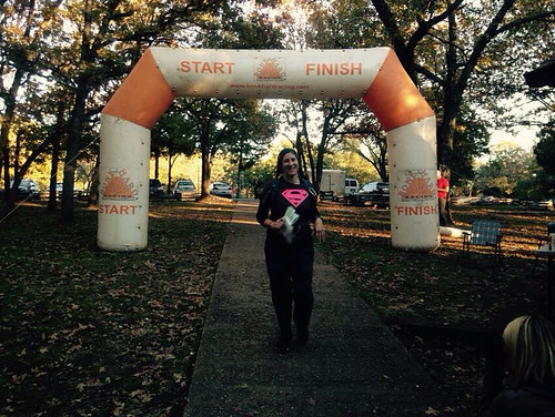
I kept on running until I crossed the finish line with 16 minutes to spare...
...and got my picture taken under the arch...
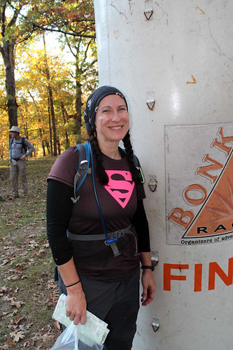
....and regaled my friends with tales of my navigational non-prowess...
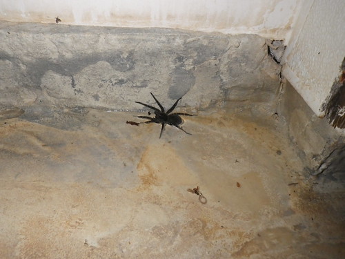
I changed into some dry clothes, inhaled some delicious food, and hung around telling and listening to stories from the day. Even though none of us placed, it was fun to cheer as some of our speedy friends collected their awards. Finally we headed back to the campground, where I met the biggest spider I've ever seen and opted to go to bed stinky rather than shower with cold water.
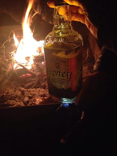
We'd planned to meet up with AR friends who were camped at another site, but we made the tactical mistake of sitting by our own fire for a minute and never managed to leave it. I hate that we missed out on the fun, but we had good company and a great time hanging out together.
After the race I told the guys there was no way I'd do Perfect 10 solo again next year, but who knows. I'd expected to be lonely, but I was so focused on the map that I never really was. I'd anticipated tears within an hour, and that didn't happen either. I'm disappointed in doing such a lousy job after a strong start, but honestly the day went far better than I'd hoped (plus, best I can calculate, I ran/hiked 24 miles, which makes for a good Skippo training day). Overall, it was a great experience, and even if my performance was sub-awesome (I came in 47 out of 53), the day was anything but.
Full results.
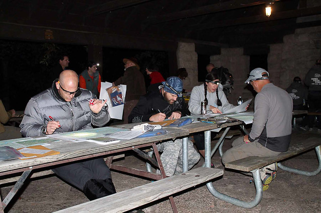
Oh, and I always assume that everybody else already knows what I do about orienteering, but since none of my teammates had seen this done, I'll share it with you guys. Before the Babler O meet a couple years ago (a race where I did do a lot of crying) Dr. Fran showed me how she marked her passport. Basically, she takes the CP clues and writes them in the corresponding box on the passport. So in my example below, the clue for CP1 would be "trail junction", 2 and 3 would be "spur", etc. I like that rather than writing the clue on the map because I'm always afraid my writing will obscure some vital information.

Intending to, but not at all excited about it. I was nervous about the potential for me to get really lost, and I knew there was no way wandering around the woods by myself for ten hours could possibly be as fun as hanging out with my team. Anybody who knows me (and has been distracted from the map by my constant chatter) knows that the social aspect is my favorite part of racing, so it shouldn't be a surprise that on race morning I still hadn't committed to racing alone.
Or that I spent more time talking than looking at my map...
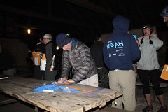
Eventually I sat down with the map. Thankfully the CPs are all pre-plotted; we just had to decide what points we were going to try for and in what order. CPs had different point values: 100, 30, 20, and 10, so it was important to plan a route that would maximize your score.
 |
| Looking over our options |
Training Wheels
Luke and I independently planned an identical route for the first 6 checkpoints. I always have a hard time with the first few CPs and was really happy that I wouldn't have to start alone...even though, for the first time ever in an orienteering meet, I knew where I was headed when the race started (and how to get there!).
 |
| The order that Luke and I ran together, though we took road and trails when possible rather than following the blue line. |
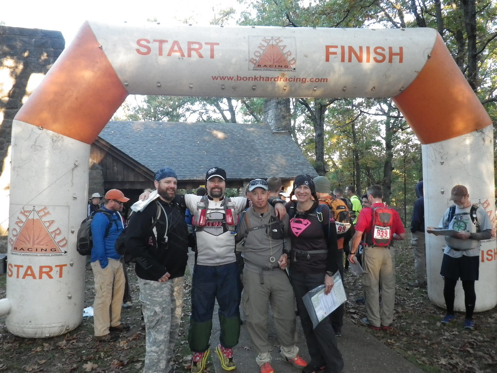 |
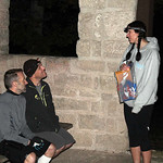
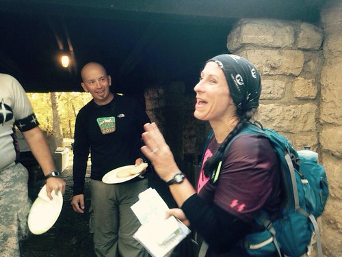
| Pre-race team photo |
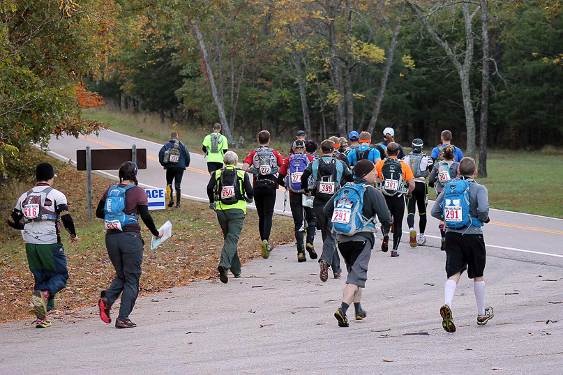 |
| "Running" at the beginning of the race. |
 |
| Photo credit: Erin Santos |
Approaching 26, we saw Andrei and Erl from Gear Junkie/Wedali (one of the top teams around) and ran to get to the CP first, just to be stupid. Of course, at this point in the race they had twice our score, but Erl was cool enough to pose for a picture showing us "ahead".
 |
| We totally had more fun points. |
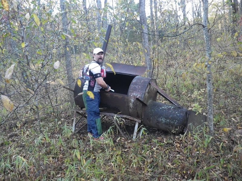
From 26 we headed northwest to the trail and then ran the trail to CP17. I think this is the area where Jason Bettis ran past us, snagged the CP, and ran back past us again while we were still standing at a trail intersection checking the map. Then we took the trail north until it crossed the creek and turned northeast. We bushwhacked toward CP25 at the pond, running across this random abandoned picnic area and gigantic grill...or, as we like to call it, an awesome photo op!
After finding CP26, we headed towards CP16. We followed the creek down the road to the west and decided to bushwhack across and up the spur to 16. We trudged across a brushy wooded area until we came to a fence. Just as Luke warned me about it and started to cross, I looked at the map and realized we were at a private property line. Damn. If you look at Alpine Shop's maps, they always block out the private property. We need to start doing that, because all of those red lines kind of run together on the map, especially when you're in a hurry.
 |
| Order up! |
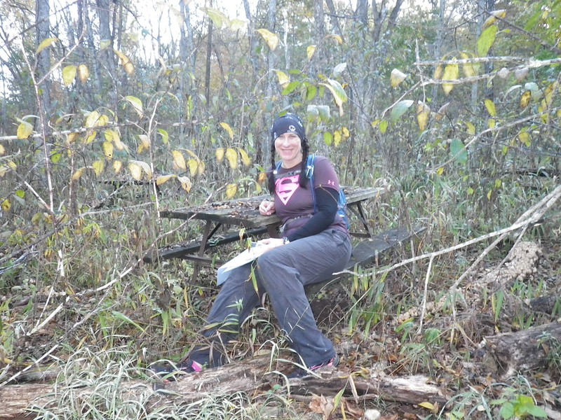 |
| Waiting to be served imaginary food, like the princess I am. |
We backtracked down the road and found CP16 right after Boom Boom Pow, leaving a turtle shell hanging in a tree so Bob and Travis would know we'd been there. We hiked back out to the road and then up to the road junction where we parted ways, Luke heading north and me going west. (Big thanks to Luke for writing up all of the route info for his own race report so I could just copy it! :D). In about 2 hours together, we'd netted about 90 points.
 |
| The western out and back; if you look at the bottom right corner you'll see CP 38 sitting there all ignored. I may have skipped it because it was kind of a long way for just 30 points, but in retrospect I really wish I'd gone there. |
From the intersection where Luke and I split up, I ran down the road until I reached the attack point for CP15, running into Boom Boom Pow along the way. We all headed to 15 together, but I was following along on my map rather than just trailing behind them, so I felt good when I saw the flag. After punching, I asked BBP where they were going next. I've really enjoyed hanging out with them at previous races, and I knew if I stayed close I was going to get sucked into sticking with friends and following along rather than navigating on my own. They decided to go out to CP5 first, so I stuck with my initial plan of 37 next.
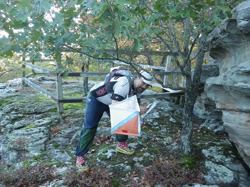
I ran down the pavement until my turn onto a gravel road that eventually petered out at a baseball field in the middle of nowhere. I had just started to cross the ball field when I saw Alpine Shop's Jeff and Emily running along what appeared to be a trail on the side of the field. If it's good enough for Alpine Shop, that's probably where I need to be... I made a quick course correction and jogged along the old dirt road until I came to the cool ruin where the CP was hung.
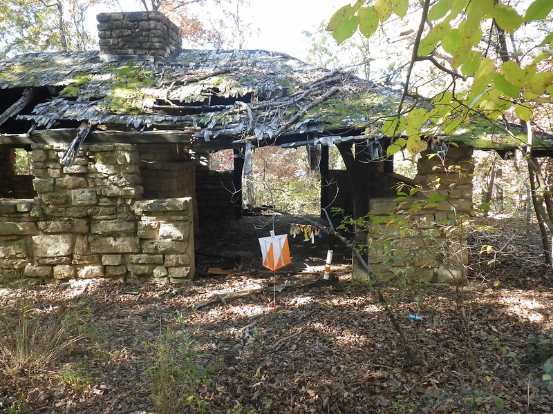 |
| Success! |
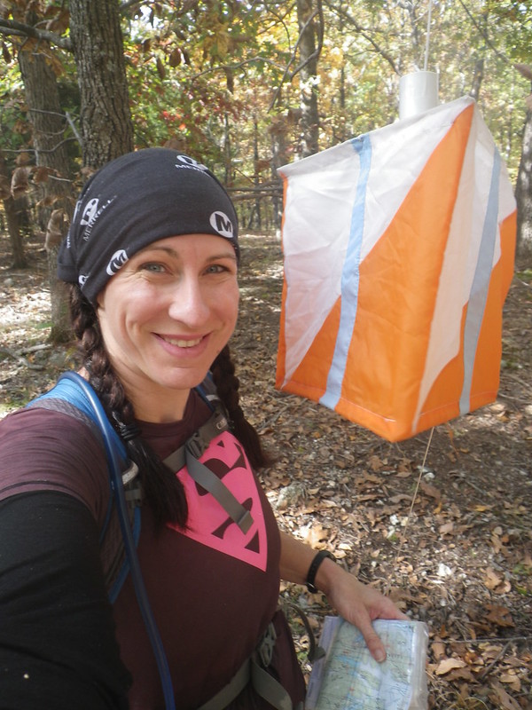
I happily ran back up the dirt and gravel roads and west along the pavement. Several private roads along the way helped me to judge my progress (and seemed to take forever to come), and my attack point was the spur just after the last of these. I found the CP with no problem.
 |
| So pleased with myself at this point. |
I headed back to the road and then west again, still running unless I was going uphill. I saw Jason again, confusing him.
"Where's your teammate?"
"I'm racing solo today!"
"What about the guy you were with?"
"Oh, him...we just had the same route at the beginning."
I ran into BBP as I was nearing the trail to CP5, and Stacey warned me that the trail could be easy to miss if I wasn't paying attention. Armed with this knowledge, I spotted my turn and found the correct reentrant with no problem.
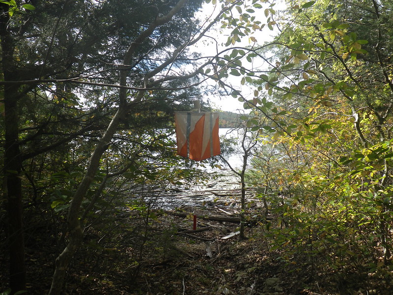 |
| I was really happy that it was hung allllll the way at the bottom of the reentrant. |
I climbed back out to the road, seeing the GJ/Wedali guys on their way to 5, and retraced my steps until I was at the attack point for CP14. I'd timed things well; my camelback was running low, and 14 was a water stop. It took a little longer than I'd expected to get to the CP, so I was glad to see Boom Boom Pow on their way out, confirming that I was going in the right direction.
I took a couple minutes at the checkpoint to adjust my socks, which had slipped down enough that my shoes were rubbing against the back of my heel/Achilles area, and refill my water. I felt really good about how I was doing. In 2 hours alone I had added another 170 points to my score and, even better, nailed the navigation all on my own. I started having delusions of a respectable score and imagining outscoring my teammates. Maybe it could happen...
Things fall apart

After seeing GJ/Wedali again as they were approaching/I was leaving CP 14, I made sure to run the road towards CP22, not wanting them to pass me while I was walking (I counted it as a personal triumph any time I was running when I saw another racer). I was very tempted by a powerline cut that seemed like it was surely the straight line to somewhere I wanted to be but resisted and took the road to my attack point for CP22, which was exactly where I expected it to be. What an awesome day. What was I so worried about? I'm a great navigator! It's a mark of how blase about success I'd become that I didn't even take a picture of the CP.
My initial plan had been to follow the high point from 22 back out to the road and then run the road until the attack point for CP33 (that long spur). Flush with victory, I decided instead to bushwhack across the creek between the checkpoints, figuring it would be easy to find the spur...I just had to keep climbing until I hit the top and then follow it westish. My navigational brilliance was confirmed when Andrei and Erl passed me as I was stopped at a downed tree putting band-aids over my raw heels (I'm so smart to be taking care of this before it becomes an actual problem!); if GJ/Wedali was going that way, it must be right!
Except I couldn't find the stupid CP. Looking back, I actually think I was on the right track on my first approach but had second thoughts, backed up, and got all mixed up. After all kinds of wandering around, I decided to take the spur back out to the road so I knew for sure where I was and then reattack. I figured all I had to do was stay on the high ground and keep heading northeast, and that worked. I was relieved to find the road...OK, I am where I think I am, now let's try this again.
This time, I think I ended up on the wider spur to the east of CP33. (And Gary, if you read this PLEASE comment or email me and let me know if that sounds right!) Wandering around semi-hopelessly, I heard voices and hoped against hope that it was some noisy racers who'd found the CP. Hiking downhill, I eventually saw water and realized it was just some people having fun on the lake. Despair.
I tried to think like Bob and Luke and use the terrain around me to help me figure out where I was. The finger of the lake I saw went sort of east-west, which narrowed things down. Looking at the map now, I can see that if I'd been thinking clearly, I'd have realized that there was no campground/private property around me, which ruled out the little finger over Camp Red Bud, and I knew the finger above Camp Pin Oak was south of me. At the time, none of that was clear to me, and after messing around for way too long, I finally gave up.
I spent probably an hour and a half looking for that CP; I should have moved on way sooner, I even knew that at the time, but since my primary goal for the day was to improve my orienteering skills rather than get a high score, I really wanted to have the experience of getting myself out of trouble. Unfortunately, it didn't work out that way, but I did come across this cool old water tower. And I didn't cry, which was a major accomplishment.
I took a couple minutes at the checkpoint to adjust my socks, which had slipped down enough that my shoes were rubbing against the back of my heel/Achilles area, and refill my water. I felt really good about how I was doing. In 2 hours alone I had added another 170 points to my score and, even better, nailed the navigation all on my own. I started having delusions of a respectable score and imagining outscoring my teammates. Maybe it could happen...
Things fall apart
After seeing GJ/Wedali again as they were approaching/I was leaving CP 14, I made sure to run the road towards CP22, not wanting them to pass me while I was walking (I counted it as a personal triumph any time I was running when I saw another racer). I was very tempted by a powerline cut that seemed like it was surely the straight line to somewhere I wanted to be but resisted and took the road to my attack point for CP22, which was exactly where I expected it to be. What an awesome day. What was I so worried about? I'm a great navigator! It's a mark of how blase about success I'd become that I didn't even take a picture of the CP.
My initial plan had been to follow the high point from 22 back out to the road and then run the road until the attack point for CP33 (that long spur). Flush with victory, I decided instead to bushwhack across the creek between the checkpoints, figuring it would be easy to find the spur...I just had to keep climbing until I hit the top and then follow it westish. My navigational brilliance was confirmed when Andrei and Erl passed me as I was stopped at a downed tree putting band-aids over my raw heels (I'm so smart to be taking care of this before it becomes an actual problem!); if GJ/Wedali was going that way, it must be right!
Except I couldn't find the stupid CP. Looking back, I actually think I was on the right track on my first approach but had second thoughts, backed up, and got all mixed up. After all kinds of wandering around, I decided to take the spur back out to the road so I knew for sure where I was and then reattack. I figured all I had to do was stay on the high ground and keep heading northeast, and that worked. I was relieved to find the road...OK, I am where I think I am, now let's try this again.
This time, I think I ended up on the wider spur to the east of CP33. (And Gary, if you read this PLEASE comment or email me and let me know if that sounds right!) Wandering around semi-hopelessly, I heard voices and hoped against hope that it was some noisy racers who'd found the CP. Hiking downhill, I eventually saw water and realized it was just some people having fun on the lake. Despair.
I tried to think like Bob and Luke and use the terrain around me to help me figure out where I was. The finger of the lake I saw went sort of east-west, which narrowed things down. Looking at the map now, I can see that if I'd been thinking clearly, I'd have realized that there was no campground/private property around me, which ruled out the little finger over Camp Red Bud, and I knew the finger above Camp Pin Oak was south of me. At the time, none of that was clear to me, and after messing around for way too long, I finally gave up.
I spent probably an hour and a half looking for that CP; I should have moved on way sooner, I even knew that at the time, but since my primary goal for the day was to improve my orienteering skills rather than get a high score, I really wanted to have the experience of getting myself out of trouble. Unfortunately, it didn't work out that way, but I did come across this cool old water tower. And I didn't cry, which was a major accomplishment.
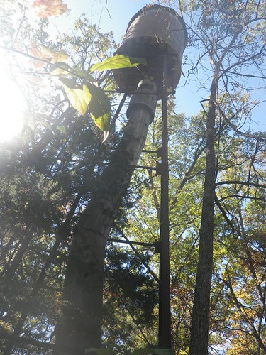 |
| It's ok as consolation prizes go, but I'd rather have had the 30 points. |
31 should have been easy, just run the road to where it curves and then go west along that skinny ridge (or spur, whatever it is). Instead, I cut in too early and spent a lot of time wandering around again. I really didn't want to fail on a second straight CP, so I stuck with it but eventually gave up and hiked back out to the road, very thankful I could at least find that.
When I made it out onto the road, though, I was considerably south of my intended attack point. Realizing my mistake, I decided to give it another try from the right spot. That worked much better, and I finally found the CP. By this time, I was starting to look at my watch and get a little nervous about making it back to race HQ in time, and I wasn't the only one. Another racer was hiking to the road at the same time I was. As I caught him, he mentioned, "I'm a little worried about getting back by 6." Me too, buddy. Rather than go after any other CPs, I decided to head back and maybe get one of the points near the start/finish line if I got back with extra time.
Except....there was CP3, a hundred pointer, conveniently sort of on my way back. I could run south along the road next to Pin Oak Hollow until turning onto the road back to the start/finish OR I could bushwhack across and hopefully pick up CP3 on my way. If I missed it, so be it, I'd just hit the road and head south again. Not having learned my lesson, that's exactly what I did.
I (shockingly) did not walk straight to the 100-pointer, and I stayed committed to my plan of heading towards the road and not wasting any further time on wild goose chases. I crossed a creek which I assumed was the one west of the churches and then totally failed to stay on my bearing for the short way to the road. I hiked and hiked, finding myself trending north every time I looked at my compass and eventually coming out at a powerline cut bordered by a fence. More private property!
I followed the fenceline until I could cut out onto a gravel road. My map was folded so that just the section I was trying to be in showed, and I had no clue where I was. The road went east-west; I needed to go east, so that's the way I turned. Before long I came to an intersection; of course the cross road was unsigned, but since I needed to go south to get back to the finish line, that's the way I went. I eventually passed a mailbox with a Kaiser Rd. address on it, but a glance at the small section of map showing failed to enlighten me.
It's hard to be to motivated about going fast when you have no idea where you're going, but deciding that it would be better to realize my mistake sooner rather than later, I started running again. Something finally compelled me to unfold my map, and that's when I saw it...Kaiser...about a mile north of where I had thought I was. Many bad words were spoken, but at least I knew where I was now.
I tried to measure off the distance remaining to the finish. It's not easy to do that while running and even harder when suffering race-brain, but I eventually figured out that I had around 10K to run in what was now around an hour and fifteen minutes. I'm a runner. I've run 6 miles plenty of times, and I'm typically capable of running faster than 12 minute miles.
 |
| My trip back |
I walked up the next hill as quickly as I could, and then started running. My very happiest moment was passing a sign that said 2.2 miles to the campground and realizing that meant only about 2 miles left to go and 40ish minutes to get there (Almost the exact same circumstances as when I did this race in 2012). I was going to make it! I could stop running!
Except...I didn't want to stop running, so I didn't. I could see 10-12 racers walking up the road along the airport boundary ahead of me, lining the side of the road like a string of war refugees. Passing two of them near the bottom of a hill, I recognized Jason and Laura Elsenraat, the former owners of BonkHard (who had a great race with Laura handling the navigation). Great...with friends behind me, now I had to run the uphill (and by this point "run" was a very loose term).
I kept on running until I crossed the finish line with 16 minutes to spare...
 |
| Photo credit: Luke Lamb |
 |
| Photo credit: Mary Welter |
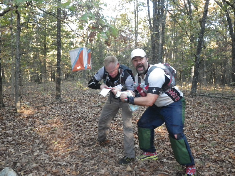
 |
| No idea what I'm talking about here, but it was clearly hilarious |
 |
 |
Full results.
Oh, and I always assume that everybody else already knows what I do about orienteering, but since none of my teammates had seen this done, I'll share it with you guys. Before the Babler O meet a couple years ago (a race where I did do a lot of crying) Dr. Fran showed me how she marked her passport. Basically, she takes the CP clues and writes them in the corresponding box on the passport. So in my example below, the clue for CP1 would be "trail junction", 2 and 3 would be "spur", etc. I like that rather than writing the clue on the map because I'm always afraid my writing will obscure some vital information.


Another fun adventure, can't wait to try it myself - Munchkin and I are signed up for an Intro to Orienteering class in a few weeks!
ReplyDeleteNice race Kate, well done! The solo adventure is something different and certainly a good experience to have had.
ReplyDeleteI'm glad you summoned the nerve to try this solo! Well done!
ReplyDeleteHow long have you been orienteering? Good for you for doing the solo.
ReplyDeleteI am glad to read that your adventurous self is still out there chasing CPs :) You totally rock Kate!!!!
ReplyDeletePerfect combination of confidence boosting and being humbled so you respect orienteering! Loved all the pictures too.
ReplyDeleteNo more words to say that you are an inspiration. Another great adventure is under your belt. And .... to be continued....
ReplyDelete