2016 Castlewood 8-Hour
Note: commentary from Mickey in pink. Brenden and Renee didn't have anything they wanted to add except what a joy I was to race with and what a pain Mickey is. Also, that last part after "add" might not be strictly true.
The Castlewood 8-Hour has been a part of my December schedule for seven years now, and I've never shared the day with the exact same group of teammates. I've volunteered with Patrick and Dave, and I've raced in varying 2- and 4-person team configurations: 2011 as a guest-racer on Orange Lederhosen; 2013 with Jim, Bob, and Adam; 2014 with Luke, Bob, and Robby; 2015 with Mickey; and this year with Brenden, Mickey, and Renee.
It's rare for me to adventure race with anyone who's not a regular teammate or frequent training partner of mine, but Renee and Brenden weren't exactly strangers. Renee and I have spent a lot of time together on bikes, and Brenden and I have at least been near each other a few times in races. If I wasn't going to be completely in my comfort zone I'd at least be within shouting distance.
We all met up at Alpine Shop on Friday night for packet pickup and then headed to a nearby restaurant to eat and plot our maps. The light ended up being too dim to do the plotting, so we all just hung out and talked for a while, leaving Mickey and Renee to deal with the maps and route planning when they got back to his house.
I was staying at Bob's with the rest of Team Virtus, so once they were all in town I headed out to meet them for our traditional race-eve Dewey's pizza. Thwarted by a long wait, instead we grabbed a few pies to go and reconvened at Chez Jenkins, where we got right to work on their maps. Eventually.
Feeling out of the loop on my own maps, I stuck myself right in the middle of theirs and took up my normal job of reading coordinates. Luke and Travis did the plotting while Chuck wrote clues on the supplemental maps and Adam monitored my reading to make sure I wasn't trying to steer them wrong. Bob and Robby did "essential race prep" in the other room.
We got our packs together over some discussion about the stupidity of my plan to leave the house at 5 a.m. to make sure I was at the bike drop the second it opened at 5:45 (spoiler alert: they were right) and eventually all headed to bed/couch/floor, where I at least tossed and turned and didn't fall asleep til well after midnight. That made the 4:15 wake-up call a joy, but it's always easier to get out of bed on race day.
I met Mickey, Renee, and Brenden at the bike drop, then we left my car in a park and ride lot since parking was limited at race HQ. Starting an adventure race in the fancy surroundings of an urban country club was a weird contrast from our typical middle-of-nowhere pavilions, but it was nice to wait inside on the frosty morning.
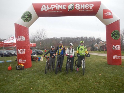
We had a short pre-race briefing under the start/finish arch at 7:30 and then milled around catching up with friends and taking team pictures until go time. As 8:00 approached, Mickey nudged us: "Let's move up further towards the front." This is the exact opposite of my natural race tendency, which is to slip to the very back and spend my day making conversation.
Mickey: Moving to the front was actually Brenden's idea.
Trek 1: 3ish miles, 34ish minutes, CP 1-3
The race started with a 5K mostly uphill road run. My recent running has been so limited as to be almost non-existent, which made running with a pack even more fun than normal. Thankfully Mickey carried most of my mandatory gear in his pack, and with the lighter load I was able to run all but the biggest hill. Road runs are tough because there's no good excuse to stop and walk, at least not on a team that won't accept "because I want to" as a legitimate reason. We collected CP 1 and 2 along the way and then finally hit a lovely, long downhill all the way to the Allenton Access boat ramp, where we collected CP3, made a quick transition, and hopped into the canoes.
Paddle 1: 6.4 miles, 1:20, CP4 at take-out
Last year's canoe leg was a huge weak point for us, as neither Mickey nor I are experienced paddlers. This year we split up, with Renee and Brenden steered our respective canoes. This was a definite improvement.
It was a gray, chilly morning, but with our canoe tracking smoothly through the water I had few worries about a potential December swim and the first half went pretty quickly. Just as I was getting sick of being in the boat, distraction paddled up in the form of our Alpine Shop buddies. We compared this canoe leg with the surprise individual kayaks at the Berryman Adventure, but when I started talking with my hands to demonstrate my lack of prowess there, Brenden directed me right back to the task at hand: "Get your paddle in the water!"
Mickey: With my poor paddling holding Renee back, you could afford to socialize for a bit.
We'd both been watching hopefully for the I44 bridge for a while when it finally came into view, heralded by the rumble of 18-wheelers on the interstate. (Mickey: Renee and I spent what seemed like half an hour lamenting just how far away from the takeout you could actually hear the traffic.) We beached our canoes on the gravel bank, pulled it out of the water, punched our passport, and then trekked below the bridge and uphill to the bike drop.
Bike 1: 2 miles, ~30 min, CP 6-8
I had a bad moment at the bike drop when Mickey went to turn on my rear blinky and it wasn't there. I hadn't even looked at it when going over the mandatory gear list because I knew it was on that bike...except that it wasn't, having been switched over to my gravel bike for Spotted Horse. Luckily Brenden had an extra one on his bike. Crisis averted.
We pedaled down the road and into West Tyson County Park, where funnily enough I'd been just a month before for the first time since running there with Chuck five years ago. I've never ridden there, though, mostly because I've heard the Chubb Trail is tough and have avoided it. "Luckily" for me, the race forced my hand.
The first CP was at the entrance to the Flint Quarry trail. Waiting for Brenden to punch our passport I looked at the hill in front of me with some dismay.
Initially the guys had us go first, but they quickly realized they were better off in the lead. Despite my doubts about the hill I made it almost all the way to the top before getting hung up on a root and having to get off my bike for a minute. The trail got more and more rocky, so rather than hike-a-bike on the trail (which I'm quite sure the guys and Renee could have ridden, and I'd like to go back and try to ride in a non-race situation) we took our show off-road with a hike-a-bike up the steep hillsides. Thankfully the guys were a lot faster and were able to help a lot push/drag/carrying the bikes up to the more rideable trail, some of which was really fun.
Mickey: local knowledge could have saved us some time here. Had I known how rocky this section of trail was, I would have started our bikewhack up the hill sooner. C'est la vie...
In what seemed like no time we were at the bike drop, manned by our friends Andrei and Amanda. Amanda! There we had to turn in our main passport in exchange for a new one: the trek was in the same area as we were biking, so the race directors needed to make sure we were only punching trekking points.
Trek 2: ~3.5 mi, 1:26, CP 9-18
Mickey had been pushing me to do the nav for the foot section, and after seeing we'd be trekking in West Tyson I agreed to do so. I'd had a really clean orienteering meet there in November and felt pretty confident in my ability to find the checkpoints. I was less sure about navigating on the clock; it's still a pretty slow process for me, kind of like little kids sounding out words as they learn to read. The ability is developing, but I'm definitely not map-fluent yet.
Luckily, the pre-marked trekking map was the exact same map as the one we had for the bike leg, so for each CP I'd show Mickey where it was located on his map and he'd follow along there. It was kind of like navigating with training wheels.
Well, sort of. Like I said, I really need time to think things through and get comfortable with the map, and instead I had to make a quick decision about how to attack the points and then go with it. Looking at the map now I can see where I could have been more efficient, but of course the trade-off is being way slower, and I'm not sure the time saved with efficiency would outweigh the time lost with slowness.
We attacked the CPs in a loose figure 8, starting with 14. I'd planned to go from there to 17 and then 16, but as we hit the trail along the ridgeline between 18 and 16 I realized it would be way easier to hit 16 first. Then I intended to go down the slightly gentler spur and hit the trail to 17, but Mickey assumed I was taking the more direct/steeper route down to the trail and led on. I could have spoken up, but I was too busy frantically looking at the map and trying to decide if my plan was dumb. In retrospect, I think it would have been much more efficient to (from our starting point at 18) hit 16 first, then 17, 14, and 13. Less hill climbing, less backtracking.
We ran the trails where we could and made decent time, though between the rocky surface and trying to look at the map as I went I was jogging along with the tiniest little cautious baby steps ever. From 14 we swung back through 18 again, hitting 13 and then returning to the trail until we could cut nearly straight downhill to 10, back up to 11, then down to 9. This is another place where I think we could have improved. To do it over again I'd go over to 11, down to 9, and then run the trail to 10.
The guys were way faster off-trail then I was, as was Renee in her rookie AR outing. Part of that was trying to watch my map as I moved, but part of it is also just being slow off-trail. Something to work on. I was definitely frustrated with myself for being so slow and having a hard time keeping up on the map and feeling like I was making the nav decisions rather than just following where the guys went.
We took the creekbed from 9 over to the park road, then followed the road and then trail, seeing Team Virtus as they were finally hitting CP6 on the bikes after being marooned at the canoe put-in with no paddles. I was happy to see my friends but so bummed for their bad luck.
Getting on the trail was actually Mickey's suggestion. I'd planned to just keep following the (dry, despite what Brenden thought) creekbed towards 12, but he noticed that the trail paralleled it for a while. In that respect, we make a good navigational team; I'm probably a little better with the big picture, but he's way better on the details. That definitely shows in our route planning: I tend to lean to routes with the easiest travel where I think I'll be able to keep track of where I am and then muddling through once I get close, while he's much better at choosing his route based on what the best attack point might be.
Once the trail started to split off, we dropped down along the creekbed and followed it until the reentrant split. When Mickey tried to send Brenden up the wrong reentrant I had a good handle on where we are and we made a quick correction. We bagged 12 and then headed uphill towards our final CP of the trek.
Since i didn't have the actual CPs marked on my map, it was a pretty long distance from the previous CP, and there were no obvious terrain features near CP12, I couldn't remember exactly where it was plotted. Good catch!
My original plan was to climb all the way to the top of the hilltop above CP15, which was a long, uphill slog. Part way up, legs burning, I started looking at my map and thinking, wait, we're going to have to go down the other side. Why are we doing all this climbing? Why not contour around? The guys, who were already higher, stayed high while Renee and I continued around lower down. Not realizing I hadn't yet crossed the trail coming down from the hilltop, I started looking at the reentrant next to me and thinking it was the right one. Thankfully Mickey was clearer about where we are and corrected us before I led us way down the wrong hill.
Once we had that last CP we climbed back up to the trail and hustled into CP18 for the last time, collecting our other passport and getting our bike gear back on while Andrei jokingly scolded me about my poor choice of footwear. With the trek done and only a short bike leg left, it seemed like the race was practically over.
Bike 2a: 2 mi, ~20 min; CP 19-23
Getting back on the bike felt fantastic after the trek, especially the part where we got to ride downhill on not scary trails, but I'd been worrying since the previous night about the course note of "technical trail ahead, use caution" on this section. We hit CP19 quickly, then hike-a-biked down an old section of trail. There I got hung up having to wait for a big group of racers flying by. Race or not, they could have used some manners, some of them nearly taking out other racers and leaving several pissed-off hikers in their wake.
They were riding like real a-holes, especially considering their position in the race.
I had to walk my bike downhill around a crash and then past a rocky, technical section I wasn't about to ride, finally catching up with my waiting teammates. It's really frustrating to be the slow one all the time.
The trail got a bit more rideable, though I still froze up on a few sections I'm sure I could have ridden if I'd taken the right line and walked a couple other sections that I might never ride. That said, I'd really like to go back and ride the trail with no race pressure and the opportunity to re-ride parts.
We're definitely going back to ride Chubb again. You to get some practice on picking smart lines, then trusting your choice. Me to ride it without a mapboard so I can actually see where I'm placing my front wheel.
We dropped back onto the park road and retraced our steps back to the canoe take-out, where we now had to ferry our bikes back across the Meramec in canoes. This normally makes me really nervous, but the short distance and great earlier paddling experience had left me pretty confident it would go well.
Paddle 2: .2 mi, ~6 minutes
And it did. Huge thanks to Will and Perry, who in addition to serving as safety boats during the race also stood in the river giving teams a push-off to make sure they didn't drift downstream towards the bridge. Their help meant our feet didn't even get wet, and that might make Castlewood the first race all year I didn't spend my day in soggy shoes.
We beached our canoes at the boat ramp on the other side of the river, unloaded the bikes, and had to lug the canoes uphill to the parking lot. After lugging our kayaks a half mile at the Berryman race, this didn't seem all that bad.
We passed a quick gear check after dropping the boats and then rode off in search of our last few CPs.
Bike 2b: 7.2 mi, 47 min, CP 24-32
This last bike leg was in Route 66 State Park, its flat, lightly wooded surroundings a strong contrast to West Tyson. Mickey's nav was sharp, and Brenden made quick work of getting the passport punched. We only had one slight bobble when we emerged onto a different spot than Mickey expected, but Brenden almost immediately recognized our location on the map.
The trails here were either gravel our grassy doubletrack, so for the first time of the day we were able to get some use of the tow Mickey had on his bike. And I needed it; my legs, which had been so happy to get back on the bike just a few miles before, were starting to cramp.
Once we had the Route 66 CPs in the bag, we had two more on the streets of Eureka, and then all that separated us from the finish line was the long climb into the Legends. I was very thankful for the tow here -- teamwork makes the dream work! -- as it made the uphill much less painful for me. Just ahead of us we could see another team, but we weren't all close enough to make an attempt to close the gap. Unfortunately it was another 4-person co-ed team, but we still finished 9th in our division, which is pretty cool.
It was a different kind of fun than in my usual races, where enjoying time with my friends and other racers is my primary goal, and racing with people so much stronger than me is hard on my ego. I had plenty of moments of frustration at not being better, but there were also accomplishments to celebrate. We worked well together as a team, we (I think) got Renee hooked on adventure racing. We pushed harder than I'm used to, and I didn't die. I helped navigate, and it wasn't a total train wreck. I saw that I'm capable of more than I give myself credit for. It may have been a lot type 2 fun, but that's still a pretty good time!
The Castlewood 8-Hour has been a part of my December schedule for seven years now, and I've never shared the day with the exact same group of teammates. I've volunteered with Patrick and Dave, and I've raced in varying 2- and 4-person team configurations: 2011 as a guest-racer on Orange Lederhosen; 2013 with Jim, Bob, and Adam; 2014 with Luke, Bob, and Robby; 2015 with Mickey; and this year with Brenden, Mickey, and Renee.
It's rare for me to adventure race with anyone who's not a regular teammate or frequent training partner of mine, but Renee and Brenden weren't exactly strangers. Renee and I have spent a lot of time together on bikes, and Brenden and I have at least been near each other a few times in races. If I wasn't going to be completely in my comfort zone I'd at least be within shouting distance.
We all met up at Alpine Shop on Friday night for packet pickup and then headed to a nearby restaurant to eat and plot our maps. The light ended up being too dim to do the plotting, so we all just hung out and talked for a while, leaving Mickey and Renee to deal with the maps and route planning when they got back to his house.
I was staying at Bob's with the rest of Team Virtus, so once they were all in town I headed out to meet them for our traditional race-eve Dewey's pizza. Thwarted by a long wait, instead we grabbed a few pies to go and reconvened at Chez Jenkins, where we got right to work on their maps. Eventually.
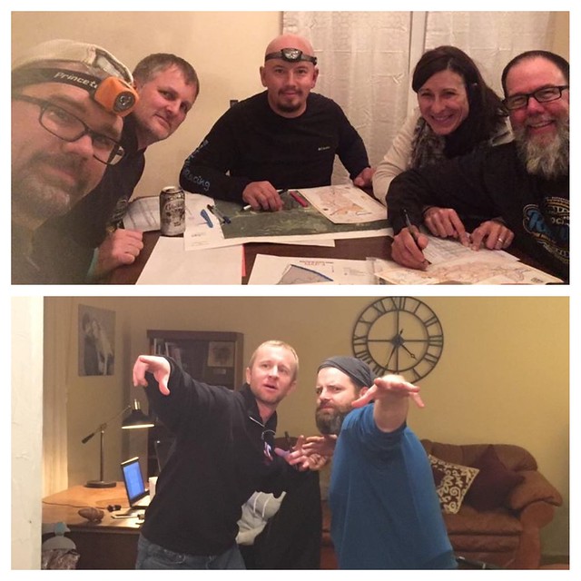 |
| Well, some of us did. |
We got our packs together over some discussion about the stupidity of my plan to leave the house at 5 a.m. to make sure I was at the bike drop the second it opened at 5:45 (spoiler alert: they were right) and eventually all headed to bed/couch/floor, where I at least tossed and turned and didn't fall asleep til well after midnight. That made the 4:15 wake-up call a joy, but it's always easier to get out of bed on race day.
I met Mickey, Renee, and Brenden at the bike drop, then we left my car in a park and ride lot since parking was limited at race HQ. Starting an adventure race in the fancy surroundings of an urban country club was a weird contrast from our typical middle-of-nowhere pavilions, but it was nice to wait inside on the frosty morning.
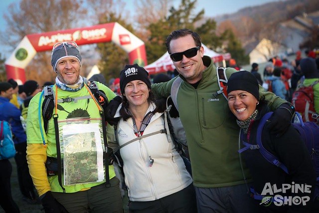 |
| Type II Fun, a very apt name for our team Photo credit: Dan Singer |
Mickey: Moving to the front was actually Brenden's idea.
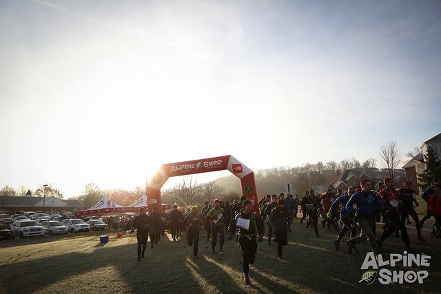 |
| And we're off! Photo credit: Dan Singer |
The race started with a 5K mostly uphill road run. My recent running has been so limited as to be almost non-existent, which made running with a pack even more fun than normal. Thankfully Mickey carried most of my mandatory gear in his pack, and with the lighter load I was able to run all but the biggest hill. Road runs are tough because there's no good excuse to stop and walk, at least not on a team that won't accept "because I want to" as a legitimate reason. We collected CP 1 and 2 along the way and then finally hit a lovely, long downhill all the way to the Allenton Access boat ramp, where we collected CP3, made a quick transition, and hopped into the canoes.
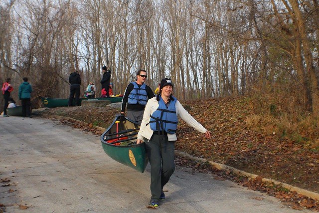 |
| Photo credit: Travis Irvin |
Paddle 1: 6.4 miles, 1:20, CP4 at take-out
Last year's canoe leg was a huge weak point for us, as neither Mickey nor I are experienced paddlers. This year we split up, with Renee and Brenden steered our respective canoes. This was a definite improvement.
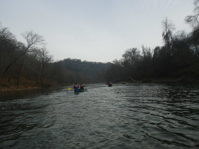 |
| Heading downriver |
It was a gray, chilly morning, but with our canoe tracking smoothly through the water I had few worries about a potential December swim and the first half went pretty quickly. Just as I was getting sick of being in the boat, distraction paddled up in the form of our Alpine Shop buddies. We compared this canoe leg with the surprise individual kayaks at the Berryman Adventure, but when I started talking with my hands to demonstrate my lack of prowess there, Brenden directed me right back to the task at hand: "Get your paddle in the water!"
Mickey: With my poor paddling holding Renee back, you could afford to socialize for a bit.
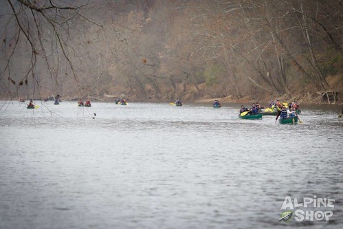 |
| Approaching the takeout. Photo credit: Dan Singer |
Bike 1: 2 miles, ~30 min, CP 6-8
I had a bad moment at the bike drop when Mickey went to turn on my rear blinky and it wasn't there. I hadn't even looked at it when going over the mandatory gear list because I knew it was on that bike...except that it wasn't, having been switched over to my gravel bike for Spotted Horse. Luckily Brenden had an extra one on his bike. Crisis averted.
We pedaled down the road and into West Tyson County Park, where funnily enough I'd been just a month before for the first time since running there with Chuck five years ago. I've never ridden there, though, mostly because I've heard the Chubb Trail is tough and have avoided it. "Luckily" for me, the race forced my hand.
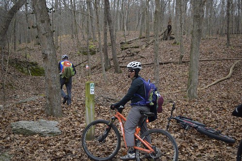 |
| Brenden heading towards the CP while Renee waits at the trailhead. Photo credit: Travis Irvin |
 |
| Probably wondering just how far I was going to make it before I had to walk. Photo credit: Travis Irvin |
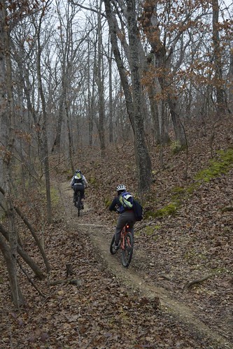 |
| Renee and I heading up. Photo credit: Travis Irvin |
Mickey: local knowledge could have saved us some time here. Had I known how rocky this section of trail was, I would have started our bikewhack up the hill sooner. C'est la vie...
In what seemed like no time we were at the bike drop, manned by our friends Andrei and Amanda. Amanda! There we had to turn in our main passport in exchange for a new one: the trek was in the same area as we were biking, so the race directors needed to make sure we were only punching trekking points.
Trek 2: ~3.5 mi, 1:26, CP 9-18
Mickey had been pushing me to do the nav for the foot section, and after seeing we'd be trekking in West Tyson I agreed to do so. I'd had a really clean orienteering meet there in November and felt pretty confident in my ability to find the checkpoints. I was less sure about navigating on the clock; it's still a pretty slow process for me, kind of like little kids sounding out words as they learn to read. The ability is developing, but I'm definitely not map-fluent yet.
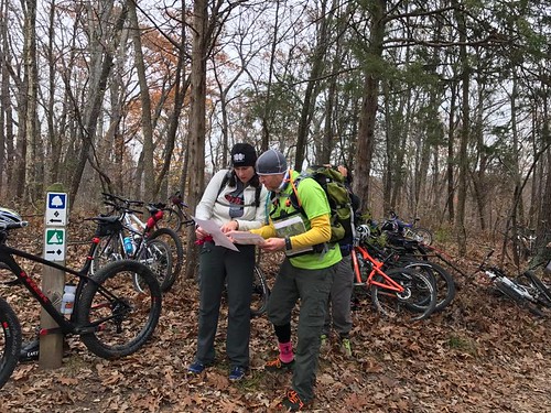 |
| Comparing maps and deciding on a strategy. Photo credit: Amanda Lappe |
 |
| Substitute "navigating with Mickey' for "being a teacher", and you'll get the idea. Source |
Well, sort of. Like I said, I really need time to think things through and get comfortable with the map, and instead I had to make a quick decision about how to attack the points and then go with it. Looking at the map now I can see where I could have been more efficient, but of course the trade-off is being way slower, and I'm not sure the time saved with efficiency would outweigh the time lost with slowness.
 |
| Our route went 14-16-17-13-10-11-9-12-15-18 Note: 18 was also the bike drop, where we'd have to return at the end of the trekking leg to continue our ride. |
We attacked the CPs in a loose figure 8, starting with 14. I'd planned to go from there to 17 and then 16, but as we hit the trail along the ridgeline between 18 and 16 I realized it would be way easier to hit 16 first. Then I intended to go down the slightly gentler spur and hit the trail to 17, but Mickey assumed I was taking the more direct/steeper route down to the trail and led on. I could have spoken up, but I was too busy frantically looking at the map and trying to decide if my plan was dumb. In retrospect, I think it would have been much more efficient to (from our starting point at 18) hit 16 first, then 17, 14, and 13. Less hill climbing, less backtracking.
We ran the trails where we could and made decent time, though between the rocky surface and trying to look at the map as I went I was jogging along with the tiniest little cautious baby steps ever. From 14 we swung back through 18 again, hitting 13 and then returning to the trail until we could cut nearly straight downhill to 10, back up to 11, then down to 9. This is another place where I think we could have improved. To do it over again I'd go over to 11, down to 9, and then run the trail to 10.
The guys were way faster off-trail then I was, as was Renee in her rookie AR outing. Part of that was trying to watch my map as I moved, but part of it is also just being slow off-trail. Something to work on. I was definitely frustrated with myself for being so slow and having a hard time keeping up on the map and feeling like I was making the nav decisions rather than just following where the guys went.
We took the creekbed from 9 over to the park road, then followed the road and then trail, seeing Team Virtus as they were finally hitting CP6 on the bikes after being marooned at the canoe put-in with no paddles. I was happy to see my friends but so bummed for their bad luck.
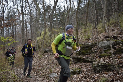 |
| We definitely weren't only running because we saw the camera. Photo credit: Travis Irvin |
Getting on the trail was actually Mickey's suggestion. I'd planned to just keep following the (dry, despite what Brenden thought) creekbed towards 12, but he noticed that the trail paralleled it for a while. In that respect, we make a good navigational team; I'm probably a little better with the big picture, but he's way better on the details. That definitely shows in our route planning: I tend to lean to routes with the easiest travel where I think I'll be able to keep track of where I am and then muddling through once I get close, while he's much better at choosing his route based on what the best attack point might be.
Once the trail started to split off, we dropped down along the creekbed and followed it until the reentrant split. When Mickey tried to send Brenden up the wrong reentrant I had a good handle on where we are and we made a quick correction. We bagged 12 and then headed uphill towards our final CP of the trek.
Since i didn't have the actual CPs marked on my map, it was a pretty long distance from the previous CP, and there were no obvious terrain features near CP12, I couldn't remember exactly where it was plotted. Good catch!
My original plan was to climb all the way to the top of the hilltop above CP15, which was a long, uphill slog. Part way up, legs burning, I started looking at my map and thinking, wait, we're going to have to go down the other side. Why are we doing all this climbing? Why not contour around? The guys, who were already higher, stayed high while Renee and I continued around lower down. Not realizing I hadn't yet crossed the trail coming down from the hilltop, I started looking at the reentrant next to me and thinking it was the right one. Thankfully Mickey was clearer about where we are and corrected us before I led us way down the wrong hill.
Once we had that last CP we climbed back up to the trail and hustled into CP18 for the last time, collecting our other passport and getting our bike gear back on while Andrei jokingly scolded me about my poor choice of footwear. With the trek done and only a short bike leg left, it seemed like the race was practically over.
Bike 2a: 2 mi, ~20 min; CP 19-23
Getting back on the bike felt fantastic after the trek, especially the part where we got to ride downhill on not scary trails, but I'd been worrying since the previous night about the course note of "technical trail ahead, use caution" on this section. We hit CP19 quickly, then hike-a-biked down an old section of trail. There I got hung up having to wait for a big group of racers flying by. Race or not, they could have used some manners, some of them nearly taking out other racers and leaving several pissed-off hikers in their wake.
They were riding like real a-holes, especially considering their position in the race.
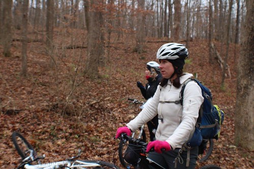
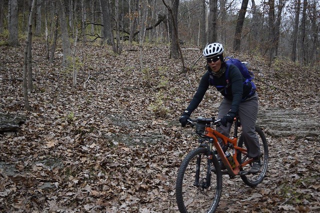
I had to walk my bike downhill around a crash and then past a rocky, technical section I wasn't about to ride, finally catching up with my waiting teammates. It's really frustrating to be the slow one all the time.
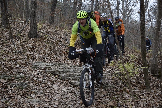 |
| Mickey and Brenden |
 |
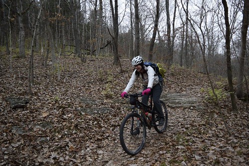
| Renee |
We're definitely going back to ride Chubb again. You to get some practice on picking smart lines, then trusting your choice. Me to ride it without a mapboard so I can actually see where I'm placing my front wheel.
 |
Paddle 2: .2 mi, ~6 minutes
And it did. Huge thanks to Will and Perry, who in addition to serving as safety boats during the race also stood in the river giving teams a push-off to make sure they didn't drift downstream towards the bridge. Their help meant our feet didn't even get wet, and that might make Castlewood the first race all year I didn't spend my day in soggy shoes.
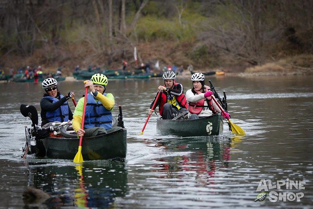 |
| I think we're trying to figure out where Renee and Mickey are going to beach their canoe so we don't crash into them. You can see where we started in the background. Photo credit: Dan Singer. |
We passed a quick gear check after dropping the boats and then rode off in search of our last few CPs.
Bike 2b: 7.2 mi, 47 min, CP 24-32
This last bike leg was in Route 66 State Park, its flat, lightly wooded surroundings a strong contrast to West Tyson. Mickey's nav was sharp, and Brenden made quick work of getting the passport punched. We only had one slight bobble when we emerged onto a different spot than Mickey expected, but Brenden almost immediately recognized our location on the map.
The trails here were either gravel our grassy doubletrack, so for the first time of the day we were able to get some use of the tow Mickey had on his bike. And I needed it; my legs, which had been so happy to get back on the bike just a few miles before, were starting to cramp.
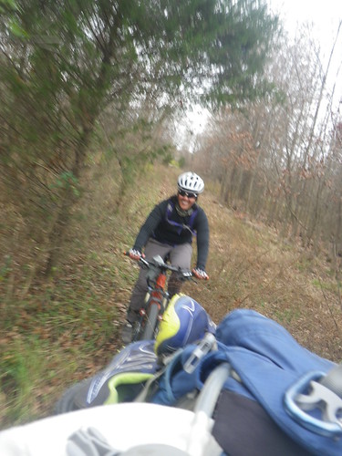 |
| Renee! |
 |
| Finishers! |
Another fantastic report! It was great seeing you & your Virtus teammates. You & your team for this race did well. We did okay thanks to my strong teammate Mike. I get frustrated being slow, so my goal next year is to lose a few lbs.& train better. Work is a lot of my problem (to many 12hr days) So we'll see.
ReplyDeleteI know I'd be faster if I dropped some weight. Putting that into practice has been a problem, though. It was so good to see you, too! Glad you guys had a good day!
Delete