The Fig 12-hr adventure race
Chuck and I had such a good time last year at the Fig that we knew we'd be back even though Stephanie of Flying Squirrel Adventures, who had quickly become one of our favorite race directors, was handing over the reins of the race to 361 Adventures. And after a long (and awesome) AR season we're both tired of long car trips, so on the way to Kentucky we agreed that if 361 didn't do a Stephanie-ish job with the race we would mark the Fig off of our 2016 schedule. (Spoiler alert: we're totally going back next year.)
Chuck: The drive is a little over six hours, so it's not terrible. But somehow I always feel betrayed by the additional hour caused when crossing the CST to EST time change in Indiana.
Pre-race:
We arrived a few minutes after check-in was scheduled to end (shocking, I know) but were still able to pick up our race number and swag bags. Without enough time to get pizza at Miguel's, we grabbed dinner at Subway instead. I was starving, so I ordered a personal pizza and a 6" flatbread sandwich. I ended up being full after the pizza, so the sandwich made a delicious pre-race breakfast.
The pre-race meeting was short and sweet, which was awesome. Before passing out the maps, Dallas gave a brief outline of the race:
My initial instinct was to knock out what seemed like the faster southern section. Chuck's first thought was to start north. After talking about it briefly we opted for his plan. All of the mandatory TAs were in the north; rather than overextend ourselves early and then spend the rest of the race chasing cutoffs (a la Hellbender), we decided we were better off tackling the north and then knowing what we had time for in the south.
Because the maps (which, incidentally, were printed on waterproof paper as was the race book -- so awesome) were preplotted except for the two points we'd plot on course, all we had to do was route planning before heading back to the hotel to prep gear and food. This was surprisingly painless, and with no bike or gear drop to worry about and about a 5ish minute drive to the 7 a.m. start, we hit the beds by 10 or so for an unheard of 7ish hours of sleep.
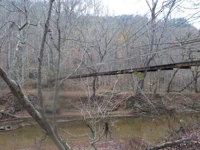
The start was downhill from the eventual finish line, so we decided to park at the top and ride down. Having Chuck's van in the closest possible spot to the finish line more than outweighed the slight inconvenience of having to leave behind our jackets and shiver a little before the start. We coasted down, collected our passport, searched in vain for an unlocked bathroom, and even had time for a pre-race team picture on a suspension bridge (yea) before rolling up to the start line with 100+ new friends-to-be.
Bike 1: ~7.4 miles to TA1
We started with a paved climb out of the park and then zipped down the highway, making a quick stop 3ish miles into the race at a rest area for that elusive bathroom before crossing under the Mountain Parkway and beginning to climb. Right away Chuck began previewing what was coming next for me, perhaps hoping to stave off my inevitable sense of betrayal when the course doesn't align with my mentaldelusions picture of it: "We've got a climb coming up...and then a serious climb after that."
We could see someone walking their bike uphill ahead of us, which always makes me happy because then if I have to walk I won't be the first or only one, but though we gained over 500 feet in less than two miles it was all gradual enough to be (almost) fun. After my implosion at BT Epic, this was a big relief.
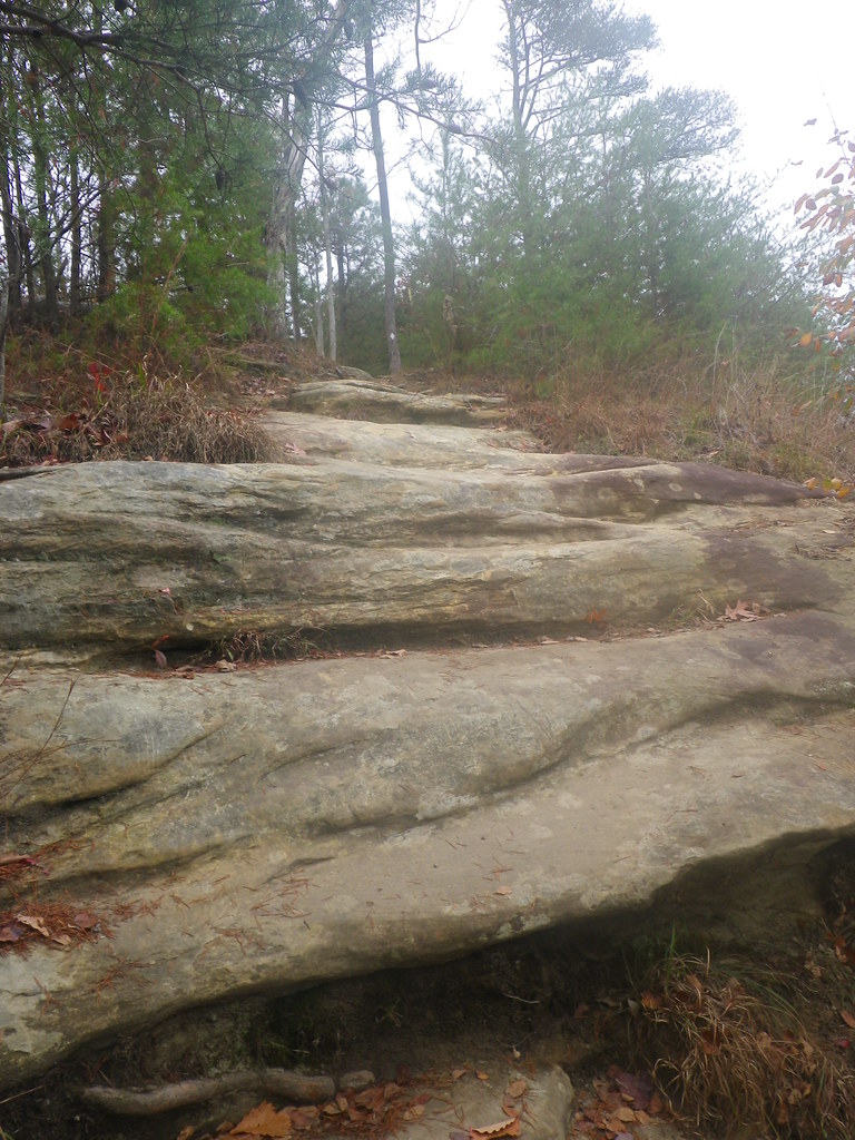
Chuck: The pines and big rock features we wound our way through were scenic enough to take your mind off the actual climb.
Trek 1: ~11 mi, CP 9-12 to TA2
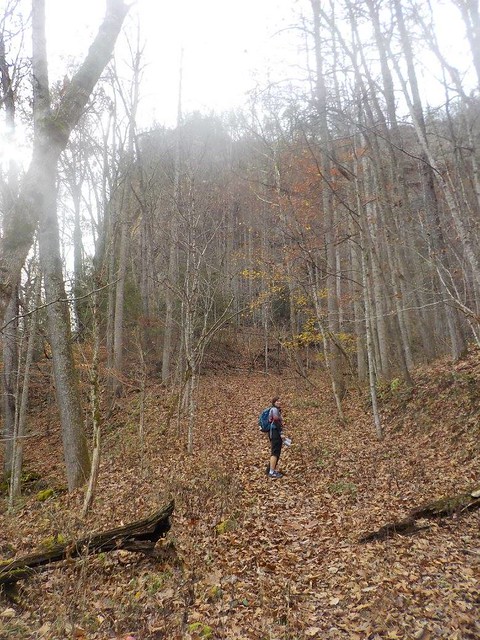
We had opted to tackle the first trekking section in a roughly counterclockwise manner and set off on a fast hike down the trail, where we were soon passed by a running Mike Garrison (who had surely already knocked out several CPs and called back that we should feel free to ignore him if he told us we were in the wrong place again). Seeing how quickly he was out of our sight made me wish I'd been spending more time running, especially on trails. As it was, though the trail was relatively smooth I didn't feel very confident in my footing and was content to hike.
Before long more running teams passed us, one of which doubled back just as Chuck was looking at the map to decide whether we'd reached our attack point for CP9, We all quickly located the CP, punched, and continued down the trail towards CP10. The morning was slightly cool and overcast, perfect race weather, and the scenery was just beautiful. All day long we passed non-racers who were out hiking and camping -- the area is obviously popular for good reason.
Chuck: We really did have perfect weather! Especially compared to last years pre-race flooding and race day snow and cold rain.
We encountered one such group as we approached a spot where the trail crossed a good-sized creek a few times. We'd carefully picked our way across rocks for the first couple crossings, but lacking their trekking poles decided wet feet were better than attempting the slippery log they used. "Oh well," Chuck remarked, "We had two hours of dry feet."
We found CP10 without incident and then made our way across our second suspension bridge of the day (yea), running into Terry and Julia, parents of solo Mike from Tomahawk, on the other side. They had come along for the day to spectate as he raced with his daughter, and seeing their friendly faces at several points in the race was always a treat.
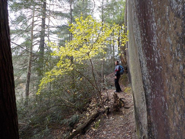
From the bridge we once again hit pavement, doing our only running of the race on the downhills and spotting the canoe put-in as we passed on our way to CP 11-12. We were SO hoping to see Mike paddling by so we could yell down, "You're going the wrong way!!" but alas, no such luck. The trail leading towards our next two CPs was sloppier than the previous ones, but we made good time and quickly knocked off CP12. 11 required a very scenic out-and-back along the base of and then climbing up along huge stone cliffs. Once again we passed families and groups, including a pair of guys who were probably in their 70's out for a hike. Luke would be sure to say something about how nice it must have been to see some of my contemporaries, but it was awesome to see so many people enjoying the outdoors.
CP11 apparently gave a lot of teams some trouble, but we don't know if it would have stymied us because as we approached it a 2-man team gave us some pointers on where to go. We walked right up to it and punched, catching back up with a couple teams we hadn't seen since CP10. From there, all we had to do was retrace our steps, giving back the 500 feet we'd just climbed, and get ourselves to TA2 and the canoes.
Paddle: ~ 3 mi, TA2, CP 13, TA3
I always dread the paddle, more so this year after tipping in two of my last three ARs, but my dread was tempered by the fact that it was such a short paddle. On the other hand, boats weren't included in the race fees, so the $40 canoe rental worked out to around $13/mi. The dearth of navigable water is just a fact of adventure racing in the Red River Gorge area, though, and most races I'd be glad to pay $40 to skip the paddle.
While short on distance (and, in several areas, low on water), the paddle was high on scenery. and after 11 miles on our feet we were both happy to sit down. We had a few spots we had to portage and one moment where I thought we might tip, but otherwise it was a smooth trip downriver to the TA.
Trek 2: ~ 8 mi, CP A, B, 6
At TA3 were were offered hot chocolate (yea!), candy (yea!), and coordinates for two "bonus" CPs. We'd anticipated their general location thanks to the overlay on the map (no point in having trails marked special in an area with no CPs) and pre-decided we'd be better off skipping the huge climb involved. Chuck changed his mind after plotting them, though. "They're pretty close, and I bet it's a great view. I know it may not be the best race strategy, but I'd like to see them."
We're more about the "adventure" than the "race", so I was open to it, Besides, I wasn't sure it was bad race strategy. Maybe it made more sense for us to tackle the trekking points, which were generally in the same area, than chase the bike CPs, which required a decent ride and included points in the vicinity of last year's bike leg. That had been its own special kind of adventure, but I wasn't eager to slop my barely recovered leg through potential mud puddles.
As we turned onto the road towards Raven Rock, we saw Lupine heading back towards us, having decided their time was better spent going after the bike CPs...basically the opposite of our strategy (full disclosure: they ended with 4 more CPs than we did, but since I don't know which ones they got and when, it's hard to compare). The path started out nice and flat, then hooked around to the left. As we made our turn, we looked up the trail and then laughed, "Oh man, look at that hill!"
"That hill" was nothing compared to the rest of the uphill trek. The trail, which followed the remains of an old, paved road, switchbacked relentlessly skyward, sometimes steep and sometimes steeper. Everyone who passed us going downhill assured us that the view was worth the climb, but that's a lot easier to say when your lungs aren't on fire. Even with all the vertical, is was a very pretty hike, though the mossy chunks of dilapidated asphalt were slippery enough that you always had to watch your footing.
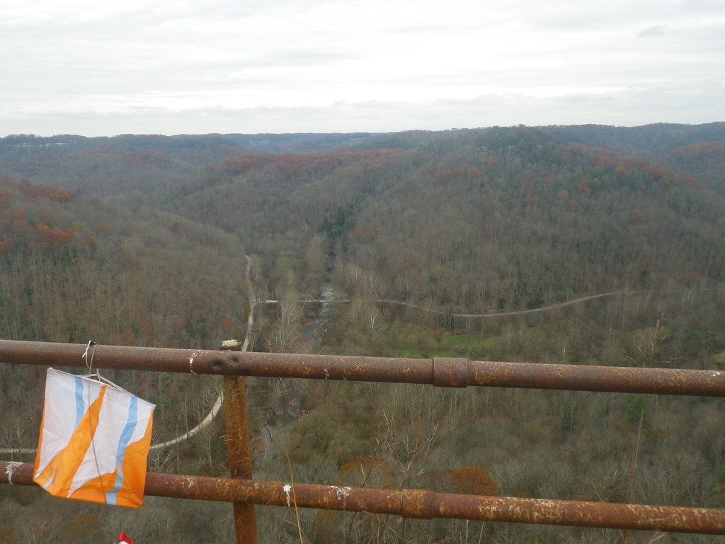
The trail grew steeper as we neared the top, but the sight of the top gave our burning legs the energy to carry us onward. Ascending the path between two huge rock outcroppings, I cheered, "We're there!" only to reach that level spot, turn to my left, and stare up an impossibly steep road bed. We were not, in fact, there.
This last stretch before the peak rose so steeply that it seemed almost possible to hold your hand in front of you and touch the road (not quite that bad, but not that far from it), and yet you could still see the yellow striping marking the centerline. I couldn't imagine attempting to drive a car up there, let alone building the road. Everyone was right, though. The view from the top was pretty incredible.
(For another description of the ascent to Raven Rock, complete with some interesting local history, check out this blog post.)
Retracing our steps was a slower-than-I'd-expected process, mostly due to the way I gingerly picked my way down the steep hill while a 2-woman team with trekking poles jogged past us. Chuck mentioned that he'd pay $1,000 for a pair of trekking poles right then, but he had no takers. While the downhill was awfully hard on the knees, thankfully it wasn't as slippery as I'd expected.
Once we made it back to the bottom, we hiked back out onto the road. Our fast hike was no competition to the teams that alternated hiking with running, and a couple of them passed us in this section (and were likely already ahead of us points-wise). The road took us to the trailhead towards CP6, and for a while we enjoyed a pretty level trail alongside a creek. The trail actually wove back and forth over the creek multiple times, and it seemed like every bridge was built differently. That made a nice diversion from our sore feet.
If I remember right, up to CP6 the trail didn't do much climbing, but immediately after punching we headed what felt like straight up. We weren't that far from CP7 and 8 and were debating whether it made more sense to go after those or head straight back from 6 to the TA and see what we could do on the southern section of the course. We had until the trail split to decide, and the trail just kept climbing...and climbing... Chuck warned that we'd have more hills if we wanted to try for 7 and 8. Our sore feet and burning legs unanimously voted to head back to the TA and our bikes.
Since the TA was located on top of a big ridegline, we still had plenty of climbing to do, including one stretch of trail that required literal climbing. I came around a turn in the trail to face a rock ledge that was the trail. I turned back and looked at Chuck in despair.
All complaining aside, I was glad we were tackling this section going up; I think I'd have been a little scared trying to go down it. Once we finished climbing up rocks, the trail leveled out into a beautiful, tree-lined path that we followed back to the TA.
Bike 2: ~23 mi, CP 16, 15, 1
We made a pretty quick transition at TA1/4 and hopped onto our bikes for the first time since about 8 a.m. If there's anything more glorious than getting off your feet after hours of trekking, it's getting off your feet after hours of trekking and coasting downhill for 4 miles.
Chuck: This was where we discovered the rear Fox suspension shock on my mtn bike had lost pressure and collapsed. Unfortunately it decided to blow the seal during a race. Fortunately it was a race without single-track. All we could do to compensate was raise the seat post to the highest position that seemed safe, then peddle along like I was riding a little kids bike.
Granted, I took the hill a little slower than Chuck. While my downhill courage has definitely improved, that's on straight roads. Winding our way back through the curves we'd climbed that morning, wheeeeee! lost the competition with what if the brakes fail?
Traffic wasn't an issue until the road straightened out, and then it seemed like every car in Kentucky was following us down. Throughout our time on the bike drivers were unfailingly careful, but the lead car in our little caravan was reluctant to pass us, even when the road ahead was clear, and a good-sized line built up behind her. Thankfully she eventually came around, and after an uncomfortable few minutes while numerous cars passed us, we had the road to ourselves.
Our plan was to go after the closest bike CPs, both of which were located just off of paved roads, and then spend any remaining time on CPs 1-5. Shortly after we passed the turn to the finish line on our way to CP1, I realized I should have timed how long it took us from that road to CP1, so I checked my watch and made what I hoped was a safe estimate about the part I'd missed.
Chuck: Kate does a great job with timekeeping sections like this, allowing me to stay focused on our nav.
We quickly found the gravel road leading up towards the trekking CPs (1-5) -- about a 15 minute ride from the finish line if I'd guessed correctly -- and then continued on towards the bike points. One was at Cliffview Resort, where we'd ridden their amazing, long zipline in last year's race, and the other was at a building at...another place. Thinking we needed to go to Cliffview first, I filed away the other clue and assumed we'd figure it out when we needed to. The ride to Cliffview took longer than I remembered (story of my life), and on the way we passed a campground called "Land of Arches".
We reached the entrance to Cliffview shortly after that, and Chuck looked at the map, trying to decide if the half-building behind the sign could be the location of our CP15, which we should have passed on the way to Cliffview. Pulling out the race book, I read the clue: "Land of Arches: building". Oops. Luckily you could get points in any order, so we quickly punched CP16 at Cliffview and then returned to Land of Arches for CP15.
After punching, we took a couple minutes to pull out our jackets for the ride back to CPs 1-5. Most of the ride there had been uphill, and we expected a fast but chilly ride back in the growing darkness. Our return trip went quickly, and I was very, very glad to have a brand new, very bright taillight. In most ARs I've done, the majority of the bike legs take place on lightly traveled gravel or doubletrack roads. We'd had to skip that part of the Fig's bike leg and instead were riding through the dark on a fairly busy two-lane highway. Once again all of the drivers were very respectful with their passes, but I've read too many stories in the past year about bike-car accidents to feel comfortable.
Chuck: And my rear blinky light was dim enough to say it was nonexistant. Too bad no one offered me replacement batteries for it during our pre-race prep the night before.
The road leading to CP1 was more of a fire road than gravel, and it began with a steep little section that, in the wrong gear after cruising downhill for several miles, I had to walk up. Once we hit the first switchback the incline gentled a bit and I was able to hop back on the bike and ride most of the climb, which was a welcome surprise after how poorly I rode at BT Epic (and further evidence that I'd derailed myself there with huge nutritional failure).
We reached the top, punched CP1, and decided we didn't have enough time to try for any of the others. I was a little nervous about the trip back downhill, but it went smoothly and we were quickly back onto the paved road back to the finish. With all of the cars on the road, we opted to turn off and ride through the campground (where, fun fact, Jeff and I stayed one very chilly March night before we were married) rather than remain on the highway any longer and rode into the finish with around 20 minutes to spare.
The post-race dinner was delicious: salad, bread, and two kinds of lasagna. We ate and caught up with how the Toporadicals' race went; we were especially interested in how they did because they'd started in the southern section of the course. Once all teams were back, Dallas announced the winners in each division in one of the most efficient post-race meetings ever.
We ended up 6/12 in our division and 41/63 overall. Typically even when we're (I'm) slower, we can make up time with good navigation and route choice, but with so many checkpoints being located near trails due to the Forest Service, the race definitely favored teams who were fast. One of my favorite things to do on the drive home from a race is to go over decisions we made and try to see where we could have improved. Driving back from Kentucky, Chuck and I both agreed that the only way we could have done better was just to be faster (which is basically exactly what we said last year...maybe this is the year that lesson finally kicks in for me!). And we agreed that we'll have to go back again, hopefully with some more Virtus/friend of Virtus teammates. Even in new hands, the Fig is way too good of a race to skip.
Full results
All of our pictures from the race
Chuck: The drive is a little over six hours, so it's not terrible. But somehow I always feel betrayed by the additional hour caused when crossing the CST to EST time change in Indiana.
Pre-race:
We arrived a few minutes after check-in was scheduled to end (shocking, I know) but were still able to pick up our race number and swag bags. Without enough time to get pizza at Miguel's, we grabbed dinner at Subway instead. I was starving, so I ordered a personal pizza and a 6" flatbread sandwich. I ended up being full after the pizza, so the sandwich made a delicious pre-race breakfast.
The pre-race meeting was short and sweet, which was awesome. Before passing out the maps, Dallas gave a brief outline of the race:
- Starting on bike.
- Sections could be done in any order, CPs could be punched in any order, and you could return to sections if you wanted.
- To be official finishers, you had to visit all TAs: 1/4 (the northern section bike drop) and 2/3, which were the paddle put-in/take-out.
- CPs had to be found by the mode specified.
- Bikes could only be dropped at TA1/4 or CP1.
- Coordinates for two additional CPs would be given at TA3.
My initial instinct was to knock out what seemed like the faster southern section. Chuck's first thought was to start north. After talking about it briefly we opted for his plan. All of the mandatory TAs were in the north; rather than overextend ourselves early and then spend the rest of the race chasing cutoffs (a la Hellbender), we decided we were better off tackling the north and then knowing what we had time for in the south.
Because the maps (which, incidentally, were printed on waterproof paper as was the race book -- so awesome) were preplotted except for the two points we'd plot on course, all we had to do was route planning before heading back to the hotel to prep gear and food. This was surprisingly painless, and with no bike or gear drop to worry about and about a 5ish minute drive to the 7 a.m. start, we hit the beds by 10 or so for an unheard of 7ish hours of sleep.
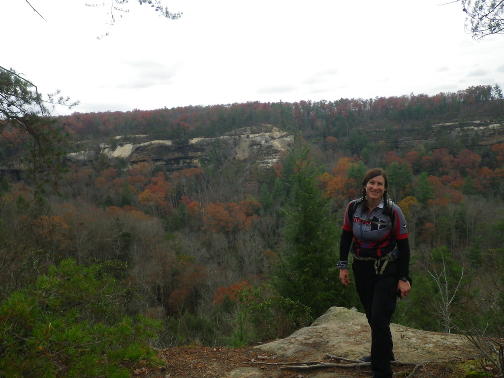
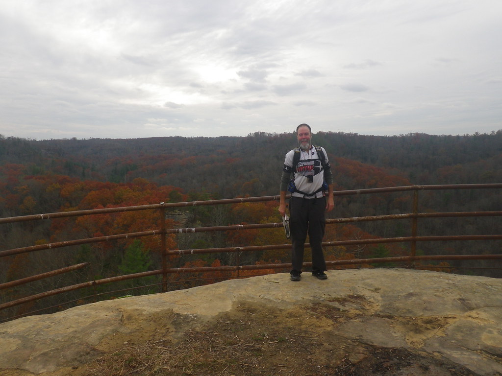
The start was downhill from the eventual finish line, so we decided to park at the top and ride down. Having Chuck's van in the closest possible spot to the finish line more than outweighed the slight inconvenience of having to leave behind our jackets and shiver a little before the start. We coasted down, collected our passport, searched in vain for an unlocked bathroom, and even had time for a pre-race team picture on a suspension bridge (yea) before rolling up to the start line with 100+ new friends-to-be.
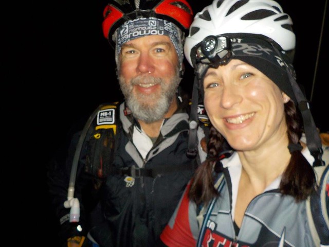 |
| As my friend Lindsay noted, that's a very nervous smile on my face. |
We started with a paved climb out of the park and then zipped down the highway, making a quick stop 3ish miles into the race at a rest area for that elusive bathroom before crossing under the Mountain Parkway and beginning to climb. Right away Chuck began previewing what was coming next for me, perhaps hoping to stave off my inevitable sense of betrayal when the course doesn't align with my mental
We could see someone walking their bike uphill ahead of us, which always makes me happy because then if I have to walk I won't be the first or only one, but though we gained over 500 feet in less than two miles it was all gradual enough to be (almost) fun. After my implosion at BT Epic, this was a big relief.
Chuck: The pines and big rock features we wound our way through were scenic enough to take your mind off the actual climb.
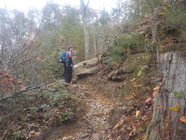
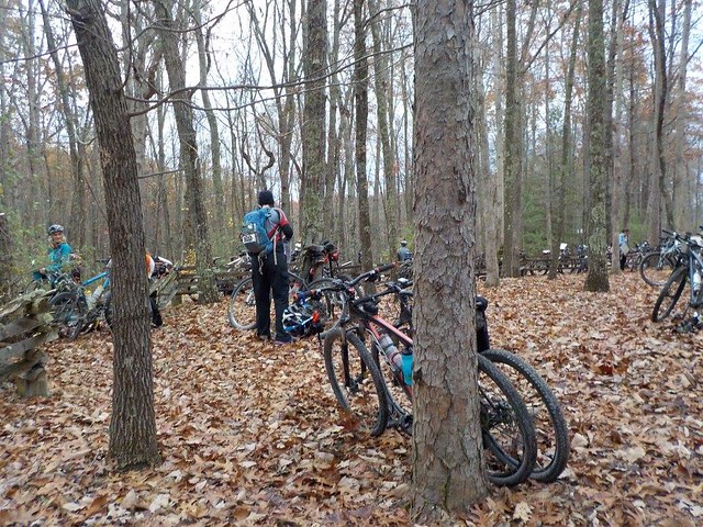 |
| TA1 bike drop (which would also be TA4 when we returned to it after the trek) |
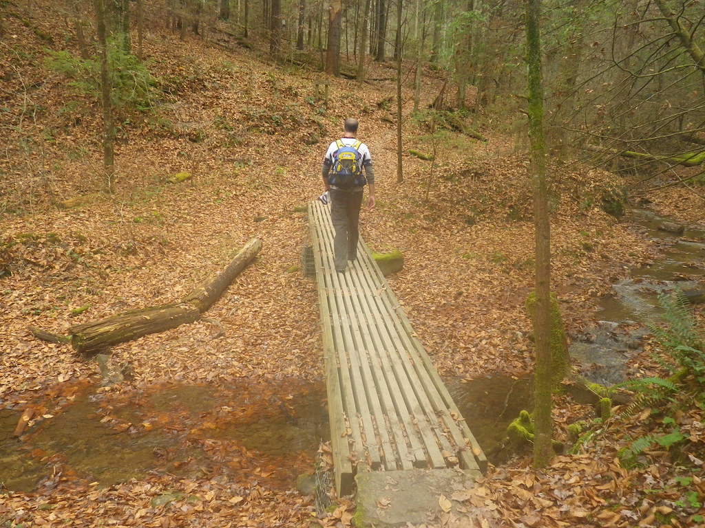
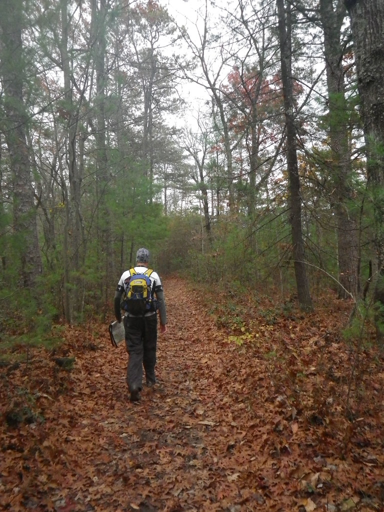 |
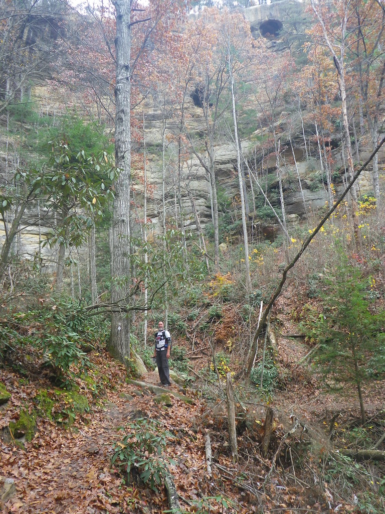
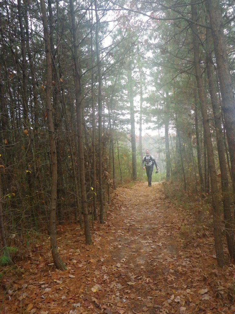
| Setting off on the first trek |
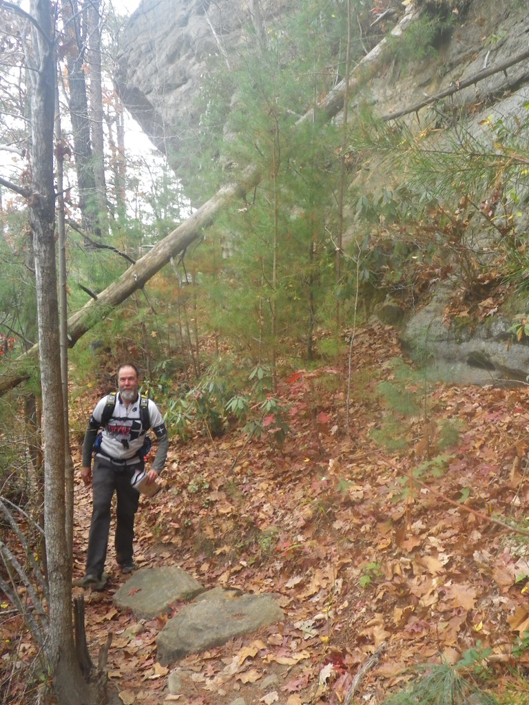
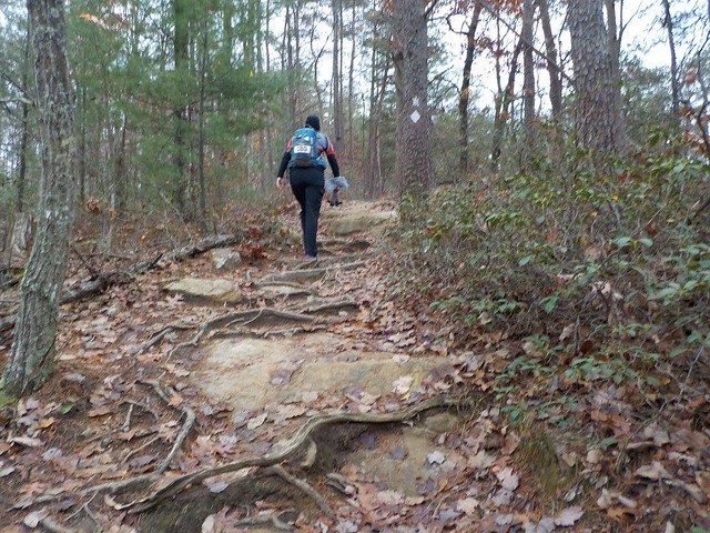 |
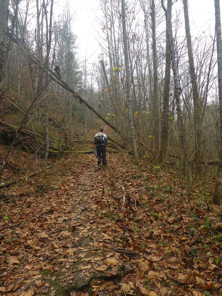
| It wasn't all super smooth...; that said, plenty of the trail looked like it did in the above picture of Chuck. |
Chuck: We really did have perfect weather! Especially compared to last years pre-race flooding and race day snow and cold rain.
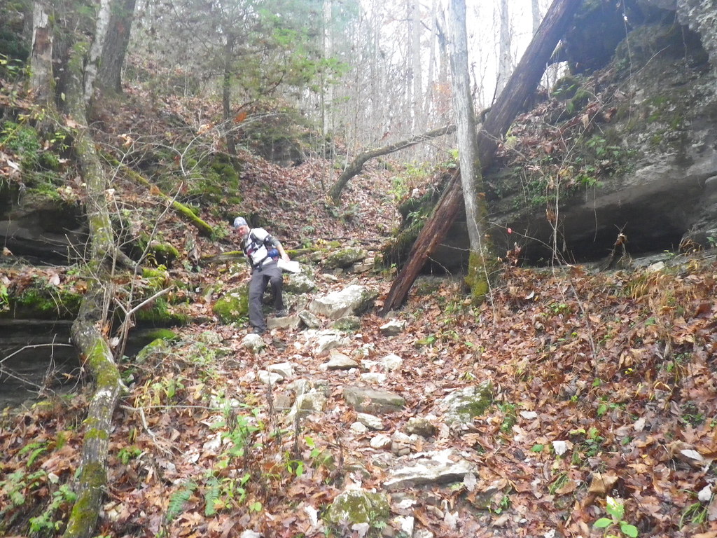 |
| Right after I took this picture, Chuck slipped and fell, tossing the map aside to catch himself. After he picked it up, he mentioned how glad he was that he didn't inadvertently throw it into some chasm. |
We found CP10 without incident and then made our way across our second suspension bridge of the day (yea), running into Terry and Julia, parents of solo Mike from Tomahawk, on the other side. They had come along for the day to spectate as he raced with his daughter, and seeing their friendly faces at several points in the race was always a treat.
 |
| Pretty, for a deathtrap... |
 |
| On the way to CP11 |
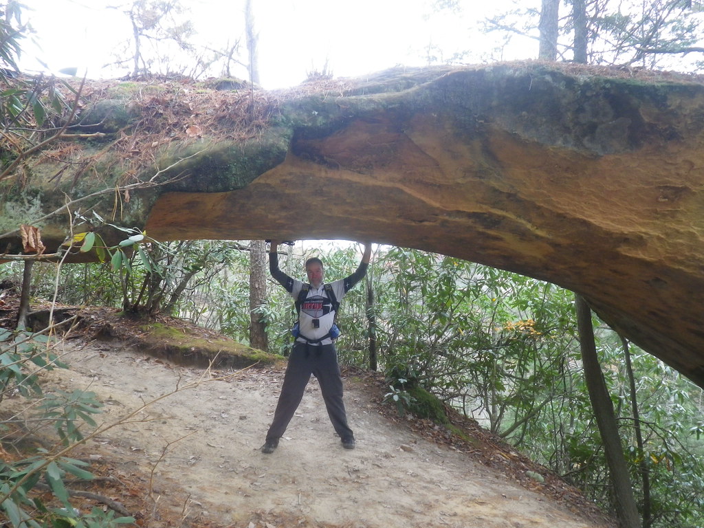 |
| Chuck kept this arch from falling down. |
CP11 apparently gave a lot of teams some trouble, but we don't know if it would have stymied us because as we approached it a 2-man team gave us some pointers on where to go. We walked right up to it and punched, catching back up with a couple teams we hadn't seen since CP10. From there, all we had to do was retrace our steps, giving back the 500 feet we'd just climbed, and get ourselves to TA2 and the canoes.
 |
| The view on the way back from CP11. I wasn't interested in getting any closer to the edge. Fun fact: I couldn't find my trekking pants while I was packing (turns out they were hanging in the garage, still not washed from the Tomahawk Challenge) and so had to wear a pair of Target brand pants that one of my older boys had discarded years ago. Random bit of trail conversation: Chuck: Hey those new pants don't have zip-off legs Kate: No, but I don't usually have much use for zip-offs. I like them so far. Chuck: Other than the fact they make your ass look huge. Kate: They Do Not! I checked in the mirror before I left! Chuck: LOL! Who does that!?
Commenting on the commentary: Who does that? Girls! As an aside, after looking at the pictures taken when I was in the front, they really did make my butt look big. Goodbye, hand-me-down pants!
|
 |
| It was so beautiful out there. |
Paddle: ~ 3 mi, TA2, CP 13, TA3
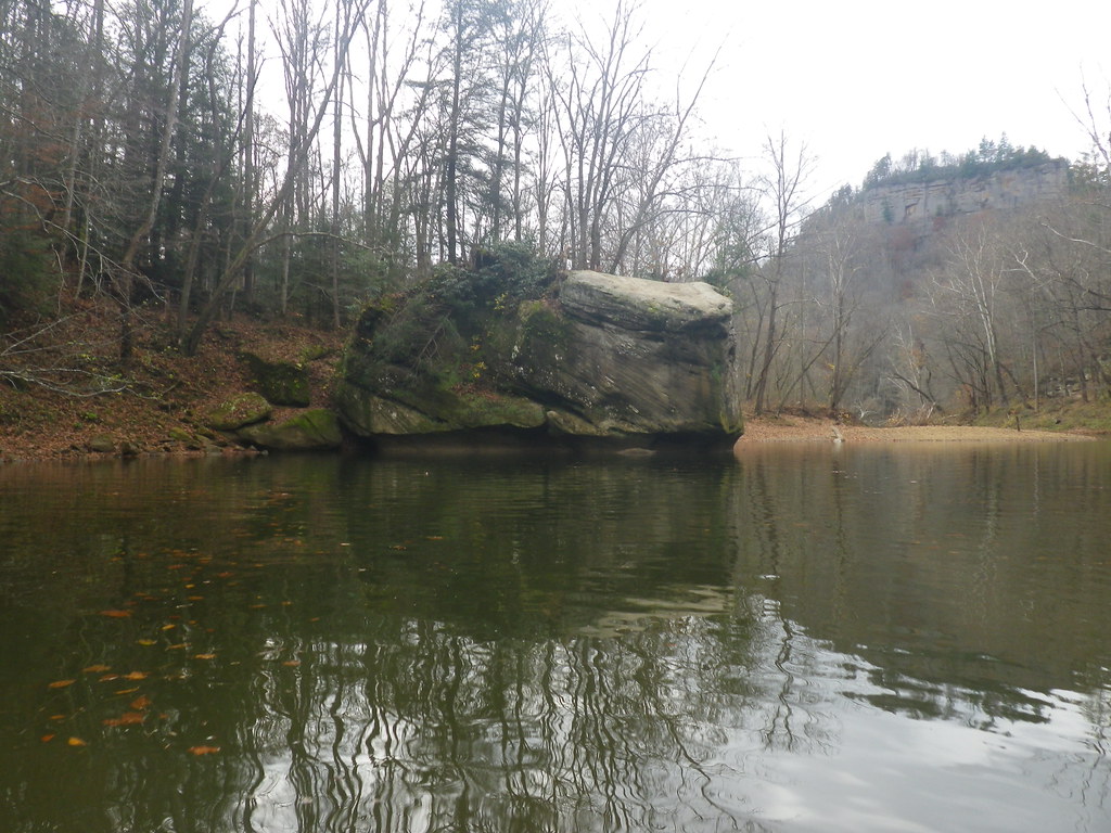
I always dread the paddle, more so this year after tipping in two of my last three ARs, but my dread was tempered by the fact that it was such a short paddle. On the other hand, boats weren't included in the race fees, so the $40 canoe rental worked out to around $13/mi. The dearth of navigable water is just a fact of adventure racing in the Red River Gorge area, though, and most races I'd be glad to pay $40 to skip the paddle.
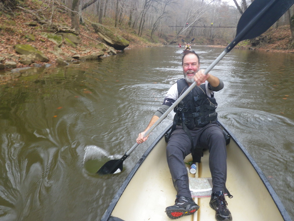 |
| Chuck does not dread paddling. |
 |
| As much as people seem to think I just pull out the camera so I don't have to paddle, Chuck is actually the one who kept telling me to take pictures. Chuck: Its true! that was a very scenic little river. I would've loved to have more paddling miles. |
At TA3 were were offered hot chocolate (yea!), candy (yea!), and coordinates for two "bonus" CPs. We'd anticipated their general location thanks to the overlay on the map (no point in having trails marked special in an area with no CPs) and pre-decided we'd be better off skipping the huge climb involved. Chuck changed his mind after plotting them, though. "They're pretty close, and I bet it's a great view. I know it may not be the best race strategy, but I'd like to see them."
We're more about the "adventure" than the "race", so I was open to it, Besides, I wasn't sure it was bad race strategy. Maybe it made more sense for us to tackle the trekking points, which were generally in the same area, than chase the bike CPs, which required a decent ride and included points in the vicinity of last year's bike leg. That had been its own special kind of adventure, but I wasn't eager to slop my barely recovered leg through potential mud puddles.
As we turned onto the road towards Raven Rock, we saw Lupine heading back towards us, having decided their time was better spent going after the bike CPs...basically the opposite of our strategy (full disclosure: they ended with 4 more CPs than we did, but since I don't know which ones they got and when, it's hard to compare). The path started out nice and flat, then hooked around to the left. As we made our turn, we looked up the trail and then laughed, "Oh man, look at that hill!"
 |
| We thought this was a hill. We were so wrong. |
 |
| Our goal was the top of that cliff in front of me...no big deal. |
 |
| Just remember that pictures never show just how steep hills are. It was even worse than it looks. |
(For another description of the ascent to Raven Rock, complete with some interesting local history, check out this blog post.)
 |
| We'd come from the road you see on the left. |
 |
| Gorgeous fall views |
Retracing our steps was a slower-than-I'd-expected process, mostly due to the way I gingerly picked my way down the steep hill while a 2-woman team with trekking poles jogged past us. Chuck mentioned that he'd pay $1,000 for a pair of trekking poles right then, but he had no takers. While the downhill was awfully hard on the knees, thankfully it wasn't as slippery as I'd expected.
Once we made it back to the bottom, we hiked back out onto the road. Our fast hike was no competition to the teams that alternated hiking with running, and a couple of them passed us in this section (and were likely already ahead of us points-wise). The road took us to the trailhead towards CP6, and for a while we enjoyed a pretty level trail alongside a creek. The trail actually wove back and forth over the creek multiple times, and it seemed like every bridge was built differently. That made a nice diversion from our sore feet.
 |
| One of the many varied bridges. |
 |
| Yeah, yeah, it's scenic. Now where's the &;#&;!@ TA |
 |
| "Seriously??" |
 |
| The trail |
 |
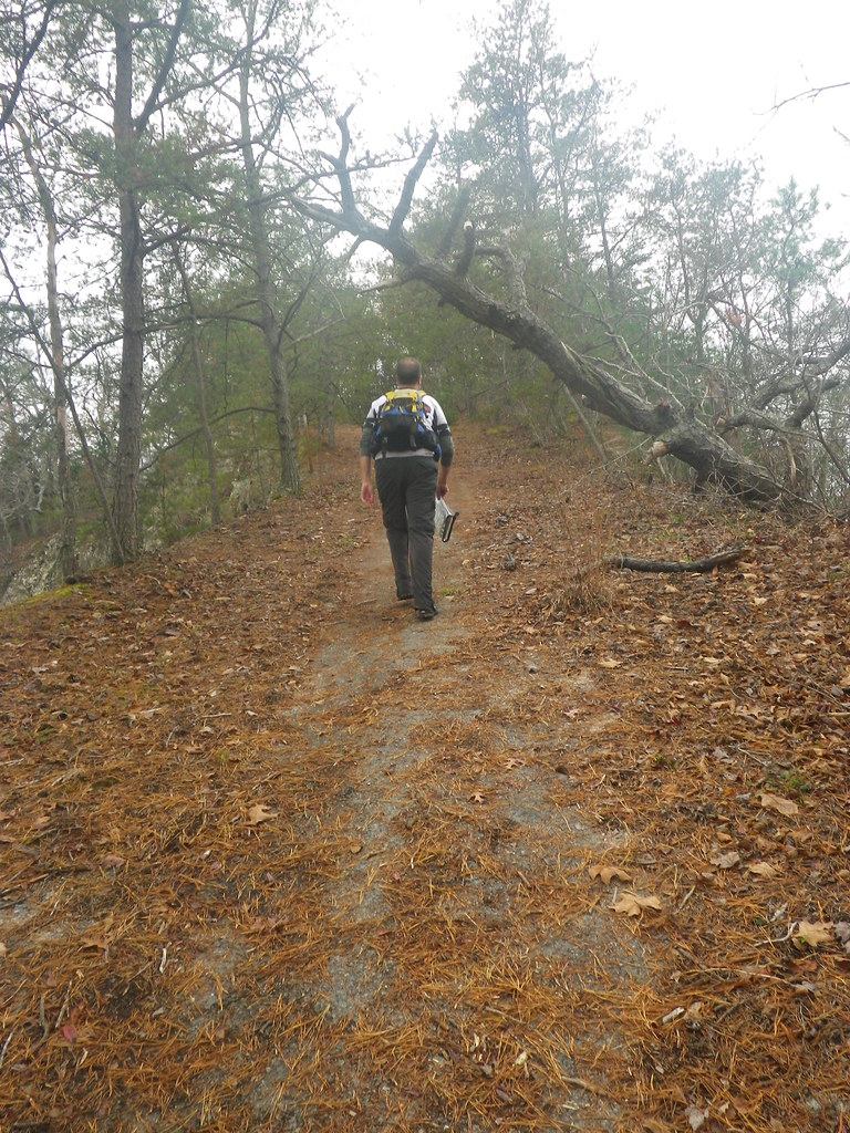
| Glorious flat trail at the top! |
We made a pretty quick transition at TA1/4 and hopped onto our bikes for the first time since about 8 a.m. If there's anything more glorious than getting off your feet after hours of trekking, it's getting off your feet after hours of trekking and coasting downhill for 4 miles.
Chuck: This was where we discovered the rear Fox suspension shock on my mtn bike had lost pressure and collapsed. Unfortunately it decided to blow the seal during a race. Fortunately it was a race without single-track. All we could do to compensate was raise the seat post to the highest position that seemed safe, then peddle along like I was riding a little kids bike.
Granted, I took the hill a little slower than Chuck. While my downhill courage has definitely improved, that's on straight roads. Winding our way back through the curves we'd climbed that morning, wheeeeee! lost the competition with what if the brakes fail?
Traffic wasn't an issue until the road straightened out, and then it seemed like every car in Kentucky was following us down. Throughout our time on the bike drivers were unfailingly careful, but the lead car in our little caravan was reluctant to pass us, even when the road ahead was clear, and a good-sized line built up behind her. Thankfully she eventually came around, and after an uncomfortable few minutes while numerous cars passed us, we had the road to ourselves.
Our plan was to go after the closest bike CPs, both of which were located just off of paved roads, and then spend any remaining time on CPs 1-5. Shortly after we passed the turn to the finish line on our way to CP1, I realized I should have timed how long it took us from that road to CP1, so I checked my watch and made what I hoped was a safe estimate about the part I'd missed.
Chuck: Kate does a great job with timekeeping sections like this, allowing me to stay focused on our nav.
We quickly found the gravel road leading up towards the trekking CPs (1-5) -- about a 15 minute ride from the finish line if I'd guessed correctly -- and then continued on towards the bike points. One was at Cliffview Resort, where we'd ridden their amazing, long zipline in last year's race, and the other was at a building at...another place. Thinking we needed to go to Cliffview first, I filed away the other clue and assumed we'd figure it out when we needed to. The ride to Cliffview took longer than I remembered (story of my life), and on the way we passed a campground called "Land of Arches".
We reached the entrance to Cliffview shortly after that, and Chuck looked at the map, trying to decide if the half-building behind the sign could be the location of our CP15, which we should have passed on the way to Cliffview. Pulling out the race book, I read the clue: "Land of Arches: building". Oops. Luckily you could get points in any order, so we quickly punched CP16 at Cliffview and then returned to Land of Arches for CP15.
After punching, we took a couple minutes to pull out our jackets for the ride back to CPs 1-5. Most of the ride there had been uphill, and we expected a fast but chilly ride back in the growing darkness. Our return trip went quickly, and I was very, very glad to have a brand new, very bright taillight. In most ARs I've done, the majority of the bike legs take place on lightly traveled gravel or doubletrack roads. We'd had to skip that part of the Fig's bike leg and instead were riding through the dark on a fairly busy two-lane highway. Once again all of the drivers were very respectful with their passes, but I've read too many stories in the past year about bike-car accidents to feel comfortable.
Chuck: And my rear blinky light was dim enough to say it was nonexistant. Too bad no one offered me replacement batteries for it during our pre-race prep the night before.
The road leading to CP1 was more of a fire road than gravel, and it began with a steep little section that, in the wrong gear after cruising downhill for several miles, I had to walk up. Once we hit the first switchback the incline gentled a bit and I was able to hop back on the bike and ride most of the climb, which was a welcome surprise after how poorly I rode at BT Epic (and further evidence that I'd derailed myself there with huge nutritional failure).
We reached the top, punched CP1, and decided we didn't have enough time to try for any of the others. I was a little nervous about the trip back downhill, but it went smoothly and we were quickly back onto the paved road back to the finish. With all of the cars on the road, we opted to turn off and ride through the campground (where, fun fact, Jeff and I stayed one very chilly March night before we were married) rather than remain on the highway any longer and rode into the finish with around 20 minutes to spare.
The post-race dinner was delicious: salad, bread, and two kinds of lasagna. We ate and caught up with how the Toporadicals' race went; we were especially interested in how they did because they'd started in the southern section of the course. Once all teams were back, Dallas announced the winners in each division in one of the most efficient post-race meetings ever.
We ended up 6/12 in our division and 41/63 overall. Typically even when we're (I'm) slower, we can make up time with good navigation and route choice, but with so many checkpoints being located near trails due to the Forest Service, the race definitely favored teams who were fast. One of my favorite things to do on the drive home from a race is to go over decisions we made and try to see where we could have improved. Driving back from Kentucky, Chuck and I both agreed that the only way we could have done better was just to be faster (which is basically exactly what we said last year...maybe this is the year that lesson finally kicks in for me!). And we agreed that we'll have to go back again, hopefully with some more Virtus/friend of Virtus teammates. Even in new hands, the Fig is way too good of a race to skip.
Full results
All of our pictures from the race


You just amaze me. These adventures always sound like so much fun...but I would be totally lost....literally! You truly are SuperKate!!
ReplyDeleteThis is SO cool! And the scenery is gorgeous! Yay for paddling!
ReplyDelete