The Fig XII (Red River Gorge American Classic)
How do you write a report about a race where nothing went wrong? A day absent of drama and figurative low points? Begin, I suppose, at the beginning, which turns out to be in the aftermath of Thunder Rolls.
Aug. 29:

Chuck's regular partner Robin had family commitments that kept her from doing the race. I was available, but our schedules worked against us.

Chuck was busy, I was busy, and we tabled the Fig talk until Berryman weekend. My acceptance of not going hadn't kept me from stalking the race website and noticing that this was going to be the final year for the Fig*. When Chuck mentioned how cool the zipline sounded and how he was going to have to do the race next year, I had to tell him there wouldn't be a race next year. He may have called me a bad influence, but the upshot was that we were registered the week after Berryman. (*As it turns out, it was the final year for Flying Squirrel Adventures to put on the Fig but it will still go on with 361 Adventures taking over the reins.)
SuperChuck: I haven't had a bad influence since high school! Just wait til my Mom finds out.
 The funny thing was that Chuck's main reason for wanting to do the race was the thing I dreaded the most. I have a well-documented fear of heights and have managed to avoid the zipline at adventure camp for the past two years. Why, WHY was I signing up for a race that would force me to do something I was scared of? The only possible answer is that I have a problem.
SuperChuck: You do have a problem, and I know how to exploit it :)... Remember "Wanna do something stupid?" at the Skippo?
The weather forecast made a nice distraction from my zipline worries as it got progressively worse in the week before the race. Snow on November 1? I'd been running in shorts and a tank just the week before!
Last winter gave me plenty of cold weather experience, but I hadn't had a chance to drag out much of my warmer gear yet this year and hadn't worked my way back to feeling comfortable with suboptimal temperatures. That said, between Stubborn Mule and Thunder Rolls I've spent enough time in the rain this year to know that I certainly won't melt.
We made decent time to Slade, KY, the only hiccups being a poor initial choice for lunch, Louisville rush-hour traffic, and the little matter of driving into a new time zone. Surprise: Kentucky is an hour
ahead of Illinois and Missouri.
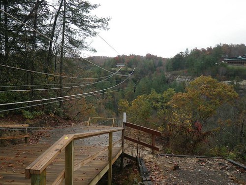
We missed check-in but arrived in time for the pre-race meeting, where race director Stephanie reminded us several times that we'd be "zipping across the canyon" (it's important that you imagine an ominous, echoing tone for that phrase) on the "longest, fastest zipline" at the resort. My stomach felt sicker each time she said it. There was actually an alternate route, but both teammates had to stick together and no way was I going to make Chuck miss the zipline. Besides, the alternate route sounded tough. Laziness trumps terror.
We were able to check in after attending the pre-race meeting and signing our lives away on the zipline waivers. Then we grabbed a delicious pizza (and significantly raised the average age) at Miguel's and drove back to the motel to put lights on the bikes and get our gear ready for the bike drop. Neither of us had brought a tub, so we stuffed my dry bag with food, spare socks, and an extra pair of shoes for me. In what's becoming a typical Kate and Chuck pre-race tradition, we had a little hiccup finding the bike drop but set up pretty quickly and then headed back to finish getting our packs ready and make a final decision on clothes.
After much agonizing, I settled on tights over bike shorts with my adventure pants on top for wind protection (forecast was wind speeds in the teens). I wore a long-sleeved tech shirt, a buff around my neck, and a fleece hat, all topped by my waterproof jacket. Because the mandatory gear list was pretty minimal, I had space in my pack for a fleece jacket as well as some extra socks and gloves. The clothing combination ended up being perfect for the day's conditions.
SuperChuck: After no agonizing at all I wore my standard AR stuff and it worked out fine.
Even after staging our bikes and gear on Friday night, we still had to make an early-morning run to Mill Creek Lake after realizing we hadn't put our bike number on. Luckily I didn't have any trouble getting up; I'd slept well until around 3:30 or 4, when headlights flashing across the window kept inspiring panic: Why are they up? Is it late? Where are they going? Is the parking lot going to be full? Will we have a place to park?
We arrived at the Activity Center in plenty of time to get a hot breakfast and relax until maps were passed out at 6 a.m. The maps were a little intimidating. Usually lots of contour is helpful in navigation, but this was elevation overload.
We had a 8 CPs to plot as well as two TAs (transition areas) and the start line; then we did our route planning. The first 14 CPs were mandatory; once we had all of those, we'd get coordinates for the remaining ten. Here's a look at what we knew at the start of the race:
Leg 1 - trekking - get CPs 1-3, all located on named features in Natural Bridge State Park, in order, then run to TA1 at Mill Creek Lake. CP2 was located under the eponymous (I was pretty sure that was the right word, but I had to look it up to be certain) bridge, leaving me very relieved that I wouldn't have to cross it. As it turned out, I was quite wrong about that.
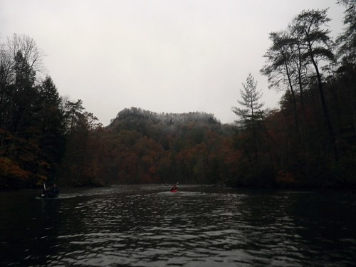
Leg 2 - paddling - get CPs 4 and 5 in any order, then return to TA. Best paddling leg EVER. Super short, on a nice, calm lake. This gave me one less thing to dread.
Dread? There's no dread in paddling! Seriously, Kate is a great paddler! So stop dreading paddle legs!
Leg 3 - biking - get CPs 6-10 in order and then proceed to TA2 at Cliffview Resort. Yay, biking! I love biking, and it's a good thing because it was a fairly long bike leg.
Leg 4 - trekking and ziplining - a total of 6 CPs worth 4 points. Upon arrival at Cliffview, teams would be assigned either the trekking loop or the ziplining loop first. This was one was Stephanie had designed the course to avoid bottlenecks at the zipline. The trekking loop was CPs 11-13. When you did the ziplining loop, you traded your main passport for a smaller one. The three CPs punched on the zipline passport were traded for CP14 on the big passport.
Once teams completed the Cliffview trek and the zipline loop, they were given coordinates for the remainder of the race. While we didn't know the location of the CPs, we knew the basics:
Leg 5 - biking - CPs 15-16 optional/any order, proceed to TA3 (same as TA1 at Mill Creek Lake)
Leg 6 - paddling/trekking - CPs 17-25 optional/any order - could be reached by paddling and/or trekking. When finished with these points, you must pick up your bike from TA and bike to finish.
At 6:45, Stephanie chased us out to hike through blowing snow flurries to the race start. Volunteers passed out passports, and I safely zipped ours into a pants pocket. The race started promptly at 7, and we started running up...and up. Before long, our pace shifted to trudging up step after step after step in the morning darkness.
Leg 1: Trekking (~5.5k, ~1:15) CP1 was located at Lover's Leap, which according to my GPS tracker was the very highest point in the entire race. We climbed approximately 150,000 stairs on our way there, literally climbing up the side of a cliff. While the darkness may have eased my fear by preventing me from seeing how high we were, I was nervous about slipping on the wet wood and stone steps and clung to the railing with both hands, soaking my gloves in the process.
I had opted to wear my smallest headlamp for the race ("It's a 7:00 start, it won't be dark long"), and while it's perfectly serviceable for walking around a campsite it's a lousy choice when attempting to run trails with rocks and roots on the top of a cliff. Lesson learned. Since we had gear stashed at the bike drop, I could easily have worn my good headlamp first thing and then switched for a smaller one at the TA once it was light (a headlamp was mandatory gear, so I had to have one with me).
Yeah, why didn't we think of stashing lights? I used my small one too, we would've been way better off with the big PT Apex lights.
Anyway, we made it to CP1, which probably has an amazing view, but it was really high up and dark anyway, so I punched our passport and got the heck away from the edge. We turned towards the next CP. Well, Chuck turned. I followed his heels. "Wanna run some?" he asked. No, I thought, no, it's dark and snowy and slippery and my light sucks and we're really high up. I don't really want to run. But what I said was, "Sure."
Somehow our route led us onto the natural bridge I'd been so relieved I wouldn't have to cross. Knowing what a chicken I am, he slowed down and told me, "Just watch my feet." It's ridiculous to be as scared as I was, because you would have to go to some serious effort to fall off the bridge, but that's why they're called irrational fears, I guess.
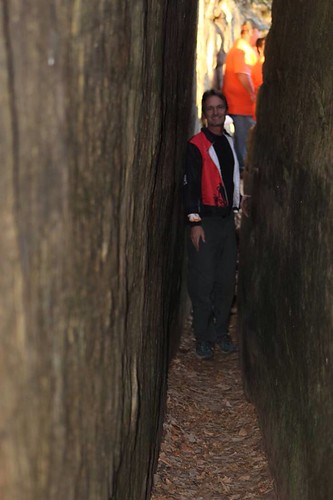
We crossed onto solid ground and then followed the trail along the base of the bridge and through a narrow passageway called Fat Man's Misery.
Obviously the above photo was taken during the daytime. It was still dark when we were there, fitting OK with our packs until halfway through when teams started coming back towards us. That made for very close quarters. I was pressed up against so many guys in passing that I felt like I owed my husband an apology. I quickly punched our passport while Chuck looked over the map, and then it was back the way we came, only now we were the ones going against the flow.
We had one more CP to pick up at Balanced Rock and then we hiked down to the road, grabbed a quick bite to eat as we walked, and then ran through the campground towards Mill Creek Lake, where we checked in with the volunteers. One of the race rules was that you had to sign in whenever you first reached a TA, and as I approached, Stephanie, who I'd introduced myself to briefly that morning, told me, "Kate, sign in here." It always surprises me when race directors, who are busy handling so many details, remember names of people they just met. We grabbed our paddles and a canoe and put in on the lake.
Leg 2: Paddling (~2.3K, ~:26) With Chuck's kayak paddles, we flew through the paddling leg and were back at the boat ramp in no time. After a summer full of less than optimal canoes, the one that we'd rented through the race was wonderful. Our transition was a bit less fantastic.
Though the cold weather wasn't an issue when we were moving, I had a harder time with it while we were getting ready for the bikes. I took off my soaked gloves, ready to trade them for a dry pair after I had my bike shoes on; after tugging on my shoe covers (which were a very good idea) and fighting to get them zipped up, my fingers were numb. I pulled on the gloves and then realized I wasn't wearing my helmet. After struggling for a minute or so to fasten the strap, I finally gave up and turned to Chuck, who'd gotten ready much more quickly: "Help!" With my teammate's assistance, I was FINALLY ready, and we took off downhill out of the parking lot and onto the pavement.
Leg 3: Biking (~4:00, ~43K) The bike CPs were pretty spread out (about 25 miles total), but the first ones were right off of the roads. Bridge, check...bridge, check. I felt great on the bike, really strong. After the second bridge CP I started to feel a little bit of a twinge in my quads and asked Chuck to get out his medicine baggie. Chuck and I have gotten pretty good at catching cramps before they start and taking endurolytes (I think that's what they are). That's been a real revelation for me. For the longest time I just thought hurting legs were a cost of racing, like that's how your legs feel after running or riding for xx hours. It's been a pretty great discovery to learn that I don't have to be sore.
Yep Endurolytes. They work fantastic and have saved me so many times, I almost consider them required gear for any race over a couple hours.
The roads changed from pavement into gravel, and then we came to our turn. Ahead of us a team was walking their bikes up a fairly steep hill. Not that long ago, that would automatically make me get off my bike too; now I'm likely to see it as a challenge, and I was happy to be able to ride past them and make it up the hill. We found CP8 (reentrant) off of the gravel road and then, as Chuck said, we were going to have to work a little harder.
Within a minute or two of leaving the CP, we rode up to a fairly deep creek crossing. We stopped and glanced down the creek to see if there was any good crossing spot. Seeing none, we carried our bikes across. "Well," I commented, "the good news is that we don't have to worry about getting our feet wet anymore."
The next hour or so gave us an up close look at all the rain the Red River Gorge area had received in the week before the race. The roads were a minefield of huge muddy puddles, and we zipped back and forth looking for the best line, sometimes avoiding the water, splashing through when necessary. And it was So. Much. Fun. I had been very disappointed in myself after being such a baby on the bike leg during September's Berryman Adventure Race and went into the Fig determined to take whatever we got with a good spirit and just accept that "this is what our bike leg is like". Total success in that department, even when riding (or walking) "roads" that looked more like hog wallows.
Eventually the road started to dry out, but that's because it started climbing.
We pushed our bikes to the top of the hill, where we joined a group of racers staring at their maps and the terrain in confusion. In addition to the hill we'd just pushed our bikes up, the road made a T in front of us with gravel stretching to the left and right and then a kind of bare area in front of us that looked like it might have been a trail at some point.
The map seemed to indicate that we should go straight ahead, and at least one team standing in our confused pack left their bikes and went exploring in that direction. Others thought they needed to go to the right. As Chuck and I puzzled over the map, he was pretty confident that we needed to go left. I could sort of see it on the map (though looking at it again now, I can't figure it out), and he'd been on all day. We climbed onto our bikes and started riding uphill.
I pulled the compass out before we made that turn to the South, and my confidence went way up when the terrain, compass, and the map all matched up. Neither one of us would have wanted to repeat any of the giant hills in the area because of a nav error.
No one followed us, but the terrain matched our map as we rode on, and our confidence in our decision grew. And was confirmed when we ran into Cecil, who we'd met near CP3, at CP9. Success! Cecil had taken an alternate route, which though longer avoided the crazy slop we'd ridden in. Definitely a smart route choice.
We moved farther down the road after punching our passport and took a moment to use the bathroom, eat a quick bite, and adjust the maps. Then it was down a big gravel downhill and off in search of CP10. We ran into pavement (or smooth gravel?) before Chuck expected, and it was a welcome surprise after the challenging roads we'd spent the last couple hours on. We pushed our bikes up a big hill, catching up with Cecil shortly after the top and riding with him for a while, talking about racing and orienteering, making good time on some cool roads, admiring the scenery as the terrain dropped away on either side.
A team came riding back towards us, concerned that they'd missed a turn. We all stopped and looked over maps before deciding that we were comfortable with the way we were going. There were a couple more map check stops before I asked Chuck, "Do you feel like we're going the right way?" He said he did, so I suggested we move on and quit second-guessing ourselves.
We hadn't gone much further when we came to another intersection. There was a private drive right in front of us, a gravel road to our right, and another gravel road ahead of us and somewhat to the right. This time we did need to stop and look over the map, and while we were doing so the group behind us rode into the intersection and onto the front/right gravel. "It's this way!" one of the guys called.
We followed after them, but before we'd gone far I saw a private property sign on a tree and called to Chuck. "Are we on private property?" He yelled ahead to the other group, but they were gone. We rode ahead, now less sure of our route. We're used to seeing private property signs along roads, but usually they're set up parallel with the road, indicating the land next to the road is off-limits. This one was faced anyone who was riding down the road. As I looked for more signs to indicate whether we were in the wrong place, I noticed bikes cruising down a gravel road to our right. "Is that where we need to be?"
Awesome save by the co-navigator!
We decided it was and backtracked, hitting one of the scariest downhills I've ridden. It was gravel, but it was steep; Strava lists the grade of the beginning of the hill as -27.3%. I've come a long way with my downhill confidence, but my brakes got a serious workout on the way down -- to the point that I could smell them. When I caught up with Chuck, who had taken the hill much more quickly than I did, he told me, "I could smell my brakes! That's never happened before."
"That's the smell of fear," I replied.
After the downhill, the road ran alongside a creek, and by "alongside" I mean through. We'd put our bikes through plenty of water and mud already, and it appeared that waterworld theme would be a recurring one. We rode through and around most of the creek sections, but there was one that we deep enough we opted to carry our bikes.
The water was cold, but our feet had been wet for the entire race so far and we hated for our legs to feel left out. This road featured lots more water and mud pools. By this point we were much less worried about trying to ride around them; instead we just plowed on through as long as they didn't look too deep. Because I wasn't following along on the map, I was surprised when we popped out at CP10 (north end of dam power pole). I punched our last CP of the bike leg, and then we rode off towards Cliffview Resort, the site of the dreaded zipline.
We had one more huge hill to push our bikes up. Even walking it was kicking my ass, and I watched in awe as another coed team spun their way to the top while everyone else around us walked. Very impressive. Once we got to the top, it was smooth pavement and flawless nav until we pulled into TA2 at Cliffview.
Leg 4A: Ziplining and trek (~1:44 including transition) Confirming myworst fears expectations, we were assigned the zipline loop first when we checked in at TA2. We traded our main passport for the zipline passport, a supplementary map of Cliffview, and a cup of hot cider (thanks, David!) which was the perfect drink after 5ish hours of cold and wet.
After a slow-ish transition, we hiked down the road in search of the zipline. Chuck handed me the map and told me I could do the nav for this section, but unlike at Thunder Rolls, I barely glanced at it before shoving it back at him. It had far less detail than our main maps and all kinds of colors, and looking at it kind of made my head hurt. We probably would have been better off if we'd taken a minute to orient ourselves on the map before heading out, but instead we did it on the fly (and by "on the fly" I mean while we were walking). We also relied a little more on the signs at the resort ("zipline" with an arrow pointing to the left), forgetting for the moment that there were numerous ziplines at Cliffview, and so we made a minor nav error before the map really clicked and Chuck locked on where we needed to be. "We can either go back around up the road or we can bushwhack up this hill."
We picked the shorter, steeper hill and popped out in view of the zipline. At first glance, it wasn't as bad as I'd anticipated. I had imagined a high tower to climb and was relieved to see that wasn't the case.
The zipline staff helped us into our harnesses, and I walked nervously to the tower. Earlier, Chuck had asked me if it would be easier for me to go first or second; I hadn't been sure at the time but once we were actually there I opted to get it over with go first.
The tower seemed much higher as I cautiously walked the swinging bridge to the top platform. You can see that, despite being clipped in to a line, I'm also holding onto the sides with both hands. I turned to Chuck and mouthed, "I hate you."
I had been really unhappy with how wimpy I was about the rappel this year at Thunder Rolls; I think maybe it's easier for me to show that I'm afraid because my friends know I'm afraid, but somehow that lack of game face makes me give into fear more. This was another area I was determined to improve on at the Fig, albeit with mixed success.
The guide had me stand on the top step ("You mean, all the way up here?") while he got me all clipped in and then told me I could step off the platform ("You mean just...step off?"). It took me a moment...or two...and then I did, indeed, step off and begin zipping across the canyon.
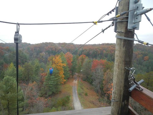
I was scared, but I reminded myself to trust my equipment. And once I was going, I wasn't that scared. It was actually kind of fun. I didn't make it quite all the way across, but the guide on the other side was out to me almost as soon as I stopped and towing me back to solid ground.
Next Chuck came zipping across with a big smile on his face.
That was so cool! Longest fastest zip I've ever done.
The guides at Red River Gorge Zipline were wonderful. Friendly, patient, and helpful, they definitely made my first zipline experience a good one, and the scenery there is amazing. Big thanks to them for the chilly day they spent outside supporting the race!
We got out of our harnesses, punched our passport, and headed off in search of our final two CPs of the zipline loop before Chuck realized he was still wearing his helmet and had to run back and return it. Then we set off again towards Susanna Arch.
Another 2-person coed team was hot on our heels at this point and eventually passed us around the final zipline CP (rock shelter), asking if we'd done the trekking loop yet. We, of course, had not, but they had, putting them around an hour ahead of us. That was disappointing, but there was still plenty of racing to do and anything can happen. We hiked more steep trails until we hit one of the Cliffview roads and made our way back to TA2 again and traded our zipline passport for CP14 and our main passport.
Leg 4B: Cliffview trek (~:54) After grabbing our packs, which we'd been allowed to leave behind for the zipline loop, we headed off in search of CPs 11-13. Chuck noticed that a trail towards 11 started behind the TA, so we took that downhill. I think it was pretty much a straight shot down to the lake, where in taking a shortcut I managed to step into water instead of over it. Oops. Oh well, we only had two more CPs before changing back into (wet) bike shoes, and then I had dry shoes back at Mill Creek Lake.
The trek to the next two CPs was pretty unremarkable, and they came more quickly than I'd expected. The flatter terrain was much easier to cover quickly. We'd had to climb a bit to get to our final CP, and then had a decision to make. Take the fairly direct way back to the TA, which would involve giving back all the elevation we'd gained and then a long uphill climb out, or take a slightly more roundabout path? We chose option B.
As we hiked along the road, I looked up the hillside next to us and noticed how flat it was at the top, as if there was a road there. "What's up there?" I asked Chuck. Looking at the map, we saw that the road we were on came close to the road we eventually needed to be on and decided to cut off some distance by bushwhacking up the hill. We popped out onto the road and hike/jogged back to TA2 for a third time.
Another great call by the co-navigator! I think this short-cut picked up 20 minutes on another team that had chosen our original route plan out of the creek valley.
Back at the TA we were offered candy and coordinates for the last 10 CPs of the race. After plotting them, we decided to definitely go for the two bike CPs and highlighted three paddle/trek CPs we thought were in reach timewise. We got back into our soggy bike shoes and then set off for Mill Creek Lake again.
Leg 5: Bike 2 (~12K, ~1:08) Unlike the previous bike leg, I was dragging. Chuck was much stronger than me here. I didn't feel bad, I just didn't have a lot of energy and felt really slow. I think this one was all pavement, and we picked up our two CPs without incident.
Leg 6: Paddle/trek (~:50) We dropped our bikes and changed into our trekking shoes. After spending the day in wet trail and biking shoes, wearing the dry shoes in our gear bag was glorious. We paddled back across the lake for CP17 (south side of boulder). A team had beached their canoe and were looking along the hillside near a great big boulder. We almost stopped there, but I asked Chuck, "Is this where you had planned to stop?" When he said no, I suggested that since he'd been on all day we stick with the original plan. We beached the canoe in a little cove. Teams were roving all over the hillside looking for the correct boulder. We didn't go straight there, but we were pretty direct in our approach, snagged it, and got back to our canoe. The steep hillsides were doing a number on my tired legs, the downhills more so than the uphills, and I was pretty slow.
Back in the canoe, we crossed the lake for CP18 (underground creek) and found it without incident.
The ceiling of the cave was covered in hundreds of spiders. All hanging upside down like bats. It's like they were just begging for someone to poke 'em with a stick. As I gave into the temptataion, Kate scrambled out of the cave cussing me and something about Aragog - the giant spider of Harry Potter fame.
Ha! I forgot all about that until now!
We had tentatively planned to go for CP19, but Monkey's Fist had warned us that they'd been cliffed out on their initial approach and had to hike way around to get it. We'd committed to being back at the TA and ready to leave at 6:30, and we didn't think we had enough time to get 19 and be back at the finish in time. Even as we paddled back towards the boat ramp we toyed with going for 19, but we decided not to, and I still think that was the right decision. In retrospect, there was one CP we probably had time to trek to, but at the time we didn't think so.
Back at the TA, we dumped any non-mandatory gear with our paddles and put on our soggy bike shoes one last time. We were on our bikes when I looked down at a flat front tire. Damn! (On the other hand, if it was getting low on our previous bike leg, maybe that would help explain how sluggish I was on the bike, which is a bit of a silver lining.)
I advocated for just airing it up and hoping it could hold out for the couple miles we had left. We had two CO2 cartridges, but after I wasted one (because I'm an idiot) we decided to play it safe and put in a new tube (and by "we", I mean Chuck. I can change a tire, but only the saddest, slowest pit crew would want my help in a race). Luckily the racers next to us had staged gear in a car and had a bike pump (thanks, Jim!), so we didn't have to use Chuck's CO2.
I can't quit laughing as I read this, remembering Kate threading in the CO2 and watching it instantly discharge, burning her hand in the process.
Bike 3: As we prepared for the second time to head to the finish, the 2-p coed team that had passed us on the Cliffview trek was also leaving. Why were they still here? We knew they almost certainly had gotten more CPs than us since they were at least an hour up on us back at Cliffview...but what if they'd had problems? Nooooo...all I'd wanted was a leisurely ride back to the finish, and now we were going to have to race.
They took the route back through the campground, so we took the road back to the park entrance, flying down the pavement and trying to look down the road to the campground as we approached the hill to the finish line. No sign of them, but as we climbed that last hill we caught sight of a 2-person team near the top. Despair, they'd beaten us.
But wait...there was a 2-person team just starting the hill below us. Maybe that was them! We pushed hard to the top of the hill, panting, legs unhappy, on the edge of throwing up. I don't think I've ridden my bike harder since the end of the bike leg at LBL. We threw our bikes down, ran to punch the final CP, paused for a finish line picture, and rushed into the building to turn in our passport...only to find the 2-p coeds already there. As it turned out, they had 2 more CPs than us, so our last-minute sprint was unnecessary, but it sure made the end of the race interesting.
It was an excellent finish! The unexpected sprint up the switchbacks to the finish were like icing on an already perfect cake.
I can't say enough good things about the race. The location was amazing, the course was fun, and the logistics (from my point of view, anyway) were flawless. CPs were accurately placed, and the disciplines were broken up nicely. A lot of thought clearly went into the course design to eliminate bottlenecks at the zipline, and the zipline itself was a very cool addition. Stephanie was a fantastic race director, and every single volunteer we encountered was friendly and helpful, despite the fact that they were sitting around in chilly temperatures. Stephanie is the race director for USARA Nationals next year, and if I'm not racing there I'll most definitely be volunteering.
As far as our race, I don't have any complaints. My favorite drive-home activity is to talk about the race and how we could have done better. We didn't come up with many "should have"s for the Fig. Maybe a couple of places (like the approach to CP9) where we'd have benefitted from slightly better route choice, but those were only obvious in hindsight. Faster transitions, for sure. That's definitely an area of weakness for me. We raced smart and were strong all day long; really, the only way to have been much faster is to be faster. That's a work in progress, as far as I'm concerned, and it would be hard to have a better day than we did. I'm already looking forward to next November in the Red River Gorge.
Our results:
Division: 3/5
Overall: 17/56
Want more?
Full results
Strava link to our course minus the zipline
Team Adventures race report
Aug. 29:
Chuck's regular partner Robin had family commitments that kept her from doing the race. I was available, but our schedules worked against us.
Chuck was busy, I was busy, and we tabled the Fig talk until Berryman weekend. My acceptance of not going hadn't kept me from stalking the race website and noticing that this was going to be the final year for the Fig*. When Chuck mentioned how cool the zipline sounded and how he was going to have to do the race next year, I had to tell him there wouldn't be a race next year. He may have called me a bad influence, but the upshot was that we were registered the week after Berryman. (*As it turns out, it was the final year for Flying Squirrel Adventures to put on the Fig but it will still go on with 361 Adventures taking over the reins.)
SuperChuck: I haven't had a bad influence since high school! Just wait til my Mom finds out.
SuperChuck: You do have a problem, and I know how to exploit it :)... Remember "Wanna do something stupid?" at the Skippo?
The weather forecast made a nice distraction from my zipline worries as it got progressively worse in the week before the race. Snow on November 1? I'd been running in shorts and a tank just the week before!
Last winter gave me plenty of cold weather experience, but I hadn't had a chance to drag out much of my warmer gear yet this year and hadn't worked my way back to feeling comfortable with suboptimal temperatures. That said, between Stubborn Mule and Thunder Rolls I've spent enough time in the rain this year to know that I certainly won't melt.
We made decent time to Slade, KY, the only hiccups being a poor initial choice for lunch, Louisville rush-hour traffic, and the little matter of driving into a new time zone. Surprise: Kentucky is an hour
ahead of Illinois and Missouri.
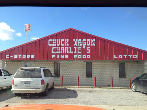 |
| "Fine" food? Possibly fine as in "acceptable" or OK, but we opted to eat elsewhere. |
We missed check-in but arrived in time for the pre-race meeting, where race director Stephanie reminded us several times that we'd be "zipping across the canyon" (it's important that you imagine an ominous, echoing tone for that phrase) on the "longest, fastest zipline" at the resort. My stomach felt sicker each time she said it. There was actually an alternate route, but both teammates had to stick together and no way was I going to make Chuck miss the zipline. Besides, the alternate route sounded tough. Laziness trumps terror.
We were able to check in after attending the pre-race meeting and signing
After much agonizing, I settled on tights over bike shorts with my adventure pants on top for wind protection (forecast was wind speeds in the teens). I wore a long-sleeved tech shirt, a buff around my neck, and a fleece hat, all topped by my waterproof jacket. Because the mandatory gear list was pretty minimal, I had space in my pack for a fleece jacket as well as some extra socks and gloves. The clothing combination ended up being perfect for the day's conditions.
SuperChuck: After no agonizing at all I wore my standard AR stuff and it worked out fine.
Even after staging our bikes and gear on Friday night, we still had to make an early-morning run to Mill Creek Lake after realizing we hadn't put our bike number on. Luckily I didn't have any trouble getting up; I'd slept well until around 3:30 or 4, when headlights flashing across the window kept inspiring panic: Why are they up? Is it late? Where are they going? Is the parking lot going to be full? Will we have a place to park?
We arrived at the Activity Center in plenty of time to get a hot breakfast and relax until maps were passed out at 6 a.m. The maps were a little intimidating. Usually lots of contour is helpful in navigation, but this was elevation overload.
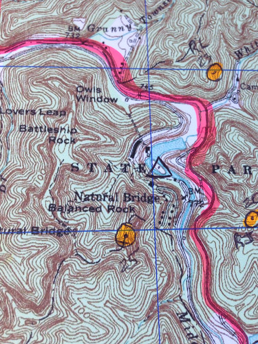 |
| There were so many lines that sometimes you really had to concentrate to realize if you were going up or down. |
Leg 1 - trekking - get CPs 1-3, all located on named features in Natural Bridge State Park, in order, then run to TA1 at Mill Creek Lake. CP2 was located under the eponymous (I was pretty sure that was the right word, but I had to look it up to be certain) bridge, leaving me very relieved that I wouldn't have to cross it. As it turned out, I was quite wrong about that.
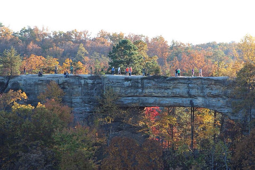 |
| Daytime picture from Flying Squirrel Adventures. Jeff and I had been to this park before we were married, and despite the fact that the bridge is wide enough to drive a car across, I was terrified walking across it. |
Dread? There's no dread in paddling! Seriously, Kate is a great paddler! So stop dreading paddle legs!
Leg 3 - biking - get CPs 6-10 in order and then proceed to TA2 at Cliffview Resort. Yay, biking! I love biking, and it's a good thing because it was a fairly long bike leg.
Leg 4 - trekking and ziplining - a total of 6 CPs worth 4 points. Upon arrival at Cliffview, teams would be assigned either the trekking loop or the ziplining loop first. This was one was Stephanie had designed the course to avoid bottlenecks at the zipline. The trekking loop was CPs 11-13. When you did the ziplining loop, you traded your main passport for a smaller one. The three CPs punched on the zipline passport were traded for CP14 on the big passport.
Once teams completed the Cliffview trek and the zipline loop, they were given coordinates for the remainder of the race. While we didn't know the location of the CPs, we knew the basics:
Leg 5 - biking - CPs 15-16 optional/any order, proceed to TA3 (same as TA1 at Mill Creek Lake)
Leg 6 - paddling/trekking - CPs 17-25 optional/any order - could be reached by paddling and/or trekking. When finished with these points, you must pick up your bike from TA and bike to finish.
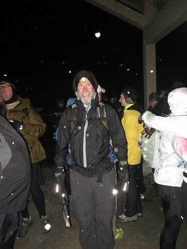 |
| "We're adventure racing! In the snow!" |
Leg 1: Trekking (~5.5k, ~1:15) CP1 was located at Lover's Leap, which according to my GPS tracker was the very highest point in the entire race. We climbed approximately 150,000 stairs on our way there, literally climbing up the side of a cliff. While the darkness may have eased my fear by preventing me from seeing how high we were, I was nervous about slipping on the wet wood and stone steps and clung to the railing with both hands, soaking my gloves in the process.
I had opted to wear my smallest headlamp for the race ("It's a 7:00 start, it won't be dark long"), and while it's perfectly serviceable for walking around a campsite it's a lousy choice when attempting to run trails with rocks and roots on the top of a cliff. Lesson learned. Since we had gear stashed at the bike drop, I could easily have worn my good headlamp first thing and then switched for a smaller one at the TA once it was light (a headlamp was mandatory gear, so I had to have one with me).
Yeah, why didn't we think of stashing lights? I used my small one too, we would've been way better off with the big PT Apex lights.
Anyway, we made it to CP1, which probably has an amazing view, but it was really high up and dark anyway, so I punched our passport and got the heck away from the edge. We turned towards the next CP. Well, Chuck turned. I followed his heels. "Wanna run some?" he asked. No, I thought, no, it's dark and snowy and slippery and my light sucks and we're really high up. I don't really want to run. But what I said was, "Sure."
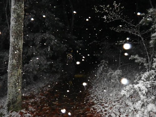 |
| Big wet flakes were sticking to the trees and leaves. |
We crossed onto solid ground and then followed the trail along the base of the bridge and through a narrow passageway called Fat Man's Misery.
 |
| Yet another picture stolen from Flying Squirrel Adventures. |
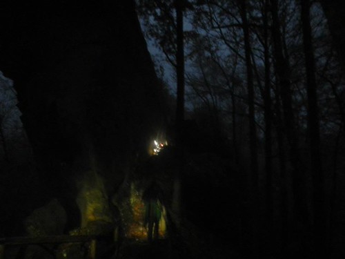 |
| Looking back through the crack as dawn approaches. Photo credit: Chuck Vohsen |
 |
| Snow still on the top trees in front of us. |
Though the cold weather wasn't an issue when we were moving, I had a harder time with it while we were getting ready for the bikes. I took off my soaked gloves, ready to trade them for a dry pair after I had my bike shoes on; after tugging on my shoe covers (which were a very good idea) and fighting to get them zipped up, my fingers were numb. I pulled on the gloves and then realized I wasn't wearing my helmet. After struggling for a minute or so to fasten the strap, I finally gave up and turned to Chuck, who'd gotten ready much more quickly: "Help!" With my teammate's assistance, I was FINALLY ready, and we took off downhill out of the parking lot and onto the pavement.
Leg 3: Biking (~4:00, ~43K) The bike CPs were pretty spread out (about 25 miles total), but the first ones were right off of the roads. Bridge, check...bridge, check. I felt great on the bike, really strong. After the second bridge CP I started to feel a little bit of a twinge in my quads and asked Chuck to get out his medicine baggie. Chuck and I have gotten pretty good at catching cramps before they start and taking endurolytes (I think that's what they are). That's been a real revelation for me. For the longest time I just thought hurting legs were a cost of racing, like that's how your legs feel after running or riding for xx hours. It's been a pretty great discovery to learn that I don't have to be sore.
Yep Endurolytes. They work fantastic and have saved me so many times, I almost consider them required gear for any race over a couple hours.
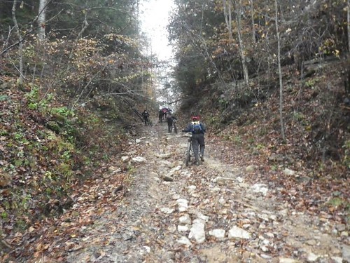
The roads changed from pavement into gravel, and then we came to our turn. Ahead of us a team was walking their bikes up a fairly steep hill. Not that long ago, that would automatically make me get off my bike too; now I'm likely to see it as a challenge, and I was happy to be able to ride past them and make it up the hill. We found CP8 (reentrant) off of the gravel road and then, as Chuck said, we were going to have to work a little harder.
Within a minute or two of leaving the CP, we rode up to a fairly deep creek crossing. We stopped and glanced down the creek to see if there was any good crossing spot. Seeing none, we carried our bikes across. "Well," I commented, "the good news is that we don't have to worry about getting our feet wet anymore."
The next hour or so gave us an up close look at all the rain the Red River Gorge area had received in the week before the race. The roads were a minefield of huge muddy puddles, and we zipped back and forth looking for the best line, sometimes avoiding the water, splashing through when necessary. And it was So. Much. Fun. I had been very disappointed in myself after being such a baby on the bike leg during September's Berryman Adventure Race and went into the Fig determined to take whatever we got with a good spirit and just accept that "this is what our bike leg is like". Total success in that department, even when riding (or walking) "roads" that looked more like hog wallows.
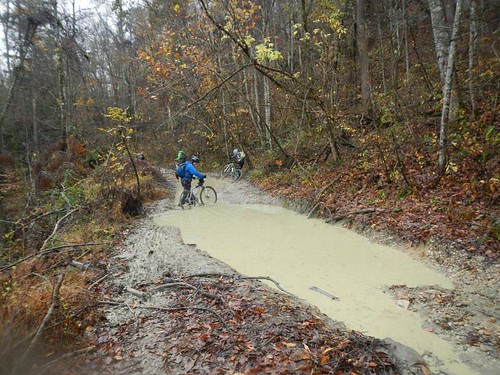 |
| Unlike some of our creek bottom roads, this one is actually cut into the slope of a fairly steep hillside, so that's just standing water in the road. |
 |
| Looking up... |
 |
| Looking back |
 |
| It's been a week and a half, but I'm pretty sure we were at the intersection just above and to the left of my fingernail, along the pink line beneath the "F" in field. |
I pulled the compass out before we made that turn to the South, and my confidence went way up when the terrain, compass, and the map all matched up. Neither one of us would have wanted to repeat any of the giant hills in the area because of a nav error.
No one followed us, but the terrain matched our map as we rode on, and our confidence in our decision grew. And was confirmed when we ran into Cecil, who we'd met near CP3, at CP9. Success! Cecil had taken an alternate route, which though longer avoided the crazy slop we'd ridden in. Definitely a smart route choice.
We moved farther down the road after punching our passport and took a moment to use the bathroom, eat a quick bite, and adjust the maps. Then it was down a big gravel downhill and off in search of CP10. We ran into pavement (or smooth gravel?) before Chuck expected, and it was a welcome surprise after the challenging roads we'd spent the last couple hours on. We pushed our bikes up a big hill, catching up with Cecil shortly after the top and riding with him for a while, talking about racing and orienteering, making good time on some cool roads, admiring the scenery as the terrain dropped away on either side.
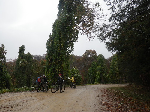 |
| The guys looking over maps while I take pictures and wait to be told where to go. :) |
A team came riding back towards us, concerned that they'd missed a turn. We all stopped and looked over maps before deciding that we were comfortable with the way we were going. There were a couple more map check stops before I asked Chuck, "Do you feel like we're going the right way?" He said he did, so I suggested we move on and quit second-guessing ourselves.
We hadn't gone much further when we came to another intersection. There was a private drive right in front of us, a gravel road to our right, and another gravel road ahead of us and somewhat to the right. This time we did need to stop and look over the map, and while we were doing so the group behind us rode into the intersection and onto the front/right gravel. "It's this way!" one of the guys called.
We followed after them, but before we'd gone far I saw a private property sign on a tree and called to Chuck. "Are we on private property?" He yelled ahead to the other group, but they were gone. We rode ahead, now less sure of our route. We're used to seeing private property signs along roads, but usually they're set up parallel with the road, indicating the land next to the road is off-limits. This one was faced anyone who was riding down the road. As I looked for more signs to indicate whether we were in the wrong place, I noticed bikes cruising down a gravel road to our right. "Is that where we need to be?"
Awesome save by the co-navigator!
We decided it was and backtracked, hitting one of the scariest downhills I've ridden. It was gravel, but it was steep; Strava lists the grade of the beginning of the hill as -27.3%. I've come a long way with my downhill confidence, but my brakes got a serious workout on the way down -- to the point that I could smell them. When I caught up with Chuck, who had taken the hill much more quickly than I did, he told me, "I could smell my brakes! That's never happened before."
"That's the smell of fear," I replied.
After the downhill, the road ran alongside a creek, and by "alongside" I mean through. We'd put our bikes through plenty of water and mud already, and it appeared that waterworld theme would be a recurring one. We rode through and around most of the creek sections, but there was one that we deep enough we opted to carry our bikes.
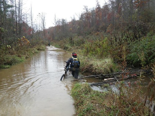 |
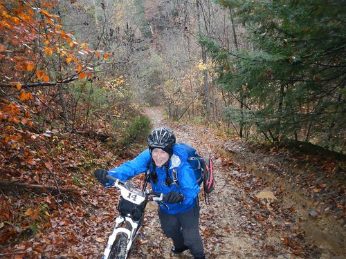
| OK, I carried mine. Chuck can do his own bike maintenance, so he's clearly not as worried about his bottom bracket. |
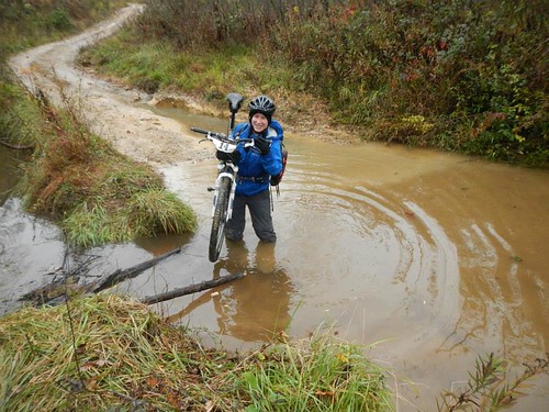 |
| Chuck asked me, "Do you want to get out of the water sooner, or do you want a picture?" It's like he doesn't even know me! |
We had one more huge hill to push our bikes up. Even walking it was kicking my ass, and I watched in awe as another coed team spun their way to the top while everyone else around us walked. Very impressive. Once we got to the top, it was smooth pavement and flawless nav until we pulled into TA2 at Cliffview.
Leg 4A: Ziplining and trek (~1:44 including transition) Confirming my
After a slow-ish transition, we hiked down the road in search of the zipline. Chuck handed me the map and told me I could do the nav for this section, but unlike at Thunder Rolls, I barely glanced at it before shoving it back at him. It had far less detail than our main maps and all kinds of colors, and looking at it kind of made my head hurt. We probably would have been better off if we'd taken a minute to orient ourselves on the map before heading out, but instead we did it on the fly (and by "on the fly" I mean while we were walking). We also relied a little more on the signs at the resort ("zipline" with an arrow pointing to the left), forgetting for the moment that there were numerous ziplines at Cliffview, and so we made a minor nav error before the map really clicked and Chuck locked on where we needed to be. "We can either go back around up the road or we can bushwhack up this hill."
We picked the shorter, steeper hill and popped out in view of the zipline. At first glance, it wasn't as bad as I'd anticipated. I had imagined a high tower to climb and was relieved to see that wasn't the case.
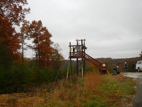 |
| Whew...that isn't so tall after all. |
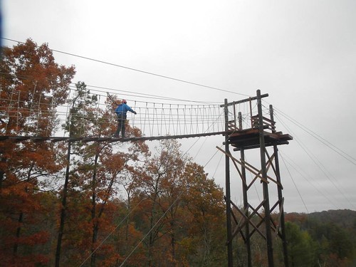 |
| Chuck posted this on facebook with the caption "Kate walks calmly to her death". |
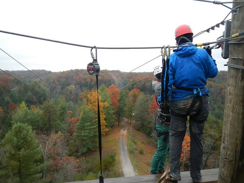 |
| Getting hooked into the main line. |
The guide had me stand on the top step ("You mean, all the way up here?") while he got me all clipped in and then told me I could step off the platform ("You mean just...step off?"). It took me a moment...or two...and then I did, indeed, step off and begin zipping across the canyon.
 |
| Goodbye, cruel world! |
Next Chuck came zipping across with a big smile on his face.
That was so cool! Longest fastest zip I've ever done.
 |
| Chuck almost all the way across |
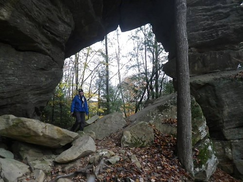
We got out of our harnesses, punched our passport, and headed off in search of our final two CPs of the zipline loop before Chuck realized he was still wearing his helmet and had to run back and return it. Then we set off again towards Susanna Arch.
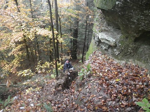 |
| The trails covered some pretty steep terrain. |
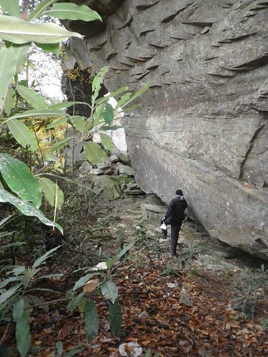 |
| Chuck approaching Susanna Arch |
 |
| We might have been able to cut some time off of our race with fewer photo ops. ;-) |
Leg 4B: Cliffview trek (~:54) After grabbing our packs, which we'd been allowed to leave behind for the zipline loop, we headed off in search of CPs 11-13. Chuck noticed that a trail towards 11 started behind the TA, so we took that downhill. I think it was pretty much a straight shot down to the lake, where in taking a shortcut I managed to step into water instead of over it. Oops. Oh well, we only had two more CPs before changing back into (wet) bike shoes, and then I had dry shoes back at Mill Creek Lake.
The trek to the next two CPs was pretty unremarkable, and they came more quickly than I'd expected. The flatter terrain was much easier to cover quickly. We'd had to climb a bit to get to our final CP, and then had a decision to make. Take the fairly direct way back to the TA, which would involve giving back all the elevation we'd gained and then a long uphill climb out, or take a slightly more roundabout path? We chose option B.
As we hiked along the road, I looked up the hillside next to us and noticed how flat it was at the top, as if there was a road there. "What's up there?" I asked Chuck. Looking at the map, we saw that the road we were on came close to the road we eventually needed to be on and decided to cut off some distance by bushwhacking up the hill. We popped out onto the road and hike/jogged back to TA2 for a third time.
Another great call by the co-navigator! I think this short-cut picked up 20 minutes on another team that had chosen our original route plan out of the creek valley.
Back at the TA we were offered candy and coordinates for the last 10 CPs of the race. After plotting them, we decided to definitely go for the two bike CPs and highlighted three paddle/trek CPs we thought were in reach timewise. We got back into our soggy bike shoes and then set off for Mill Creek Lake again.
Leg 5: Bike 2 (~12K, ~1:08) Unlike the previous bike leg, I was dragging. Chuck was much stronger than me here. I didn't feel bad, I just didn't have a lot of energy and felt really slow. I think this one was all pavement, and we picked up our two CPs without incident.
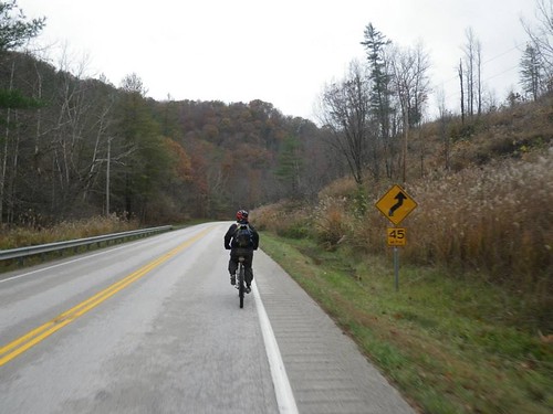 |
| Chuck cruising ahead |
 |
| Clearly I was having no fun at all. |
Back in the canoe, we crossed the lake for CP18 (underground creek) and found it without incident.
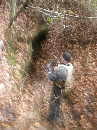 |
| Here's a really crappy picture of the entrance to the cave where the CP was. |
Ha! I forgot all about that until now!
We had tentatively planned to go for CP19, but Monkey's Fist had warned us that they'd been cliffed out on their initial approach and had to hike way around to get it. We'd committed to being back at the TA and ready to leave at 6:30, and we didn't think we had enough time to get 19 and be back at the finish in time. Even as we paddled back towards the boat ramp we toyed with going for 19, but we decided not to, and I still think that was the right decision. In retrospect, there was one CP we probably had time to trek to, but at the time we didn't think so.
Back at the TA, we dumped any non-mandatory gear with our paddles and put on our soggy bike shoes one last time. We were on our bikes when I looked down at a flat front tire. Damn! (On the other hand, if it was getting low on our previous bike leg, maybe that would help explain how sluggish I was on the bike, which is a bit of a silver lining.)
I advocated for just airing it up and hoping it could hold out for the couple miles we had left. We had two CO2 cartridges, but after I wasted one (because I'm an idiot) we decided to play it safe and put in a new tube (and by "we", I mean Chuck. I can change a tire, but only the saddest, slowest pit crew would want my help in a race). Luckily the racers next to us had staged gear in a car and had a bike pump (thanks, Jim!), so we didn't have to use Chuck's CO2.
I can't quit laughing as I read this, remembering Kate threading in the CO2 and watching it instantly discharge, burning her hand in the process.
Bike 3: As we prepared for the second time to head to the finish, the 2-p coed team that had passed us on the Cliffview trek was also leaving. Why were they still here? We knew they almost certainly had gotten more CPs than us since they were at least an hour up on us back at Cliffview...but what if they'd had problems? Nooooo...all I'd wanted was a leisurely ride back to the finish, and now we were going to have to race.
They took the route back through the campground, so we took the road back to the park entrance, flying down the pavement and trying to look down the road to the campground as we approached the hill to the finish line. No sign of them, but as we climbed that last hill we caught sight of a 2-person team near the top. Despair, they'd beaten us.
But wait...there was a 2-person team just starting the hill below us. Maybe that was them! We pushed hard to the top of the hill, panting, legs unhappy, on the edge of throwing up. I don't think I've ridden my bike harder since the end of the bike leg at LBL. We threw our bikes down, ran to punch the final CP, paused for a finish line picture, and rushed into the building to turn in our passport...only to find the 2-p coeds already there. As it turned out, they had 2 more CPs than us, so our last-minute sprint was unnecessary, but it sure made the end of the race interesting.
It was an excellent finish! The unexpected sprint up the switchbacks to the finish were like icing on an already perfect cake.
I can't say enough good things about the race. The location was amazing, the course was fun, and the logistics (from my point of view, anyway) were flawless. CPs were accurately placed, and the disciplines were broken up nicely. A lot of thought clearly went into the course design to eliminate bottlenecks at the zipline, and the zipline itself was a very cool addition. Stephanie was a fantastic race director, and every single volunteer we encountered was friendly and helpful, despite the fact that they were sitting around in chilly temperatures. Stephanie is the race director for USARA Nationals next year, and if I'm not racing there I'll most definitely be volunteering.
As far as our race, I don't have any complaints. My favorite drive-home activity is to talk about the race and how we could have done better. We didn't come up with many "should have"s for the Fig. Maybe a couple of places (like the approach to CP9) where we'd have benefitted from slightly better route choice, but those were only obvious in hindsight. Faster transitions, for sure. That's definitely an area of weakness for me. We raced smart and were strong all day long; really, the only way to have been much faster is to be faster. That's a work in progress, as far as I'm concerned, and it would be hard to have a better day than we did. I'm already looking forward to next November in the Red River Gorge.
Our results:
Division: 3/5
Overall: 17/56
Want more?
Full results
Strava link to our course minus the zipline
Team Adventures race report


Beautiful area to almost die in! LOL
ReplyDeleteI have a serious fear of heights and love to be up high, ironic right? Have never been on a serious zip line but def want to try. Looks like a great adventure!
ReplyDeleteYou're like me...I love adventure racing, but I worry about most of the disciplines!
DeleteWait, you got pizza at miguel's but weren't there just for climbing?! I hope you at least had a few Ale-8's! The zipline looks awesome :)
ReplyDeleteHa! You have me confused with your crazy more daring types. I'd be the one at the bottom of the wall telling my friends I'll take their pictures!
DeleteOne of the things I didn't try in Alaska was a zip line. I figured I could do that back here. I guess I need to get on it. You are amazing in all your races and the various aspects.
ReplyDeleteLooks like a beautiful course! Sounds like a perfectly executed race on top of that. Glad you had fun.
ReplyDelete